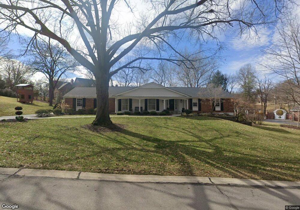
1917 Gray Dr Saint Louis, MO 63131
Estimated Value: $765,073 - $838,000
4
Beds
4
Baths
2,489
Sq Ft
$326/Sq Ft
Est. Value
About This Home
This home is located at 1917 Gray Dr, Saint Louis, MO 63131 and is currently estimated at $810,518, approximately $325 per square foot. 1917 Gray Dr is a home located in St. Louis County with nearby schools including Westchester Elementary School, North Kirkwood Middle School, and Kirkwood Senior High School.
Ownership History
Date
Name
Owned For
Owner Type
Purchase Details
Closed on
Nov 25, 2024
Sold by
Lenzen Daniel M and Lenzen Ann S
Bought by
Lenzen Revocable Trust and Lenzen
Current Estimated Value
Purchase Details
Closed on
Sep 10, 2012
Sold by
Lenzen Daniel M and Lenzen Ann S
Bought by
Lenzen Daniel M and Lenzen Ann S
Home Financials for this Owner
Home Financials are based on the most recent Mortgage that was taken out on this home.
Original Mortgage
$292,000
Interest Rate
3.59%
Mortgage Type
New Conventional
Purchase Details
Closed on
Aug 20, 1997
Sold by
Wolf Ray H and Wolf Carol J
Bought by
Lenzen Daniel M and Lenzen Ann C
Home Financials for this Owner
Home Financials are based on the most recent Mortgage that was taken out on this home.
Original Mortgage
$248,000
Interest Rate
7.47%
Create a Home Valuation Report for This Property
The Home Valuation Report is an in-depth analysis detailing your home's value as well as a comparison with similar homes in the area
Home Values in the Area
Average Home Value in this Area
Purchase History
| Date | Buyer | Sale Price | Title Company |
|---|---|---|---|
| Lenzen Revocable Trust | -- | None Listed On Document | |
| Lenzen Revocable Trust | -- | None Listed On Document | |
| Lenzen Daniel M | -- | Title Partners Agency Llc | |
| Lenzen Daniel M | -- | -- |
Source: Public Records
Mortgage History
| Date | Status | Borrower | Loan Amount |
|---|---|---|---|
| Previous Owner | Lenzen Daniel M | $292,000 | |
| Previous Owner | Lenzen Daniel M | $248,000 |
Source: Public Records
Tax History Compared to Growth
Tax History
| Year | Tax Paid | Tax Assessment Tax Assessment Total Assessment is a certain percentage of the fair market value that is determined by local assessors to be the total taxable value of land and additions on the property. | Land | Improvement |
|---|---|---|---|---|
| 2025 | $7,299 | $135,580 | $77,880 | $57,700 |
| 2024 | $7,299 | $126,260 | $63,270 | $62,990 |
| 2023 | $7,186 | $126,260 | $63,270 | $62,990 |
| 2022 | $7,051 | $115,480 | $63,270 | $52,210 |
| 2021 | $6,975 | $115,480 | $63,270 | $52,210 |
| 2020 | $7,111 | $113,200 | $36,460 | $76,740 |
| 2019 | $7,120 | $113,200 | $36,460 | $76,740 |
| 2018 | $6,546 | $93,350 | $28,560 | $64,790 |
| 2017 | $6,563 | $93,350 | $28,560 | $64,790 |
| 2016 | $5,895 | $84,900 | $28,560 | $56,340 |
| 2015 | $5,903 | $84,900 | $28,560 | $56,340 |
| 2014 | $5,969 | $83,910 | $26,680 | $57,230 |
Source: Public Records
Map
Nearby Homes
- 2134 East Dr
- 8 Briarbrook Trail
- 1737 Folkstone Dr
- 723 Oak Valley Dr
- TBB Ballas Ridge Hawthorne II
- TBB Ballas Ridge Roclare II
- TBB
- TBB
- TBB Ballas Ridge Westchester IV
- 22 Countryside Ln
- 2056 N Ballas Rd
- 2062 N Ballas Rd
- 551 High Meadow Rd
- 108 Frontenac Forest
- 12439 Springdale Ln Unit TBB
- 152 Frontenac Forest
- 1126 Bopp Rd
- 0 Unknown Unit 22071090
- 811 Cherry St
- 16 Holiday Ln