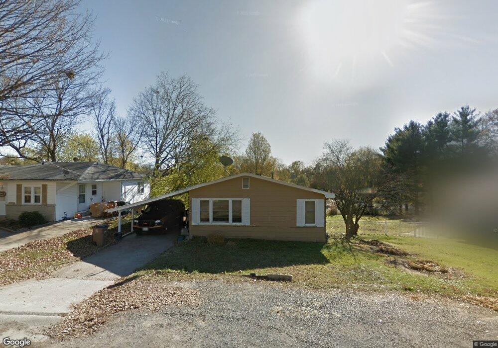
1917 New Mardrid Cape Girardeau, MO 63701
Estimated Value: $112,578 - $136,000
3
Beds
1
Bath
930
Sq Ft
$135/Sq Ft
Est. Value
About This Home
This home is located at 1917 New Mardrid, Cape Girardeau, MO 63701 and is currently estimated at $125,645, approximately $135 per square foot. 1917 New Mardrid is a home located in Cape Girardeau County with nearby schools including Franklin Elementary School, Central Middle School, and Central Junior High School.
Ownership History
Date
Name
Owned For
Owner Type
Purchase Details
Closed on
Sep 25, 2018
Sold by
Ezgh Property Llc
Bought by
Hao Charles H
Current Estimated Value
Purchase Details
Closed on
Apr 22, 2009
Sold by
First General Abaptist Church Of Cape G
Bought by
Hammonmtre Doris and Hammonmtre Lawrence
Home Financials for this Owner
Home Financials are based on the most recent Mortgage that was taken out on this home.
Original Mortgage
$52,500
Interest Rate
4.84%
Mortgage Type
Unknown
Purchase Details
Closed on
Oct 31, 2008
Sold by
Weatherly James D and Weatherly Joann
Bought by
First General Baptist Church Of Cape Gir
Create a Home Valuation Report for This Property
The Home Valuation Report is an in-depth analysis detailing your home's value as well as a comparison with similar homes in the area
Home Values in the Area
Average Home Value in this Area
Purchase History
| Date | Buyer | Sale Price | Title Company |
|---|---|---|---|
| Hao Charles H | -- | None Available | |
| Hammonmtre Doris | -- | Abstract And Title Co Inc | |
| First General Baptist Church Of Cape Gir | -- | None Available |
Source: Public Records
Mortgage History
| Date | Status | Borrower | Loan Amount |
|---|---|---|---|
| Previous Owner | Hammonmtre Doris | $52,500 |
Source: Public Records
Tax History Compared to Growth
Tax History
| Year | Tax Paid | Tax Assessment Tax Assessment Total Assessment is a certain percentage of the fair market value that is determined by local assessors to be the total taxable value of land and additions on the property. | Land | Improvement |
|---|---|---|---|---|
| 2025 | $5 | $10,800 | $0 | $10,800 |
| 2024 | $5 | $10,290 | $0 | $10,290 |
| 2023 | $535 | $10,290 | $0 | $10,290 |
| 2022 | $493 | $9,480 | $0 | $9,480 |
| 2021 | $493 | $9,480 | $0 | $9,480 |
| 2020 | $494 | $9,480 | $0 | $9,480 |
| 2019 | $494 | $9,480 | $0 | $0 |
| 2018 | $493 | $9,480 | $0 | $0 |
| 2017 | $494 | $9,480 | $0 | $0 |
| 2016 | $514 | $9,900 | $0 | $0 |
| 2015 | $514 | $9,900 | $0 | $0 |
| 2014 | $517 | $9,900 | $0 | $0 |
Source: Public Records
Map
Nearby Homes
- 1958 Dunklin St
- 1742 Dunklin St
- 1814 Ricardo Dr
- 1806 Stoddard St
- 820 Perry Ave
- 701 Penny Ave
- 1210 Perryville Rd
- 303 Orange Bowl Dr
- 1415 N Clark St
- 2416 Terrie Hill Rd
- 2323 Jean Ann Dr
- 242 Orange Bowl Dr
- 2022 Thilenius St
- 1527 Howell St
- 1417 Mary Ann St
- 1014 N Henderson Ave
- 1738 Luce St
- 381 N Park Ave
- 1427 Price Dr
- 1446 N Henderson St
- 1917 New Madrid St
- 1915 New Madrid St
- 1911 New Madrid St
- 1921 New Madrid St
- 1930 Dunklin St
- 1908 New Madrid St
- 1926 Dunklin St
- 1922 Dunklin St
- 1857 New Madrid St
- 1904 New Madrid St
- 1918 Dunklin St
- 1934 Dunklin St
- 1925 New Madrid St
- 1004 Haddock St
- 1853 New Madrid St
- 1924 Benjamin Ct
- 1941 New Madrid St
- 1850 Dunklin St
- 1938 Dunklin St
- 1858 New Madrid St