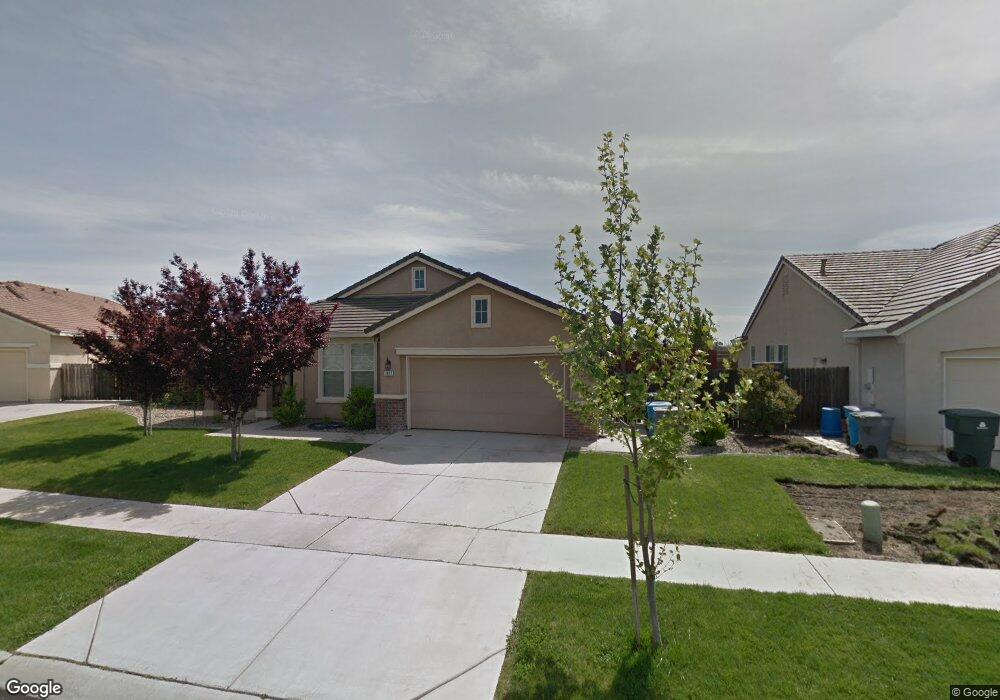
1917 Sling Shot Dr Olivehurst, CA 95961
Estimated Value: $429,000 - $466,646
4
Beds
2
Baths
1,847
Sq Ft
$246/Sq Ft
Est. Value
About This Home
This home is located at 1917 Sling Shot Dr, Olivehurst, CA 95961 and is currently estimated at $455,162, approximately $246 per square foot. 1917 Sling Shot Dr is a home located in Yuba County with nearby schools including Rio Del Oro Elementary School, Cobblestone Elementary School, and Riverside Meadows Intermediate School.
Ownership History
Date
Name
Owned For
Owner Type
Purchase Details
Closed on
Mar 30, 2015
Sold by
Gardner Gilbert R
Bought by
Bradley Kenneth and Bradley Kari
Current Estimated Value
Home Financials for this Owner
Home Financials are based on the most recent Mortgage that was taken out on this home.
Original Mortgage
$237,616
Outstanding Balance
$187,015
Interest Rate
4.37%
Mortgage Type
FHA
Estimated Equity
$268,147
Purchase Details
Closed on
Jan 29, 2010
Sold by
Outside Industries Inc
Bought by
Gardner Gilbert R and Gardner Wanda A
Purchase Details
Closed on
Dec 8, 2009
Sold by
Walker Andrew
Bought by
Outside Industries Inc
Purchase Details
Closed on
Jun 28, 2007
Sold by
Walker Andrew
Bought by
Walker Andrew and Walker Micheyl
Home Financials for this Owner
Home Financials are based on the most recent Mortgage that was taken out on this home.
Original Mortgage
$335,000
Interest Rate
6.36%
Mortgage Type
New Conventional
Purchase Details
Closed on
Jun 14, 2005
Sold by
Beazer Homes Holdings Corp
Bought by
Walker Andrew M
Home Financials for this Owner
Home Financials are based on the most recent Mortgage that was taken out on this home.
Original Mortgage
$258,000
Interest Rate
6.75%
Mortgage Type
Stand Alone First
Purchase Details
Closed on
Jun 8, 2005
Sold by
Walker Micheyl Renee
Bought by
Walker Andrew M
Home Financials for this Owner
Home Financials are based on the most recent Mortgage that was taken out on this home.
Original Mortgage
$258,000
Interest Rate
6.75%
Mortgage Type
Stand Alone First
Purchase Details
Closed on
May 19, 2005
Sold by
Beazer Homes Holdings Corp
Bought by
Walker Andrew M
Home Financials for this Owner
Home Financials are based on the most recent Mortgage that was taken out on this home.
Original Mortgage
$258,000
Interest Rate
6.75%
Mortgage Type
Stand Alone First
Create a Home Valuation Report for This Property
The Home Valuation Report is an in-depth analysis detailing your home's value as well as a comparison with similar homes in the area
Home Values in the Area
Average Home Value in this Area
Purchase History
| Date | Buyer | Sale Price | Title Company |
|---|---|---|---|
| Bradley Kenneth | $242,000 | First American Title Company | |
| Gardner Gilbert R | $154,000 | None Available | |
| Outside Industries Inc | $143,800 | None Available | |
| Walker Andrew | -- | First American Title Co | |
| Walker Andrew M | $323,000 | First American Title Company | |
| Walker Andrew M | -- | First American Title Company | |
| Walker Andrew M | $323,000 | First American Title Company |
Source: Public Records
Mortgage History
| Date | Status | Borrower | Loan Amount |
|---|---|---|---|
| Open | Bradley Kenneth | $237,616 | |
| Previous Owner | Walker Andrew | $335,000 | |
| Previous Owner | Walker Andrew M | $258,000 | |
| Previous Owner | Walker Andrew M | $258,000 |
Source: Public Records
Tax History Compared to Growth
Tax History
| Year | Tax Paid | Tax Assessment Tax Assessment Total Assessment is a certain percentage of the fair market value that is determined by local assessors to be the total taxable value of land and additions on the property. | Land | Improvement |
|---|---|---|---|---|
| 2025 | $4,484 | $290,837 | $42,059 | $248,778 |
| 2023 | $4,484 | $279,545 | $40,427 | $239,118 |
| 2022 | $4,352 | $274,065 | $39,635 | $234,430 |
| 2021 | $4,269 | $268,692 | $38,858 | $229,834 |
| 2020 | $4,234 | $265,938 | $38,460 | $227,478 |
| 2019 | $4,164 | $260,724 | $37,706 | $223,018 |
| 2018 | $4,036 | $255,613 | $36,967 | $218,646 |
| 2017 | $4,251 | $250,602 | $36,243 | $214,359 |
| 2016 | $4,206 | $245,689 | $35,533 | $210,156 |
| 2015 | $3,613 | $191,173 | $21,479 | $169,694 |
| 2014 | -- | $187,429 | $21,059 | $166,370 |
Source: Public Records
Map
Nearby Homes
- 1406 Sundance Dr
- 1974 Bidwell Bar Dr
- 1352 Bedford Way
- 1149 Oxbow Ct
- 1962 Knights Ferry Dr
- 1078 Silver Spur Way
- 1203 Drakes Bar Ct
- 1073 Bronco Dr
- 1337 Wawona Ct
- 2021 Ponderosa Ranch Way
- 1073 Broken Spur Way
- 2035 Bidwell Bar Dr
- 1171 Aldersgate Dr
- 1165 Aldersgate Dr
- 1721 London Way
- 1153 Aldersgate Dr
- 1720 London Way
- 1714 London Way
- 2022 Maverick Dr
- 1351 Leighton Grove Dr
- 1917 Slingshot Dr
- 1911 Slingshot Dr
- 1923 Slingshot Dr
- 1905 Slingshot Dr
- 1905 Sling Shot Dr
- 1232 Broken Spur Way
- 1239 Broken Spur Way
- 1899 Slingshot Dr
- 1219 Bronco Dr
- 1233 Broken Spur Way Unit 15
- 1233 Broken Spur Way
- 1226 Broken Spur Way
- 1227 Broken Spur Way
- 1893 Slingshot Dr
- 1213 Bronco Dr
- 1220 Broken Spur Way Unit 34
- 1220 Broken Spur Way
- 1221 Broken Spur Way
- 1205 Bronco Dr
- 1887 Slingshot Dr Unit 1