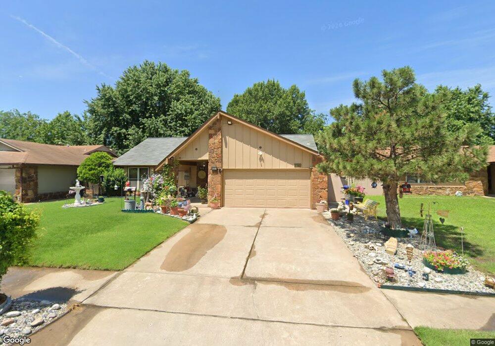
1918 N Eucalyptus Ct Broken Arrow, OK 74012
Southbrook NeighborhoodEstimated Value: $182,518 - $233,000
--
Bed
2
Baths
1,512
Sq Ft
$139/Sq Ft
Est. Value
About This Home
This home is located at 1918 N Eucalyptus Ct, Broken Arrow, OK 74012 and is currently estimated at $210,630, approximately $139 per square foot. 1918 N Eucalyptus Ct is a home located in Tulsa County with nearby schools including McAuliffe Elementary School, Union 8th Grade Center, and Union 6th-7th Grade Center.
Ownership History
Date
Name
Owned For
Owner Type
Purchase Details
Closed on
Sep 12, 2013
Sold by
Tatum Gary W
Bought by
Huynh Dieu Quang and Huynh Tuyet
Current Estimated Value
Purchase Details
Closed on
Mar 12, 2004
Sold by
Maxey Darwin P and Maxey Linda J
Bought by
Tatum Gary W
Purchase Details
Closed on
Aug 1, 1989
Purchase Details
Closed on
Jul 1, 1981
Create a Home Valuation Report for This Property
The Home Valuation Report is an in-depth analysis detailing your home's value as well as a comparison with similar homes in the area
Home Values in the Area
Average Home Value in this Area
Purchase History
| Date | Buyer | Sale Price | Title Company |
|---|---|---|---|
| Huynh Dieu Quang | $95,000 | Residential Title & Escrow | |
| Tatum Gary W | -- | -- | |
| -- | $54,000 | -- | |
| -- | $67,500 | -- |
Source: Public Records
Tax History Compared to Growth
Tax History
| Year | Tax Paid | Tax Assessment Tax Assessment Total Assessment is a certain percentage of the fair market value that is determined by local assessors to be the total taxable value of land and additions on the property. | Land | Improvement |
|---|---|---|---|---|
| 2025 | $2,232 | $16,996 | $2,525 | $14,471 |
| 2024 | $1,989 | $16,186 | $2,734 | $13,452 |
| 2023 | $1,989 | $15,415 | $2,699 | $12,716 |
| 2022 | $1,910 | $14,681 | $2,959 | $11,722 |
| 2021 | $1,825 | $13,982 | $2,819 | $11,163 |
| 2020 | $1,750 | $13,316 | $3,201 | $10,115 |
| 2019 | $1,747 | $13,316 | $3,201 | $10,115 |
| 2018 | $1,742 | $13,316 | $3,201 | $10,115 |
| 2017 | $1,706 | $12,867 | $3,093 | $9,774 |
| 2016 | $1,603 | $12,254 | $3,201 | $9,053 |
| 2015 | $1,604 | $12,254 | $3,201 | $9,053 |
| 2014 | $1,594 | $12,254 | $3,201 | $9,053 |
Source: Public Records
Map
Nearby Homes
- 11327 E 63rd St
- 1908 N Cypress Ave
- 6526 S 111th East Ave
- 6407 S 109th East Ave
- 1812 N Butternut Ave
- 11329 E 61st St
- 6727 S 112th East Ave
- 4441 W Queens St
- 11860 E 62nd Place
- 1429 N Yellowood Ave
- 1312 N Willow Ave
- 2416 W Lansing Place
- 911 N Butternut Ct
- 905 N Butternut Ave
- 0000 E 62nd St S
- 6240 S 101st East Ave
- 6312 S 101st East Ave
- 6220 S 101st East Ave
- 9919 E 63rd St
- 4501 W Hartford St
- 1914 N Eucalyptus Ct
- 1917 N Firewood Ave
- 1910 N Eucalyptus Ct
- 1913 N Firewood Ave
- 1921 N Firewood Ave
- 1919 N Eucalyptus Ct
- 1909 N Firewood Ave
- 1915 N Eucalyptus Ct
- 1923 N Eucalyptus Ct
- 1906 N Eucalyptus Ct
- 1911 N Eucalyptus Ct
- 4820 W Uniontown St
- 4816 W Uniontown St
- 1905 N Firewood Ave
- 4824 W Uniontown St
- 4812 W Uniontown St
- 1907 N Eucalyptus Ct
- 1902 N Eucalyptus Ct
- 4808 W Uniontown St
- 1901 N Firewood Ave
