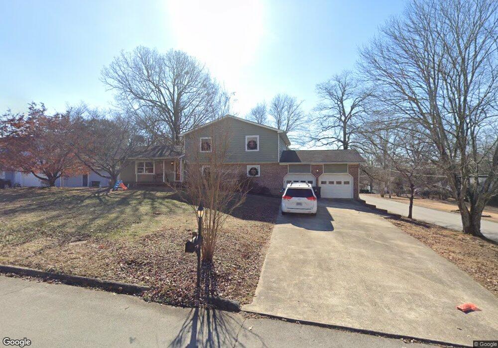
1918 Sand Dunes Dr Hixson, TN 37343
Estimated Value: $383,000 - $426,000
4
Beds
3
Baths
2,616
Sq Ft
$152/Sq Ft
Est. Value
About This Home
This home is located at 1918 Sand Dunes Dr, Hixson, TN 37343 and is currently estimated at $397,709, approximately $152 per square foot. 1918 Sand Dunes Dr is a home located in Hamilton County with nearby schools including McConnell Elementary School, Loftis Middle School, and Hixson High School.
Ownership History
Date
Name
Owned For
Owner Type
Purchase Details
Closed on
Jun 28, 2006
Sold by
Crofton Joseph J and Crofton Robin L
Bought by
Conner James David and Conner Stacey L
Current Estimated Value
Home Financials for this Owner
Home Financials are based on the most recent Mortgage that was taken out on this home.
Original Mortgage
$141,600
Outstanding Balance
$84,204
Interest Rate
6.68%
Mortgage Type
Purchase Money Mortgage
Estimated Equity
$313,505
Purchase Details
Closed on
Sep 28, 2004
Sold by
Woodley Lamar P and Woodley Patricia M
Bought by
Crofton Ii Joseph J and Crofton Robin L
Home Financials for this Owner
Home Financials are based on the most recent Mortgage that was taken out on this home.
Original Mortgage
$151,600
Interest Rate
4.62%
Mortgage Type
Purchase Money Mortgage
Create a Home Valuation Report for This Property
The Home Valuation Report is an in-depth analysis detailing your home's value as well as a comparison with similar homes in the area
Home Values in the Area
Average Home Value in this Area
Purchase History
| Date | Buyer | Sale Price | Title Company |
|---|---|---|---|
| Conner James David | $177,000 | Scenic City Title Agency | |
| Crofton Ii Joseph J | $159,600 | First Volunteer Title Co Llc |
Source: Public Records
Mortgage History
| Date | Status | Borrower | Loan Amount |
|---|---|---|---|
| Open | Conner James David | $141,600 | |
| Previous Owner | Crofton Ii Joseph J | $151,600 |
Source: Public Records
Tax History Compared to Growth
Tax History
| Year | Tax Paid | Tax Assessment Tax Assessment Total Assessment is a certain percentage of the fair market value that is determined by local assessors to be the total taxable value of land and additions on the property. | Land | Improvement |
|---|---|---|---|---|
| 2024 | $1,250 | $55,850 | $0 | $0 |
| 2023 | $1,259 | $55,850 | $0 | $0 |
| 2022 | $1,259 | $55,850 | $0 | $0 |
| 2021 | $1,259 | $55,850 | $0 | $0 |
| 2020 | $1,209 | $43,400 | $0 | $0 |
| 2019 | $1,209 | $43,400 | $0 | $0 |
| 2018 | $1,209 | $43,400 | $0 | $0 |
| 2017 | $1,209 | $43,400 | $0 | $0 |
| 2016 | $1,110 | $0 | $0 | $0 |
| 2015 | $1,110 | $39,800 | $0 | $0 |
| 2014 | $1,110 | $0 | $0 | $0 |
Source: Public Records
Map
Nearby Homes
- 6517 Shelter Cove Dr
- 1924 Bay Pointe Dr
- 1705 Sea Gull Ln
- 1820 Rock Bluff Rd
- 2027 Paige Meadows Ct
- 2039 Paige Meadows Ct
- 0 Ridge Lake Rd Unit RTC2805180
- 0 Ridge Lake Rd Unit 1509241
- 2227 Bay Pointe Dr
- 1800 Mountain Bay Dr
- 6512 Fairview Rd
- 6400 Ridge Lake Rd Unit 3
- 1706 Mountain Bay Dr
- 6418 Ridge Lake Rd
- 6829 Big Ridge Rd
- 2109 Rambler Ln
- 1693 Destiny Dr
- 1689 Destiny Dr
- 1681 Destiny Dr
- 1722 Lake Wood Cir
- 1920 Sand Dunes Dr
- 6404 Sea Haven Dr
- 6409 Sea Haven Dr
- 1924 Sand Dunes Dr Unit 10
- 6412 Sea Haven Dr Unit 10
- 6412 Sea Haven Dr Unit 1032
- 6405 Sea Haven Dr Unit 10
- 1921 Sand Dunes Dr
- 6400 Sea Haven Dr Unit 10
- 1903 Lake Peninsula Dr Unit 10
- 1903 Lake Peninsula Dr Unit 1032
- 1928 Sand Dunes Dr
- 6413 Sea Haven Dr Unit 10
- 6401 Sea Haven Dr Unit 10
- 6401 Sea Haven Dr Unit 1032
- 1923 Sand Dunes Dr
- 1905 Lake Peninsula Dr Unit 10
- 6416 Sea Haven Dr
- 6416 Sea Haven Dr Unit 1032
- 1930 Sand Dunes Dr