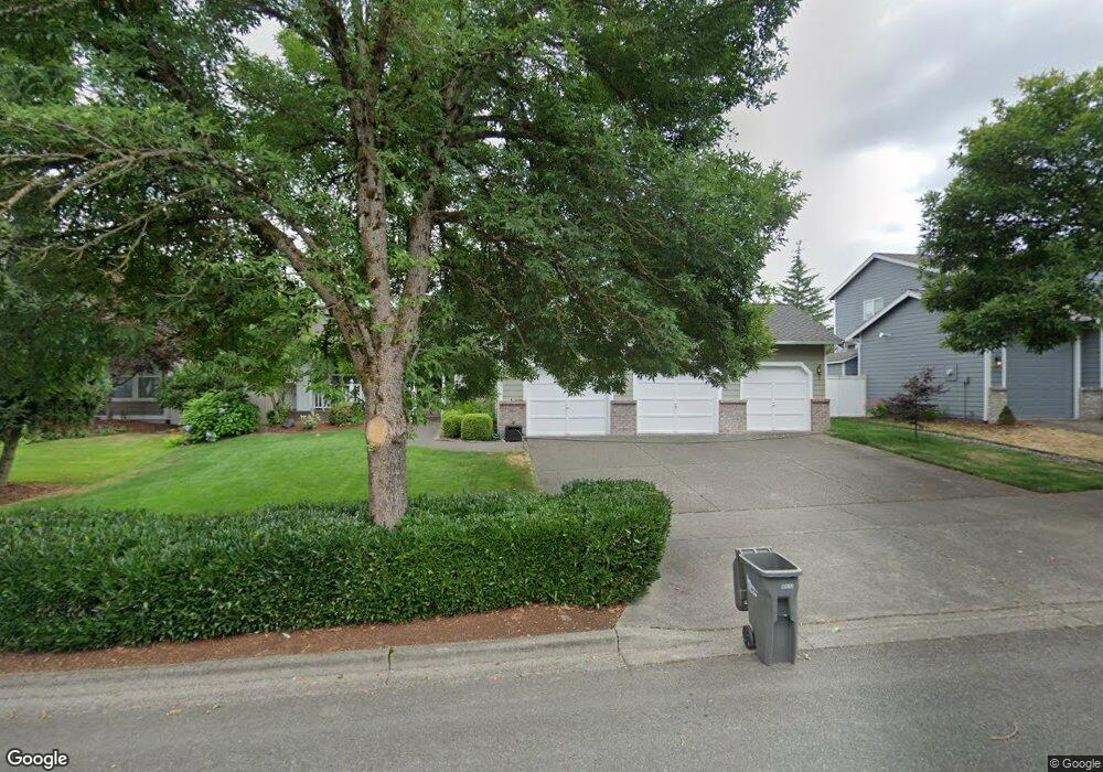
1919 Highpoint St Enumclaw, WA 98022
Estimated Value: $635,000 - $748,000
4
Beds
3
Baths
2,270
Sq Ft
$297/Sq Ft
Est. Value
About This Home
This home is located at 1919 Highpoint St, Enumclaw, WA 98022 and is currently estimated at $674,585, approximately $297 per square foot. 1919 Highpoint St is a home located in King County with nearby schools including Byron Kibler Elementary School, Enumclaw Middle School, and Enumclaw Senior High School.
Ownership History
Date
Name
Owned For
Owner Type
Purchase Details
Closed on
May 9, 2002
Sold by
Parr Donald F and Parr Marianne
Bought by
Kinniburgh Gary D and Kinniburgh Carolyn E
Current Estimated Value
Home Financials for this Owner
Home Financials are based on the most recent Mortgage that was taken out on this home.
Original Mortgage
$172,000
Outstanding Balance
$73,650
Interest Rate
7.13%
Estimated Equity
$600,935
Purchase Details
Closed on
Mar 16, 1998
Sold by
Mjf Holdings Inc
Bought by
Parr Donald F and Parr Marianne
Home Financials for this Owner
Home Financials are based on the most recent Mortgage that was taken out on this home.
Original Mortgage
$179,400
Interest Rate
7.02%
Purchase Details
Closed on
Jul 25, 1996
Sold by
The Quadrant Corp
Bought by
Mjf Holdings Inc
Home Financials for this Owner
Home Financials are based on the most recent Mortgage that was taken out on this home.
Original Mortgage
$964,800
Interest Rate
8.32%
Create a Home Valuation Report for This Property
The Home Valuation Report is an in-depth analysis detailing your home's value as well as a comparison with similar homes in the area
Home Values in the Area
Average Home Value in this Area
Purchase History
| Date | Buyer | Sale Price | Title Company |
|---|---|---|---|
| Kinniburgh Gary D | $215,000 | Stewart Title | |
| Parr Donald F | $184,950 | Pacific Northwest Title Co | |
| Mjf Holdings Inc | $295,570 | Chicago Title Insurance Co |
Source: Public Records
Mortgage History
| Date | Status | Borrower | Loan Amount |
|---|---|---|---|
| Open | Kinniburgh Gary D | $172,000 | |
| Previous Owner | Parr Donald F | $179,400 | |
| Previous Owner | Mjf Holdings Inc | $964,800 |
Source: Public Records
Tax History
| Year | Tax Paid | Tax Assessment Tax Assessment Total Assessment is a certain percentage of the fair market value that is determined by local assessors to be the total taxable value of land and additions on the property. | Land | Improvement |
|---|---|---|---|---|
| 2024 | $5,721 | $596,000 | $212,000 | $384,000 |
| 2023 | $5,301 | $511,000 | $182,000 | $329,000 |
| 2022 | $4,747 | $583,000 | $208,000 | $375,000 |
| 2021 | $4,406 | $473,000 | $180,000 | $293,000 |
| 2020 | $4,024 | $400,000 | $123,000 | $277,000 |
| 2018 | $4,253 | $368,000 | $113,000 | $255,000 |
| 2017 | $3,777 | $347,000 | $103,000 | $244,000 |
| 2016 | $3,715 | $318,000 | $95,000 | $223,000 |
| 2015 | $3,503 | $308,000 | $90,000 | $218,000 |
| 2014 | -- | $278,000 | $91,000 | $187,000 |
| 2013 | -- | $214,000 | $73,000 | $141,000 |
Source: Public Records
Map
Nearby Homes
- 2881 Initial Ave
- 3555 Elmont Ave
- 1720 Garfield St Unit 4
- 1471 Florence St
- 1722 Harding St
- 23724 SE 436th St
- 3183 Roosevelt Ave
- 3189 Roosevelt Ave
- 3359 Terry Ln
- 43128 260th Ave SE
- 1705 Marshall Ave
- 2921 Frederickson St
- 1101 Wells St
- 1234 Lincoln Ave Unit A
- 1234 Lincoln Ave Unit B
- 23420 SE 448th St
- 2054 Roosevelt Ave
- 522 Harmony Ln
- 1107 Griffin Ave
- 3436 Wetherbee Ln
- 1929 Highpoint St
- 1909 Highpoint St
- 1920 Hawk Ct
- 1930 Hawk Ct
- 1930 Highpoint St
- 1910 Hawk Ct
- 1939 Highpoint St
- 3119 Silver Springs Ave
- 3109 Silver Springs Ave
- 1940 Hawk Ct
- 1938 Highpoint St
- 3233 Lois Ln
- 1900 Highpoint St
- 1949 Highpoint St
- 3105 Silver Springs Ave
- 1915 Hawk Ct
- 1948 Highpoint St
- 1950 Hawk Ct
- 1931 Hawk Ct
- 1941 Hawk Ct
Your Personal Tour Guide
Ask me questions while you tour the home.