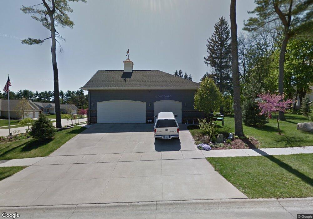
1919 Hughes Cir SW Cedar Rapids, IA 52404
Estimated Value: $411,000 - $519,000
3
Beds
5
Baths
2,525
Sq Ft
$182/Sq Ft
Est. Value
About This Home
This home is located at 1919 Hughes Cir SW, Cedar Rapids, IA 52404 and is currently estimated at $458,531, approximately $181 per square foot. 1919 Hughes Cir SW is a home located in Linn County with nearby schools including Junction City Elementary School, Perryville Elementary School, and Van Buren Elementary School.
Ownership History
Date
Name
Owned For
Owner Type
Purchase Details
Closed on
Jan 18, 2016
Sold by
Rutz Lowell A and Rutz Connie M
Bought by
Rutz Lowell A and Lowell A Rutz Revocable Trust
Current Estimated Value
Purchase Details
Closed on
Dec 8, 2003
Sold by
Hughes Development Inc
Bought by
Rutz Lowell A and Rutz Connie M
Create a Home Valuation Report for This Property
The Home Valuation Report is an in-depth analysis detailing your home's value as well as a comparison with similar homes in the area
Home Values in the Area
Average Home Value in this Area
Purchase History
| Date | Buyer | Sale Price | Title Company |
|---|---|---|---|
| Rutz Lowell A | -- | None Available | |
| Rutz Lowell A | $85,500 | -- | |
| Hughes Development Inc | $45,500 | -- |
Source: Public Records
Tax History Compared to Growth
Tax History
| Year | Tax Paid | Tax Assessment Tax Assessment Total Assessment is a certain percentage of the fair market value that is determined by local assessors to be the total taxable value of land and additions on the property. | Land | Improvement |
|---|---|---|---|---|
| 2025 | $8,356 | $466,200 | $101,400 | $364,800 |
| 2024 | $8,856 | $458,100 | $107,900 | $350,200 |
| 2023 | $8,856 | $489,700 | $98,100 | $391,600 |
| 2022 | $8,334 | $428,800 | $91,600 | $337,200 |
| 2021 | $8,664 | $411,300 | $88,300 | $323,000 |
| 2020 | $8,664 | $401,300 | $65,400 | $335,900 |
| 2019 | $8,174 | $387,700 | $65,400 | $322,300 |
| 2018 | $7,944 | $387,700 | $65,400 | $322,300 |
| 2017 | $7,693 | $361,900 | $65,400 | $296,500 |
| 2016 | $7,693 | $361,900 | $65,400 | $296,500 |
| 2015 | $7,723 | $362,984 | $65,401 | $297,583 |
| 2014 | $7,538 | $362,984 | $65,401 | $297,583 |
| 2013 | $7,372 | $362,984 | $65,401 | $297,583 |
Source: Public Records
Map
Nearby Homes
- 2207 Shady Grove Rd SW
- 2404 25th St SW
- Remington - Cedar Rapids Plan at Whispering Pines
- Copeland Plan at Whispering Pines
- Meadowbrook - Cedar Rapids Plan at Stags Leap Estates
- Caldwell Plan at Stags Leap Estates
- Concord - Cedar Rapids Plan at Stags Leap Estates
- Yuma Expanded Plan at Whispering Pines
- Becker II Plan at Kirkwood Village - Kirk Wood Village
- Meadowbrook - Cedar Rapids Plan at Whispering Pines
- Richland Plan at Stags Leap Estates
- Prescott - Cedar Rapids Plan at Stags Leap Estates
- Becker Plan at Kirkwood Village - Kirk Wood Village
- Bakersfield - Cedar Rapids Plan at Whispering Pines
- Cedar Plan at Stags Leap Estates
- Becker - Cedar Rapids Plan at Whispering Pines
- Becker II - Cedar Rapids Plan at Whispering Pines
- Becker II - Cedar Rapids Plan at Stags Leap Estates
- Concord - Cedar Rapids Plan at Whispering Pines
- Yuma Expanded Plan at Stags Leap Estates
- 1911 Hughes Cir SW
- 1929 Hughes Dr SW
- 1935 Hughes Dr SW
- 2003 Hughes Dr SW
- 1922 Hughes Cir SW
- 1916 Hughes Cir SW
- 1800 Hughes Dr SW
- 1808 Hughes Dr SW
- 1908 Hughes Cir SW
- 1905 Hughes Cir SW
- 2009 Hughes Dr SW
- 1816 Hughes Dr SW
- 1726 Hughes Dr SW
- 1926 Hughes Dr SW
- 1760 Hughes Cir SW
- 1918 Hughes Dr SW
- 1700 Hughes Cir SW
- 1706 Hughes Cir SW
- 1821 Hughes Cir SW
- 1718 Hughes Dr SW