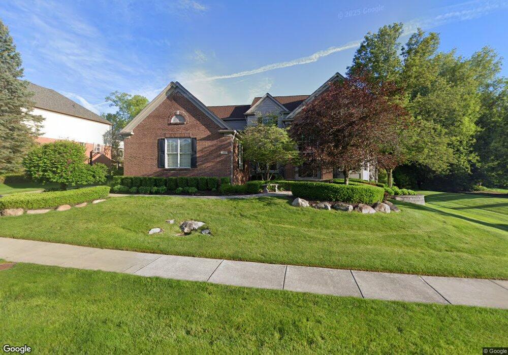
1919 Watson Cir Rochester, MI 48306
Estimated Value: $686,300 - $864,000
4
Beds
3
Baths
2,998
Sq Ft
$260/Sq Ft
Est. Value
About This Home
This home is located at 1919 Watson Cir, Rochester, MI 48306 and is currently estimated at $778,325, approximately $259 per square foot. 1919 Watson Cir is a home located in Oakland County with nearby schools including Hart Middle School, Hugger Elementary School, and Stoney Creek High School.
Ownership History
Date
Name
Owned For
Owner Type
Purchase Details
Closed on
May 5, 2009
Sold by
Washington David and Washington Amy M Sheposh
Bought by
Washington David T and Washington Amy M Sheposh
Current Estimated Value
Purchase Details
Closed on
Jul 13, 2005
Sold by
Bare Cleve I and Bare Tara
Bought by
Washington David
Purchase Details
Closed on
Nov 19, 1999
Sold by
Pulte Homes Of Mi Corp
Bought by
Pulte Land Dev Corp
Create a Home Valuation Report for This Property
The Home Valuation Report is an in-depth analysis detailing your home's value as well as a comparison with similar homes in the area
Home Values in the Area
Average Home Value in this Area
Purchase History
| Date | Buyer | Sale Price | Title Company |
|---|---|---|---|
| Washington David T | -- | None Available | |
| Washington David T | -- | None Available | |
| Washington David | $500,000 | Title One Inc | |
| Pulte Land Dev Corp | -- | -- |
Source: Public Records
Tax History Compared to Growth
Tax History
| Year | Tax Paid | Tax Assessment Tax Assessment Total Assessment is a certain percentage of the fair market value that is determined by local assessors to be the total taxable value of land and additions on the property. | Land | Improvement |
|---|---|---|---|---|
| 2024 | $6,129 | $289,740 | $0 | $0 |
| 2023 | $5,869 | $258,880 | $0 | $0 |
| 2022 | $6,243 | $239,680 | $0 | $0 |
| 2021 | $5,865 | $236,190 | $0 | $0 |
| 2020 | $5,507 | $227,580 | $0 | $0 |
| 2019 | $6,054 | $221,690 | $0 | $0 |
| 2018 | $6,046 | $215,310 | $0 | $0 |
| 2017 | $5,928 | $214,010 | $0 | $0 |
| 2016 | $5,740 | $206,360 | $0 | $0 |
| 2015 | -- | $196,000 | $0 | $0 |
| 2014 | -- | $182,680 | $0 | $0 |
| 2011 | -- | $156,780 | $0 | $0 |
Source: Public Records
Map
Nearby Homes
- 1983 Dunham Dr
- 1955 Clearwood Ct Unit 665
- 1322 Copper Cir Unit 26
- 2156 Willow Cir
- 2423 Buckthorn Dr
- 2583 Barberry Dr
- 2113 Marissa Way Unit 99
- 54673 Marissa Way Unit 93
- 1985 Monarch Dr Unit 7
- 2632 Hawthorne Dr S
- 628 Springview Dr Unit 120
- 6230 Winkler Mill Rd
- 2282 Kingscross Dr
- 1600 Mill Race
- 674 Springview Dr
- 54782 Whitby Way
- 54660 Whitby Way
- 877 Quarry
- 861 Quarry
- 620 Appoline Ct
- 1911 Watson Cir
- 1918 Watson Cir
- 1114 Miners Run
- 1935 Watson Cir
- 1905 Watson Cir
- 1912 Watson Cir
- 1930 Watson Cir
- 1120 Miners Run
- 1959 Watson Cir
- 1906 Watson Cir
- 1921 Catlin Dr
- 2006 Dunham Dr
- 1936 Watson Cir
- 2012 Dunham Dr
- 2000 Dunham Dr
- 1915 Catlin Dr
- 1939 Catlin Dr
- 1977 Watson Cir
- 1948 Watson Cir
- 1107 Miners Run