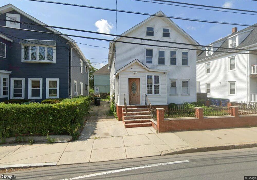
192 Cedar St Somerville, MA 02145
Ball Square NeighborhoodEstimated Value: $1,144,000 - $1,658,121
8
Beds
3
Baths
2,948
Sq Ft
$473/Sq Ft
Est. Value
About This Home
This home is located at 192 Cedar St, Somerville, MA 02145 and is currently estimated at $1,394,280, approximately $472 per square foot. 192 Cedar St is a home located in Middlesex County with nearby schools including Somerville High School and St. Clement Elementary School.
Ownership History
Date
Name
Owned For
Owner Type
Purchase Details
Closed on
Nov 26, 2007
Sold by
Lloyd Deborah A and Lloyd Edward J
Bought by
Jmg Dev Llc
Current Estimated Value
Purchase Details
Closed on
Nov 29, 1991
Sold by
Ludico Peter J
Bought by
Sthilaire Hardal and Preval Lionel
Purchase Details
Closed on
Dec 19, 1989
Sold by
Lloyd Edward B
Bought by
Lloyd Edward J
Home Financials for this Owner
Home Financials are based on the most recent Mortgage that was taken out on this home.
Original Mortgage
$95,000
Interest Rate
9.73%
Mortgage Type
Purchase Money Mortgage
Create a Home Valuation Report for This Property
The Home Valuation Report is an in-depth analysis detailing your home's value as well as a comparison with similar homes in the area
Home Values in the Area
Average Home Value in this Area
Purchase History
| Date | Buyer | Sale Price | Title Company |
|---|---|---|---|
| Jmg Dev Llc | $360,000 | -- | |
| Sthilaire Hardal | $165,000 | -- | |
| Lloyd Edward J | $119,000 | -- |
Source: Public Records
Mortgage History
| Date | Status | Borrower | Loan Amount |
|---|---|---|---|
| Previous Owner | Lloyd Edward J | $12,100 | |
| Previous Owner | Lloyd Edward J | $95,000 | |
| Previous Owner | Lloyd Edward J | $55,000 | |
| Previous Owner | Lloyd Edward J | $15,000 |
Source: Public Records
Tax History
| Year | Tax Paid | Tax Assessment Tax Assessment Total Assessment is a certain percentage of the fair market value that is determined by local assessors to be the total taxable value of land and additions on the property. | Land | Improvement |
|---|---|---|---|---|
| 2025 | $12,795 | $1,172,800 | $510,200 | $662,600 |
| 2024 | $11,603 | $1,102,900 | $510,200 | $592,700 |
| 2023 | $10,986 | $1,062,500 | $510,200 | $552,300 |
| 2022 | $10,350 | $1,016,700 | $485,900 | $530,800 |
| 2021 | $10,021 | $983,400 | $482,300 | $501,100 |
| 2020 | $9,628 | $954,200 | $482,700 | $471,500 |
| 2019 | $9,075 | $843,400 | $439,300 | $404,100 |
| 2018 | $8,331 | $736,600 | $399,400 | $337,200 |
| 2017 | $8,178 | $700,800 | $376,800 | $324,000 |
| 2016 | $7,913 | $631,500 | $336,500 | $295,000 |
| 2015 | $7,606 | $603,200 | $310,800 | $292,400 |
Source: Public Records
Map
Nearby Homes
- 13 Warwick St
- 167 Albion St
- 16 Rogers Ave
- 156 Albion St Unit 1
- 288 Cedar St
- 49 Cherry St Unit 1
- 79 Willow Ave
- 32 Richardson St
- 8 Albion Terrace
- 595 Broadway Unit 302
- 595 Broadway Unit 102
- 595 Broadway Unit 202
- 595 Broadway Unit 101
- 595 Broadway Unit 301
- 3 Vinal St
- 227 Highland Ave Unit 2
- 227 Highland Ave Unit 3
- 227 Highland Ave Unit 1
- 371 Highland Ave
- 221 Highland Ave Unit 1
- 192 Cedar St Unit 2
- 194 Cedar St Unit 1
- 188 Cedar St Unit 2
- 188 Cedar St
- 190 Cedar St Unit 1
- 198 Cedar St
- 198 Cedar St Unit 3
- 17 Boston Ave
- 184 Cedar St
- 19 Boston Ave
- 19 Boston Ave Unit 1
- 15 Boston Ave Unit 2
- 15 Boston Ave Unit 1
- 15 Boston Ave
- 191 Cedar St
- 23 Boston Ave Unit 2
- 25 Boston Ave
- 189 Cedar St
- 189 Cedar St Unit A
- 189 Cedar St Unit 3
Your Personal Tour Guide
Ask me questions while you tour the home.