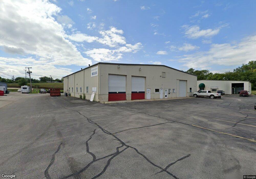
1920 51st St NE Cedar Rapids, IA 52402
Noelridge Park Neighborhood
--
Bed
--
Bath
10,000
Sq Ft
--
Built
About This Home
This home is located at 1920 51st St NE, Cedar Rapids, IA 52402. 1920 51st St NE is a home located in Linn County with nearby schools including T.C. Cherry Elementary School, Wright Elementary School, and Harding Middle School.
Ownership History
Date
Name
Owned For
Owner Type
Purchase Details
Closed on
Nov 21, 2024
Sold by
Korczyk Thomas F and Korczyk Ann L
Bought by
Korczyk Revocable Trust and Korczyk
Purchase Details
Closed on
Nov 1, 2018
Sold by
Korezyk Thomas F and Korezyk Ann L
Bought by
Progressive Investments Inc
Home Financials for this Owner
Home Financials are based on the most recent Mortgage that was taken out on this home.
Original Mortgage
$399,000
Interest Rate
4.7%
Mortgage Type
Land Contract Argmt. Of Sale
Purchase Details
Closed on
Dec 17, 2007
Sold by
Korczyk Thomas F and Korczyk Ann L
Bought by
Eden Christopher T
Create a Home Valuation Report for This Property
The Home Valuation Report is an in-depth analysis detailing your home's value as well as a comparison with similar homes in the area
Home Values in the Area
Average Home Value in this Area
Purchase History
| Date | Buyer | Sale Price | Title Company |
|---|---|---|---|
| Korczyk Revocable Trust | -- | None Listed On Document | |
| Korczyk Revocable Trust | -- | None Listed On Document | |
| Korczyk Thomas F | -- | None Listed On Document | |
| Progressive Investments Inc | $420,000 | None Available | |
| Eden Christopher T | $35,000 | None Available |
Source: Public Records
Mortgage History
| Date | Status | Borrower | Loan Amount |
|---|---|---|---|
| Previous Owner | Progressive Investments Inc | $399,000 |
Source: Public Records
Tax History Compared to Growth
Tax History
| Year | Tax Paid | Tax Assessment Tax Assessment Total Assessment is a certain percentage of the fair market value that is determined by local assessors to be the total taxable value of land and additions on the property. | Land | Improvement |
|---|---|---|---|---|
| 2025 | $17,014 | $606,700 | $272,900 | $333,800 |
| 2024 | $17,432 | $583,300 | $272,900 | $310,400 |
| 2023 | $17,432 | $567,800 | $272,900 | $294,900 |
| 2022 | $12,598 | $560,800 | $272,900 | $287,900 |
| 2021 | $13,146 | $623,700 | $272,900 | $350,800 |
| 2020 | $13,146 | $649,100 | $272,900 | $376,200 |
| 2019 | $12,558 | $461,000 | $272,900 | $188,100 |
| 2018 | $12,504 | $461,000 | $272,900 | $188,100 |
| 2017 | $14,274 | $414,700 | $135,300 | $279,400 |
| 2016 | $14,262 | $414,700 | $135,300 | $279,400 |
| 2015 | $14,246 | $414,595 | $135,250 | $279,345 |
| 2014 | $14,246 | $414,595 | $135,250 | $279,345 |
| 2013 | $15,076 | $414,595 | $135,250 | $279,345 |
Source: Public Records
Map
Nearby Homes
- 1638 47th St NE
- 5455 Blairs Ferry Rd NE
- 109 E Willman St
- 1006 Messina Dr NE
- 1138 Messina Dr NE
- 105 W Willman St
- 2106 42nd St NE
- 1 N Center Point Rd
- 3 N Center Point Rd
- 4309 Benton St NE
- 4609 White Pine Dr NE
- 4216 Marilyn Dr NE
- 250 Cimarron Dr Unit 311
- 0 Council St NE
- 327 Meadows Field Dr NE
- 3858 Northwood Dr NE
- 6505 Brookview Ln NE
- 306 10th Ave
- 4761 Westchester Dr NE Unit C
- 114 Northwood Dr
- 1936 51st St NE
- 1960 51st St NE
- 5100 Center Point Rd NE
- 1933 51st St NE
- 2010 Sylvia Ave NE Unit C
- 2010 Sylvia Ave NE Unit B
- 2010 Sylvia Ave NE Unit 1
- 2010 Sylvia Ave NE Unit 3
- 2010 Sylvia Ave NE Unit 2
- 2010 Sylvia Ave NE
- 1967 51st St NE
- 1951 51st St NE Unit 1
- 1951 51st St NE Unit 3
- 5400 Center Point Rd NE
- 5400 Center Point Rd NE Unit A
- 5400 Center Point Rd NE Unit 2
- 5400 Center Point Rd NE Unit 3
- 5400 Center Point Rd NE Unit B
- 5400 Center Point Rd NE Unit 1
- 2020 Sylvia Ave NE