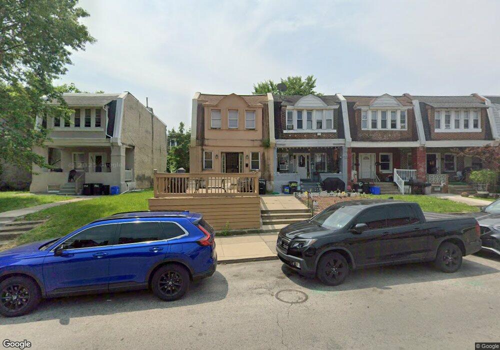
1920 65th Ave Philadelphia, PA 19138
West Oak Lane NeighborhoodEstimated Value: $186,000 - $206,360
3
Beds
1
Bath
1,222
Sq Ft
$160/Sq Ft
Est. Value
About This Home
This home is located at 1920 65th Ave, Philadelphia, PA 19138 and is currently estimated at $196,090, approximately $160 per square foot. 1920 65th Ave is a home located in Philadelphia County with nearby schools including Prince Hall School, Gen. Louis Wagner Middle School, and Martin Luther King High School.
Ownership History
Date
Name
Owned For
Owner Type
Purchase Details
Closed on
Aug 15, 2016
Sold by
Hargrove Latisha Doris
Bought by
Hargrove Shareem Salideem
Current Estimated Value
Purchase Details
Closed on
Nov 24, 2008
Sold by
Moore Earl
Bought by
Hargrove Shareem Salideem and Hargrove Latisha Doris
Purchase Details
Closed on
Oct 20, 2006
Sold by
Savior Lezlie
Bought by
Moore Earl
Purchase Details
Closed on
Aug 22, 2006
Sold by
Lewis Paul and Lewis Goldie
Bought by
Savior Lezlie
Create a Home Valuation Report for This Property
The Home Valuation Report is an in-depth analysis detailing your home's value as well as a comparison with similar homes in the area
Home Values in the Area
Average Home Value in this Area
Purchase History
| Date | Buyer | Sale Price | Title Company |
|---|---|---|---|
| Hargrove Shareem Salideem | -- | None Available | |
| Hargrove Shareem Salideem | $4,000 | None Available | |
| Moore Earl | $28,448 | None Available | |
| Savior Lezlie | $1,000 | None Available |
Source: Public Records
Tax History Compared to Growth
Tax History
| Year | Tax Paid | Tax Assessment Tax Assessment Total Assessment is a certain percentage of the fair market value that is determined by local assessors to be the total taxable value of land and additions on the property. | Land | Improvement |
|---|---|---|---|---|
| 2026 | $1,942 | $170,800 | $34,160 | $136,640 |
| 2025 | $1,942 | $170,800 | $34,160 | $136,640 |
| 2024 | $1,942 | $170,800 | $34,160 | $136,640 |
| 2023 | $1,942 | $138,700 | $27,740 | $110,960 |
| 2022 | $1,492 | $138,700 | $27,740 | $110,960 |
| 2021 | $1,492 | $0 | $0 | $0 |
| 2020 | $1,492 | $0 | $0 | $0 |
| 2019 | $953 | $0 | $0 | $0 |
| 2018 | $706 | $0 | $0 | $0 |
| 2017 | $706 | $0 | $0 | $0 |
| 2016 | $694 | $0 | $0 | $0 |
| 2015 | $784 | $0 | $0 | $0 |
| 2014 | -- | $58,500 | $9,535 | $48,965 |
| 2012 | -- | $8,736 | $2,183 | $6,553 |
Source: Public Records
Map
Nearby Homes
- 6518 Ogontz Ave
- 6436 N 20th St
- 6436 Ogontz Ave
- 1916 Colonial St
- 2022 66th Ave
- 6419 Limekiln Pike
- 6600 N Opal St
- 6603 Ogontz Ave
- 6558 Limekiln Pike
- 1914 W 65th Ave
- 6625 Ogontz Ave
- 6609 N Gratz St
- 6420 N Woodstock St
- 6323 Ogontz Ave
- 6642 N 20th St
- 2012 E Chelten Ave
- 6629 N Gratz St
- 6534 N Lambert St
- 6324 N Gratz St
- 6329 N Woodstock St
- 1922 65th Ave
- 1924 65th Ave
- 1920 W 65th Ave
- 1926 65th Ave
- 1916 W 65th Ave
- 1916 65th Ave
- 1928 65th Ave
- 1923 Colonial St
- 1930 65th Ave
- 1925 Colonial St
- 1921 Colonial St
- 1919 Colonial St
- 1927 Colonial St
- 1912 65th Ave
- 1932 W 65th Ave
- 1932 65th Ave
- 1929 Colonial St
- 1929 Colonial St Unit 2
- 1915 Colonial St
- 1931 Colonial St