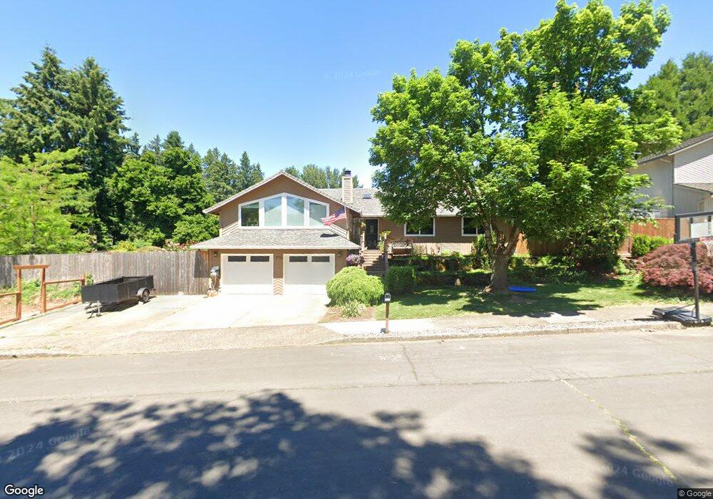
1920 Bristol Ct West Linn, OR 97068
Willamette NeighborhoodEstimated Value: $527,000 - $690,000
3
Beds
2
Baths
2,696
Sq Ft
$232/Sq Ft
Est. Value
About This Home
This home is located at 1920 Bristol Ct, West Linn, OR 97068 and is currently estimated at $626,169, approximately $232 per square foot. 1920 Bristol Ct is a home located in Clackamas County with nearby schools including Willamette Primary School, Athey Creek Middle School, and West Linn High School.
Ownership History
Date
Name
Owned For
Owner Type
Purchase Details
Closed on
May 17, 2021
Sold by
Royce Michael J and Royce Michael J
Bought by
Cunningham John and Cunningham Mckenzie
Current Estimated Value
Home Financials for this Owner
Home Financials are based on the most recent Mortgage that was taken out on this home.
Original Mortgage
$418,000
Outstanding Balance
$378,006
Interest Rate
3.1%
Mortgage Type
New Conventional
Estimated Equity
$248,163
Purchase Details
Closed on
Nov 28, 2018
Sold by
Royce Michael J and Royce Kathleen J
Bought by
Royce Michael J and Royce Kathleen J
Purchase Details
Closed on
Jun 3, 1999
Sold by
Otos William C and Otos Maurine B
Bought by
Royce Michael J and Royce Kathleen J
Create a Home Valuation Report for This Property
The Home Valuation Report is an in-depth analysis detailing your home's value as well as a comparison with similar homes in the area
Home Values in the Area
Average Home Value in this Area
Purchase History
| Date | Buyer | Sale Price | Title Company |
|---|---|---|---|
| Cunningham John | $440,000 | First American | |
| Royce Michael J | -- | None Available | |
| Royce Michael J | $205,000 | First American Title Co |
Source: Public Records
Mortgage History
| Date | Status | Borrower | Loan Amount |
|---|---|---|---|
| Open | Cunningham John | $418,000 |
Source: Public Records
Tax History Compared to Growth
Tax History
| Year | Tax Paid | Tax Assessment Tax Assessment Total Assessment is a certain percentage of the fair market value that is determined by local assessors to be the total taxable value of land and additions on the property. | Land | Improvement |
|---|---|---|---|---|
| 2025 | $5,984 | $310,525 | -- | -- |
| 2024 | $5,760 | $301,481 | -- | -- |
| 2023 | $5,760 | $292,700 | $0 | $0 |
| 2022 | $5,437 | $284,175 | $0 | $0 |
| 2021 | $5,161 | $275,899 | $0 | $0 |
| 2020 | $5,196 | $267,864 | $0 | $0 |
| 2019 | $4,955 | $260,063 | $0 | $0 |
| 2018 | $4,734 | $252,488 | $0 | $0 |
| 2017 | $4,550 | $245,134 | $0 | $0 |
| 2016 | $4,433 | $237,994 | $0 | $0 |
| 2015 | $4,214 | $231,062 | $0 | $0 |
| 2014 | $4,019 | $224,332 | $0 | $0 |
Source: Public Records
Map
Nearby Homes
- 1765 Ostman Rd
- 1925 Hillhouse Dr
- 1075 Epperly Way
- 1160 Blankenship Rd
- 1733 Jamie Cir
- 25540 Cheryl Dr
- 1694 16th St
- 1721 Dollar St Unit 1721
- 1690 16th St
- 812 Wendy Ct
- 2026 Virginia Ln
- 1931 13th St
- 1101 Ryan Ct
- 975 Springtree Ln
- 2250 River Heights Cir
- 1791 Blankenship Rd
- 880 Springtree Ln Unit 880
- 850 Springtree Ln Unit 850
- 800 Springtree Ln
- 640 Springtree Ln
- 1910 Bristol Ct
- 1203 Orchard St
- 1930 Bristol Ct
- 1205 Orchard St
- 1915 Bristol Ct
- 1201 Orchard St
- 1940 Bristol Ct
- 1207 Orchard St
- 2033 Doral Ct
- 1935 Bristol Ct
- 1210 Dollar St
- 1188 Dollar St
- 1209 Orchard St
- 1990 19th St
- 1250 Dollar St
- 1202 Orchard St
- 1970 19th St
- 2015 Doral Ct
- 1211 Orchard St
- 1270 Dollar St