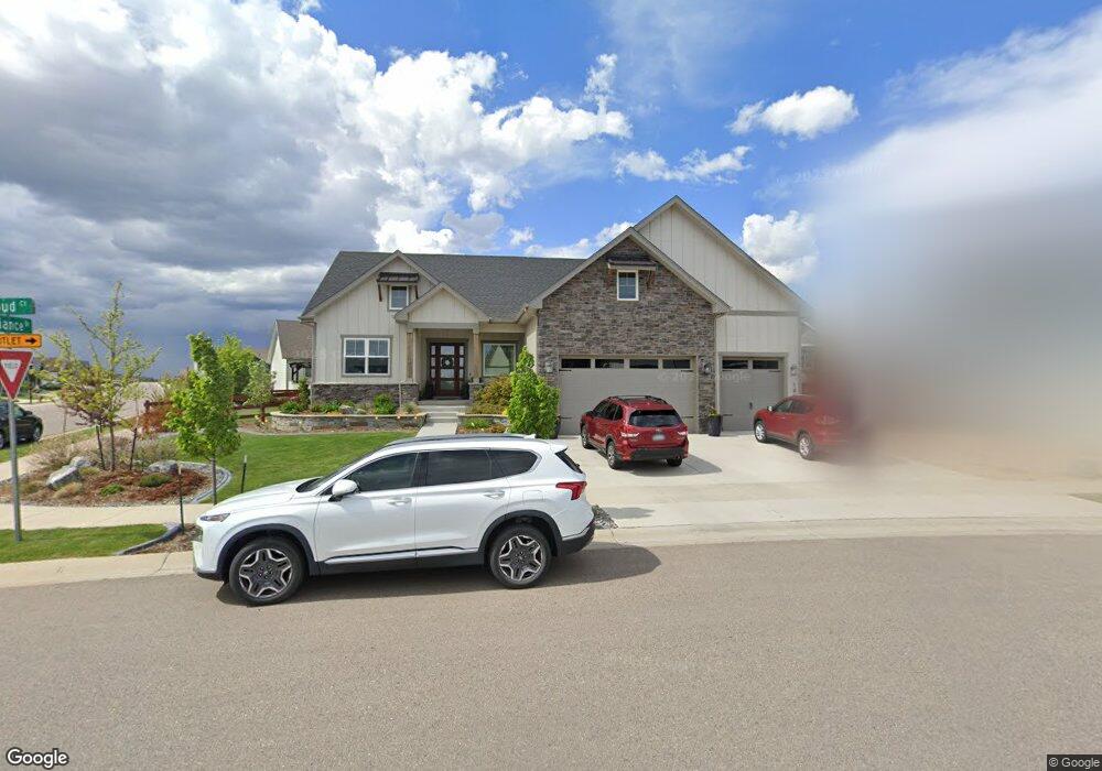
1920 Cloud Ct Unit 12 Windsor, CO 80550
RainDance NeighborhoodEstimated Value: $948,619 - $1,022,000
5
Beds
4
Baths
2,449
Sq Ft
$403/Sq Ft
Est. Value
About This Home
This home is located at 1920 Cloud Ct Unit 12, Windsor, CO 80550 and is currently estimated at $987,655, approximately $403 per square foot. 1920 Cloud Ct Unit 12 is a home located in Weld County with nearby schools including Windsor Middle School, Windsor High School, and Windsor Charter Academy Early College High School.
Ownership History
Date
Name
Owned For
Owner Type
Purchase Details
Closed on
Oct 18, 2024
Sold by
Millard Joshua J and Millard Caren E
Bought by
Lenkway John R and Lenkway Alyssa M
Current Estimated Value
Home Financials for this Owner
Home Financials are based on the most recent Mortgage that was taken out on this home.
Original Mortgage
$525,000
Outstanding Balance
$519,481
Interest Rate
6.35%
Mortgage Type
New Conventional
Estimated Equity
$468,174
Purchase Details
Closed on
Jan 27, 2020
Sold by
Bridgewater Homes Llc
Bought by
Millard Joshua J and Millard Caren E
Home Financials for this Owner
Home Financials are based on the most recent Mortgage that was taken out on this home.
Original Mortgage
$649,248
Interest Rate
3.25%
Mortgage Type
New Conventional
Create a Home Valuation Report for This Property
The Home Valuation Report is an in-depth analysis detailing your home's value as well as a comparison with similar homes in the area
Home Values in the Area
Average Home Value in this Area
Purchase History
| Date | Buyer | Sale Price | Title Company |
|---|---|---|---|
| Lenkway John R | $1,025,000 | Land Title Guarantee | |
| Millard Joshua J | $811,560 | First American |
Source: Public Records
Mortgage History
| Date | Status | Borrower | Loan Amount |
|---|---|---|---|
| Open | Lenkway John R | $525,000 | |
| Previous Owner | Millard Joshua J | $649,248 |
Source: Public Records
Tax History
| Year | Tax Paid | Tax Assessment Tax Assessment Total Assessment is a certain percentage of the fair market value that is determined by local assessors to be the total taxable value of land and additions on the property. | Land | Improvement |
|---|---|---|---|---|
| 2025 | $7,238 | $57,950 | $6,250 | $51,700 |
| 2024 | $7,238 | $57,950 | $6,250 | $51,700 |
| 2023 | $7,003 | $55,400 | $7,100 | $48,300 |
| 2022 | $6,873 | $48,480 | $6,260 | $42,220 |
| 2021 | $6,519 | $49,870 | $6,440 | $43,430 |
| 2020 | $2,407 | $18,550 | $5,360 | $13,190 |
| 2019 | $235 | $1,820 | $1,820 | $0 |
| 2018 | $6 | $10 | $10 | $0 |
Source: Public Records
Map
Nearby Homes
- 1956 Blossom Grove Dr
- 1937 Raindrop Dr
- 1585 Winter Glow Dr
- 1881 Blossom Grove Dr
- 1653 Winter Glow Dr
- 1876 Blossom Grove Dr
- 1657 Winter Glow Dr
- 1875 Blossom Grove Dr
- 1869 Blossom Grove Dr
- 1501 Flowering Tree Ct
- 1508 Flowering Tree Ct
- 1644 Sundown Run Dr
- 1648 Sundown Run Dr
- 1683 Sundown Run Dr
- 1819 Vista Valley Dr
- 1907 Spring Bloom Dr
- 1685 Crystalline Dr
- 2009 Orchard Bloom Dr
- 1962 Covered Bridge Pkwy
- 2012 Day Spring Dr
- 1920 Cloud Ct
- 1914 Cloud Ct
- 1955 Rolling Wind Dr
- 1920 Osprey Ct
- 1949 Rolling Wind Dr
- 1943 Rolling Wind Dr
- 1906 Cloud Ct
- 1939 Rolling Wind Dr
- 1959 Reliance Dr
- 1955 Reliance Dr
- 1911 Cloud Ct
- 1963 Reliance Dr
- 1951 Reliance Dr
- 1935 Rolling Wind Dr
- 1900 Cloud Ct
- 1901 Cloud Ct
- 1947 Reliance Dr
- 1931 Rolling Wind Dr
- 1977 Reliance Dr
- 1958 Rollingwood Dr
Your Personal Tour Guide
Ask me questions while you tour the home.