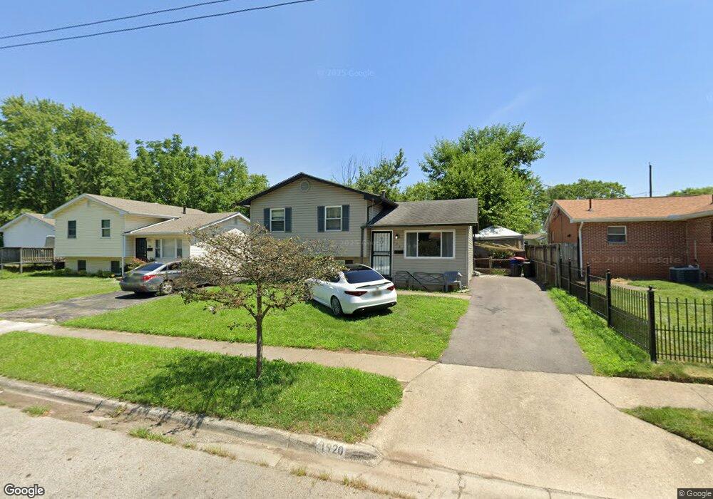
1920 Dunning Rd Columbus, OH 43219
Brittany Hills NeighborhoodEstimated Value: $173,211 - $202,000
3
Beds
1
Bath
1,324
Sq Ft
$139/Sq Ft
Est. Value
About This Home
This home is located at 1920 Dunning Rd, Columbus, OH 43219 and is currently estimated at $184,053, approximately $139 per square foot. 1920 Dunning Rd is a home located in Franklin County with nearby schools including South Mifflin Stem Academy (K-6), Linden-Mckinley Stem School On Arcadia, and Cesar Chavez College Preparatory School.
Ownership History
Date
Name
Owned For
Owner Type
Purchase Details
Closed on
Nov 12, 2007
Sold by
Bank Of New York
Bought by
Lee Steven S and Lee Wendy M
Current Estimated Value
Purchase Details
Closed on
Jul 16, 2007
Sold by
Lamar Louis and Case #06Cve08 10605
Bought by
Bank Of New York and Cwabs Inc Asset Backed Certificates Seri
Purchase Details
Closed on
Aug 8, 2005
Sold by
Gwinn Donna R
Bought by
Lamar Louis
Home Financials for this Owner
Home Financials are based on the most recent Mortgage that was taken out on this home.
Original Mortgage
$75,200
Interest Rate
6.5%
Mortgage Type
Fannie Mae Freddie Mac
Purchase Details
Closed on
Jun 19, 1997
Sold by
Bates Altora M
Bought by
Ford Consumer Finance Company Inc
Purchase Details
Closed on
Mar 1, 1986
Create a Home Valuation Report for This Property
The Home Valuation Report is an in-depth analysis detailing your home's value as well as a comparison with similar homes in the area
Home Values in the Area
Average Home Value in this Area
Purchase History
| Date | Buyer | Sale Price | Title Company |
|---|---|---|---|
| Lee Steven S | $45,000 | Resource | |
| Bank Of New York | $58,000 | None Available | |
| Lamar Louis | $94,000 | -- | |
| Ford Consumer Finance Company Inc | $32,600 | -- | |
| -- | -- | -- |
Source: Public Records
Mortgage History
| Date | Status | Borrower | Loan Amount |
|---|---|---|---|
| Previous Owner | Lamar Louis | $75,200 |
Source: Public Records
Tax History Compared to Growth
Tax History
| Year | Tax Paid | Tax Assessment Tax Assessment Total Assessment is a certain percentage of the fair market value that is determined by local assessors to be the total taxable value of land and additions on the property. | Land | Improvement |
|---|---|---|---|---|
| 2024 | $2,252 | $49,150 | $10,680 | $38,470 |
| 2023 | $2,224 | $49,150 | $10,680 | $38,470 |
| 2022 | $1,120 | $21,080 | $2,210 | $18,870 |
| 2021 | $1,272 | $21,080 | $2,210 | $18,870 |
| 2020 | $1,245 | $21,080 | $2,210 | $18,870 |
| 2019 | $995 | $16,000 | $1,750 | $14,250 |
| 2018 | $1,063 | $16,000 | $1,750 | $14,250 |
| 2017 | $1,119 | $16,000 | $1,750 | $14,250 |
| 2016 | $1,244 | $18,310 | $2,490 | $15,820 |
| 2015 | $1,133 | $18,310 | $2,490 | $15,820 |
| 2014 | $1,135 | $18,310 | $2,490 | $15,820 |
| 2013 | $622 | $20,335 | $2,765 | $17,570 |
Source: Public Records
Map
Nearby Homes
- 1882 Dunning Rd
- 2336 Edenburgh Dr S
- 2398 Dunkirk Dr
- 1808 Brentnell Ave
- 1794 Devonshire Rd
- 1790 Marston Rd
- 2471 Mock Rd
- 0 Mock Rd
- 1789 Marston Rd
- 2054 Jermain Dr
- 0 Danby Dr
- 1991 Woodland Ave
- 0 Rankin Ave Unit (Rear)
- 2483 Vendome Dr
- 1978 Argyle Dr
- 2228 Holt Ave
- 2736 Bellero Way Unit 94
- 1860 Meadowlawn Dr Unit 75
- 1975 Mock Rd
- 2424 Holt Ave
- 1926 Dunning Rd
- 2318 Edenburgh Dr S
- 2328 Edenburgh Dr S
- 2321 Dunning Ct
- 2331 Dunning Ct
- 2337 Dunning Ct
- 1921 Dunning Rd
- 1927 Dunning Rd
- 1915 Dunning Rd
- 2317 Edenburgh Dr S
- 2342 Edenburgh Dr E
- 1933 Dunning Rd
- 2342 Edenburgh Dr S
- 1907 Dunning Rd
- 2347 Dunning Ct
- 1941 Dunning Rd
- 2327 Edenburgh Dr S
- 2322 Dunning Ct
- 1899 Dunning Rd
- 1890 Dunning Rd