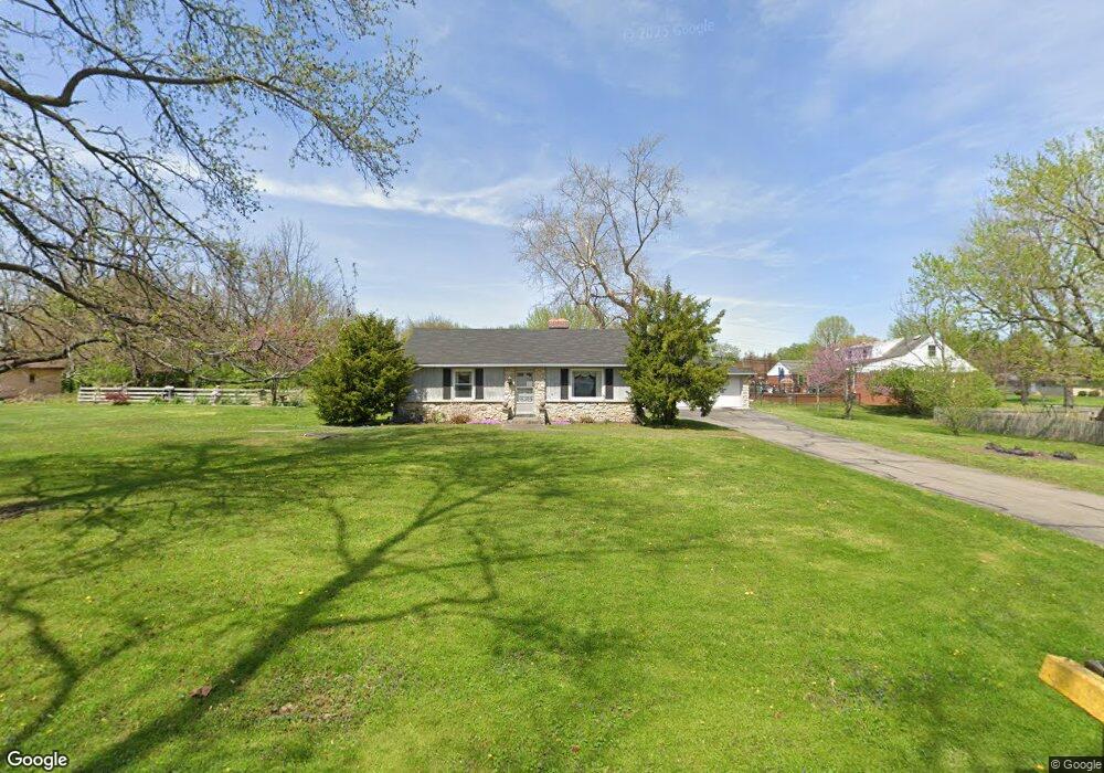
1920 E Loretta Dr Indianapolis, IN 46227
Estimated Value: $239,000 - $275,000
2
Beds
2
Baths
1,700
Sq Ft
$149/Sq Ft
Est. Value
About This Home
This home is located at 1920 E Loretta Dr, Indianapolis, IN 46227 and is currently estimated at $253,314, approximately $149 per square foot. 1920 E Loretta Dr is a home located in Marion County with nearby schools including Southport Elementary School, Southport 6th Grade Academy, and Southport Middle School.
Ownership History
Date
Name
Owned For
Owner Type
Purchase Details
Closed on
Oct 26, 2007
Sold by
Payne Herlen
Bought by
Secrest Joel M and Secrest Mary L
Current Estimated Value
Home Financials for this Owner
Home Financials are based on the most recent Mortgage that was taken out on this home.
Original Mortgage
$30,000
Interest Rate
6.44%
Mortgage Type
New Conventional
Purchase Details
Closed on
Aug 5, 2003
Sold by
Mcmillan William E and Mcmillan Revocable L William E
Bought by
Payne Herlen
Create a Home Valuation Report for This Property
The Home Valuation Report is an in-depth analysis detailing your home's value as well as a comparison with similar homes in the area
Home Values in the Area
Average Home Value in this Area
Purchase History
We collect this data history from publicly available records. To have your information removed, we recommend requesting removal directly through your county’s website.
| Date | Buyer | Sale Price | Title Company |
|---|---|---|---|
| Secrest Joel M | -- | None Available | |
| Payne Herlen | -- | None Available |
Source: Public Records
Mortgage History
We collect this data history from publicly available records. To have your information removed, we recommend requesting removal directly through your county’s website.
| Date | Status | Borrower | Loan Amount |
|---|---|---|---|
| Closed | Secrest Joel M | $30,000 |
Source: Public Records
Tax History
| Year | Tax Paid | Tax Assessment Tax Assessment Total Assessment is a certain percentage of the fair market value that is determined by local assessors to be the total taxable value of land and additions on the property. | Land | Improvement |
|---|---|---|---|---|
| 2025 | $2,408 | $196,500 | $28,100 | $168,400 |
| 2024 | $2,525 | $191,800 | $28,100 | $163,700 |
| 2023 | $2,525 | $192,700 | $28,100 | $164,600 |
| 2022 | $2,358 | $175,900 | $28,100 | $147,800 |
| 2021 | $1,940 | $143,800 | $28,100 | $115,700 |
| 2020 | $1,918 | $141,800 | $28,100 | $113,700 |
| 2019 | $1,140 | $101,200 | $14,800 | $86,400 |
| 2018 | $1,017 | $94,600 | $14,800 | $79,800 |
| 2017 | $991 | $93,600 | $14,800 | $78,800 |
| 2016 | $957 | $91,400 | $14,800 | $76,600 |
| 2014 | $747 | $90,200 | $14,800 | $75,400 |
| 2013 | $801 | $90,200 | $14,800 | $75,400 |
Source: Public Records
Map
Nearby Homes
- 2326 E Banta Rd
- 6618 Twin Brooks Dr
- 6502 Homestead Dr
- 6506 Twin Brooks Dr
- 2416 Tulip Dr S
- 2202 Fairhope Dr
- 2428 Tulip Dr S
- 1718 Tulip Dr
- 6808 Madison Ave
- 1708 Cardinal Dr
- 1620 Southview Dr
- 1649 Southview Dr
- 6107 Homestead Dr
- 54 Church St
- 700 E Werges Ave
- 6720 Mcfarland Rd
- 1353 E Loretta Dr
- 1352 Southview Dr
- 6315 Mcfarland Rd
- 1216 E Cragmont Dr
- 6530 Derbyshire Rd
- 1910 E Loretta Dr
- 1919 E Loretta Dr
- 2231 E Banta Rd
- 1929 E Loretta Dr
- 2245 E Banta Rd
- 2229 E Banta Rd
- 6523 Fable St
- 1906 E Loretta Dr
- 1909 E Loretta Dr
- 2255 E Banta Rd
- 1931 E Banta Rd
- 6535 Derbyshire Rd
- 1925 E Banta Rd
- 6610 Derbyshire Rd
- 6631 Fable St
- 2305 E Banta Rd
- 6604 Fable St
- 6524 Fable St
- 6612 Fable St
Your Personal Tour Guide
Ask me questions while you tour the home.