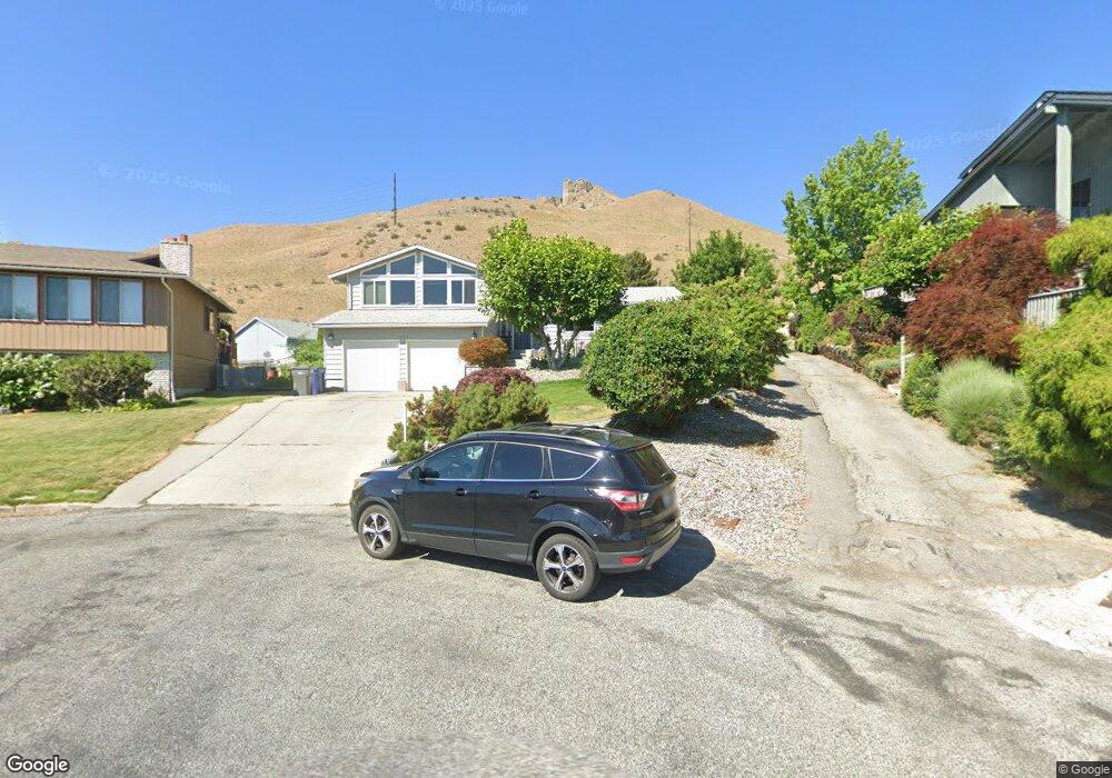
1920 Emerald Place Wenatchee, WA 98801
Estimated Value: $643,180 - $752,000
--
Bed
1
Bath
2,850
Sq Ft
$245/Sq Ft
Est. Value
About This Home
This home is located at 1920 Emerald Place, Wenatchee, WA 98801 and is currently estimated at $698,727, approximately $245 per square foot. 1920 Emerald Place is a home located in Chelan County with nearby schools including John Newbery Elementary School, Foothills Middle School, and Wenatchee High School.
Ownership History
Date
Name
Owned For
Owner Type
Purchase Details
Closed on
Feb 13, 2008
Sold by
Hurt Brock V and Hurt Allison
Bought by
Hurt Brock and Hurt Allison
Current Estimated Value
Home Financials for this Owner
Home Financials are based on the most recent Mortgage that was taken out on this home.
Original Mortgage
$276,000
Interest Rate
5.64%
Mortgage Type
New Conventional
Purchase Details
Closed on
Mar 22, 2007
Sold by
Hurt Brock V and Hurt Allison M
Bought by
Hurt Brock and Hurt Allison M
Home Financials for this Owner
Home Financials are based on the most recent Mortgage that was taken out on this home.
Original Mortgage
$225,600
Interest Rate
6.31%
Mortgage Type
New Conventional
Purchase Details
Closed on
Jul 5, 2005
Sold by
Hart Kristen E B
Bought by
Hart Brock
Create a Home Valuation Report for This Property
The Home Valuation Report is an in-depth analysis detailing your home's value as well as a comparison with similar homes in the area
Home Values in the Area
Average Home Value in this Area
Purchase History
| Date | Buyer | Sale Price | Title Company |
|---|---|---|---|
| Hurt Brock | -- | First American Title | |
| Hurt Brock | -- | Stewart Title Guaranty Co | |
| Hart Brock | -- | First American Title |
Source: Public Records
Mortgage History
| Date | Status | Borrower | Loan Amount |
|---|---|---|---|
| Closed | Hurt Brock | $276,000 | |
| Closed | Hurt Brock | $225,600 |
Source: Public Records
Tax History Compared to Growth
Tax History
| Year | Tax Paid | Tax Assessment Tax Assessment Total Assessment is a certain percentage of the fair market value that is determined by local assessors to be the total taxable value of land and additions on the property. | Land | Improvement |
|---|---|---|---|---|
| 2021 | $4,059 | $414,396 | $99,600 | $314,796 |
| 2020 | $3,567 | $359,156 | $99,600 | $259,556 |
| 2019 | $3,337 | $345,418 | $60,000 | $285,418 |
| 2018 | $3,514 | $341,268 | $60,000 | $281,268 |
| 2017 | $2,944 | $294,280 | $60,000 | $234,280 |
| 2016 | $2,663 | $265,345 | $60,000 | $205,345 |
| 2015 | $2,663 | $269,805 | $60,000 | $209,805 |
| 2013 | $2,663 | $237,875 | $54,000 | $183,875 |
Source: Public Records
Map
Nearby Homes
- 1900 Cumbo Ct
- 1827 Dorner Place
- 2012 Linville Dr
- 340 Brandi Ln
- 756 Castle Heights Dr
- 2013 Linville Dr
- 301 Canyon Place
- 204 Pershing Cir
- 507 Cedar Wood Ln
- 300 S Elliott Ave Unit 29
- 1428 John St
- 520 Cedar Wood Ln
- 512 Cedar Wood Place
- 613 Meadows Dr N
- 1701 Skyline Dr
- 9 Elliott Ave N
- 624 Meadows Dr
- 1 NNA Skyline Dr
- 1310 Castlerock Ave Unit 19
- 1310 Castlerock Ave Unit 30
- 1921 Emerald Place
- 1916 Emerald Place
- 1958 Castlerock Ave
- 1954 Castlerock Ave
- 1950 Castlerock Ave
- 1915 Rocklund Dr
- 1917 Emerald Place
- 1911 Rocklund Dr
- 1946 Castlerock Ave
- 1913 Emerald Place
- 1942 Castlerock Ave
- 1951 Castlerock Ave
- 1919 Rocklund Dr
- 1947 Castlerock Ave
- 1938 Castlerock Ave
- 1943 Castlerock Ave
- 1922 Rocklund Dr
- 1939 Castlerock Ave
- 1934 Castlerock Ave
- 1918 Rocklund Dr