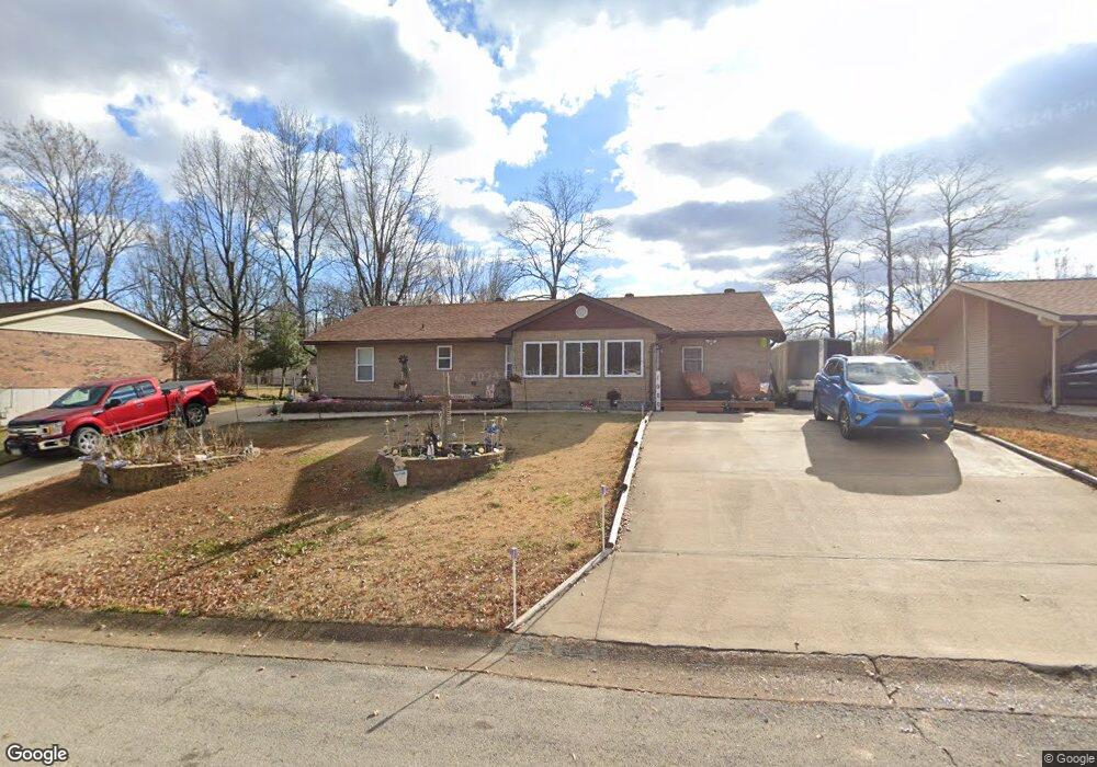
1920 Fernwood Rd Poplar Bluff, MO 63901
Estimated Value: $162,931 - $182,000
--
Bed
--
Bath
1,678
Sq Ft
$103/Sq Ft
Est. Value
About This Home
This home is located at 1920 Fernwood Rd, Poplar Bluff, MO 63901 and is currently estimated at $173,483, approximately $103 per square foot. 1920 Fernwood Rd is a home with nearby schools including Eugene Field Elementary School, Poplar Bluff Fifth & Sixth Grade Center, and Poplar Bluff Junior High School.
Ownership History
Date
Name
Owned For
Owner Type
Purchase Details
Closed on
May 24, 2022
Sold by
Nordeen Linda C
Bought by
Nordeen Duane E and Nordeen Linda C
Current Estimated Value
Purchase Details
Closed on
Jul 14, 2017
Sold by
Nordeen Linda and Mannon Linda
Bought by
Nordeen Linda
Home Financials for this Owner
Home Financials are based on the most recent Mortgage that was taken out on this home.
Original Mortgage
$62,200
Interest Rate
3.9%
Mortgage Type
New Conventional
Create a Home Valuation Report for This Property
The Home Valuation Report is an in-depth analysis detailing your home's value as well as a comparison with similar homes in the area
Home Values in the Area
Average Home Value in this Area
Purchase History
| Date | Buyer | Sale Price | Title Company |
|---|---|---|---|
| Nordeen Duane E | -- | None Listed On Document | |
| Nordeen Linda | -- | None Available |
Source: Public Records
Mortgage History
| Date | Status | Borrower | Loan Amount |
|---|---|---|---|
| Previous Owner | Nordeen Linda | $62,200 |
Source: Public Records
Tax History Compared to Growth
Tax History
| Year | Tax Paid | Tax Assessment Tax Assessment Total Assessment is a certain percentage of the fair market value that is determined by local assessors to be the total taxable value of land and additions on the property. | Land | Improvement |
|---|---|---|---|---|
| 2024 | $990 | $20,480 | $0 | $0 |
| 2023 | $989 | $20,480 | $0 | $0 |
| 2022 | $879 | $18,230 | $0 | $0 |
| 2021 | $879 | $18,230 | $0 | $0 |
| 2020 | $862 | $17,630 | $0 | $0 |
| 2019 | $861 | $17,630 | $0 | $0 |
| 2018 | $861 | $14,380 | $0 | $0 |
| 2017 | -- | $14,380 | $0 | $0 |
| 2016 | -- | $14,380 | $0 | $0 |
| 2015 | -- | $14,380 | $0 | $0 |
| 2014 | -- | $13,420 | $0 | $0 |
| 2012 | $572 | $13,420 | $0 | $0 |
Source: Public Records
Map
Nearby Homes
- 2024 Glendale Rd
- 2718 Bedoll Ave
- 2801 Bedoll Ave
- 2925 Wayne Ave
- 1110 Commerce St
- 2121 Pike St
- 1039 Franklin St
- 1025 Delano St
- 1315 S 11th St
- 2335 Cheshire Blvd
- 1000 W Victor St
- 712 Nickey St
- 622 Nickey St
- 912 Adam St
- 163 Fairway Dr
- 0 County Road 301
- 112 Kaylee Cir
- 1905 Kentucky Ave
- 1708 Kentucky Ave
- 792 County Road 466
- 1926 Fernwood Rd
- 1912 Fernwood Rd
- 1919 Fernwood Rd
- 1936 Fernwood Rd
- 1911 Fernwood Rd
- 1929 Fernwood Rd
- 1935 Fernwood Rd
- 1902 Fernwood Rd
- 1942 Fernwood Rd
- 1901 Fernwood Rd
- 1941 Fernwood Rd
- 1948 Fernwood Rd
- 1930 Glendale Rd
- 2613 National Ave
- 1924 Glendale Rd
- 1949 Fernwood Rd
- 1936 Glendale Rd
- 1912 Glendale Rd
- 1918 Glendale Rd
- 1906 Glendale Rd