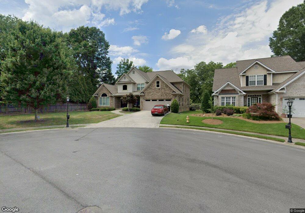
1920 Keystone Way Dalton, GA 30720
Estimated Value: $470,366 - $575,000
--
Bed
1
Bath
3,570
Sq Ft
$147/Sq Ft
Est. Value
About This Home
This home is located at 1920 Keystone Way, Dalton, GA 30720 and is currently estimated at $523,342, approximately $146 per square foot. 1920 Keystone Way is a home with nearby schools including Brookwood Elementary School, Dalton Middle School, and Dalton High School.
Ownership History
Date
Name
Owned For
Owner Type
Purchase Details
Closed on
Sep 6, 2022
Sold by
Washa Mutafa
Bought by
Wah Irrevocable Trust
Current Estimated Value
Purchase Details
Closed on
Jun 28, 2013
Sold by
Hadba Wasim Abu
Bought by
Mustafa Wadha
Purchase Details
Closed on
Jul 6, 2012
Sold by
Corbin Connie
Bought by
Abuhadba Wasim
Purchase Details
Closed on
May 27, 2008
Sold by
Wentworth Development Llc
Bought by
Corbin Connie
Purchase Details
Closed on
Mar 11, 2008
Sold by
Not Provided
Bought by
Corbin Connie
Purchase Details
Closed on
Dec 24, 2004
Sold by
Wilding Development Group Llc
Bought by
Hollis & Hollis Development Co Llc
Create a Home Valuation Report for This Property
The Home Valuation Report is an in-depth analysis detailing your home's value as well as a comparison with similar homes in the area
Home Values in the Area
Average Home Value in this Area
Purchase History
| Date | Buyer | Sale Price | Title Company |
|---|---|---|---|
| Wah Irrevocable Trust | -- | -- | |
| Mustafa Wadha | -- | -- | |
| Abuhadba Wasim | $36,000 | -- | |
| Corbin Connie | $35,000 | -- | |
| Corbin Connie | -- | -- | |
| Hollis & Hollis Development Co Llc | -- | -- |
Source: Public Records
Tax History Compared to Growth
Tax History
| Year | Tax Paid | Tax Assessment Tax Assessment Total Assessment is a certain percentage of the fair market value that is determined by local assessors to be the total taxable value of land and additions on the property. | Land | Improvement |
|---|---|---|---|---|
| 2024 | $5,887 | $214,374 | $13,200 | $201,174 |
| 2023 | $5,887 | $165,431 | $12,720 | $152,711 |
| 2022 | $4,167 | $128,378 | $12,720 | $115,658 |
| 2021 | $4,173 | $128,378 | $12,720 | $115,658 |
| 2020 | $200 | $128,378 | $12,720 | $115,658 |
| 2019 | $4,454 | $128,378 | $12,720 | $115,658 |
| 2018 | $4,814 | $128,378 | $12,720 | $115,658 |
| 2017 | $4,634 | $128,378 | $12,720 | $115,658 |
| 2016 | $4,214 | $115,992 | $10,800 | $105,192 |
| 2014 | $356 | $116,164 | $10,800 | $105,364 |
| 2013 | -- | $10,800 | $10,800 | $0 |
Source: Public Records
Map
Nearby Homes
- 1506 Summer Gate Way
- 1506 Summer Gate Way Unit 8
- 1709 Dug Gap Rd
- 1922 Fairfield Dr
- 1482 Mineral Springs Rd
- 1498 Mineral Springs Rd
- 1704 Southmont Dr
- 1913 Tara Place
- 1934 Spring Chase Way
- 1608 Ryman Ridge Rd
- 00 Rio Vista Dr
- 0 Horizon Ct Unit 130497
- 0 Horizon Ct Unit 130499
- 0 Horizon Ct Unit 130479
- 0 Horizon Ct Unit 130477
- 0 Horizon Ct Unit 130478
- 0 Horizon Ct Unit 130496
- 0 Horizon Ct Unit 130498
- 1504 Belmont Dr
- 111 Broadview Terrace
- 1918 Keystone Way
- 1916 Keystone Way
- 1919 Keystone Way
- 1601 Habersham Way
- 1603 Habersham Way
- 1917 Keystone Way
- 1914 Keystone Way
- 1515 Habersham Way
- 1915 Keystone Way
- 1912 Keystone Way
- 1913 Keystone Way
- 714 Hackney Dr
- 1916 Fairington Dr
- 712 Hackney Dr
- 1910 Keystone Way
- 1513 Habersham Way
- 1918 Fairington Dr
- 1911 Keystone Way
- 710 Hackney Dr
- 1901 Kingston Ct