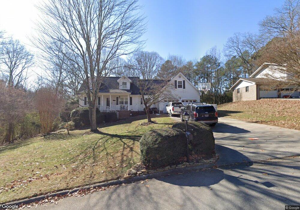
1920 Light Tower Cir Unit 13 Hixson, TN 37343
Estimated Value: $414,982 - $490,000
3
Beds
3
Baths
2,784
Sq Ft
$161/Sq Ft
Est. Value
About This Home
This home is located at 1920 Light Tower Cir Unit 13, Hixson, TN 37343 and is currently estimated at $447,246, approximately $160 per square foot. 1920 Light Tower Cir Unit 13 is a home located in Hamilton County with nearby schools including McConnell Elementary School, Loftis Middle School, and Hixson High School.
Ownership History
Date
Name
Owned For
Owner Type
Purchase Details
Closed on
Jan 29, 2010
Sold by
White Gary T and White Gale L
Bought by
Stanton Craig L and Stanton Lindsay H
Current Estimated Value
Home Financials for this Owner
Home Financials are based on the most recent Mortgage that was taken out on this home.
Original Mortgage
$203,741
Outstanding Balance
$132,940
Interest Rate
4.75%
Mortgage Type
FHA
Estimated Equity
$314,306
Purchase Details
Closed on
Aug 15, 1995
Bought by
White Gary T and White Gale L
Create a Home Valuation Report for This Property
The Home Valuation Report is an in-depth analysis detailing your home's value as well as a comparison with similar homes in the area
Home Values in the Area
Average Home Value in this Area
Purchase History
| Date | Buyer | Sale Price | Title Company |
|---|---|---|---|
| Stanton Craig L | $207,500 | Northgate Title Escrow Inc | |
| White Gary T | $129,900 | -- |
Source: Public Records
Mortgage History
| Date | Status | Borrower | Loan Amount |
|---|---|---|---|
| Open | Stanton Craig L | $203,741 |
Source: Public Records
Tax History
| Year | Tax Paid | Tax Assessment Tax Assessment Total Assessment is a certain percentage of the fair market value that is determined by local assessors to be the total taxable value of land and additions on the property. | Land | Improvement |
|---|---|---|---|---|
| 2025 | $1,423 | $93,875 | $0 | $0 |
| 2024 | $1,278 | $57,100 | $0 | $0 |
| 2023 | $1,287 | $57,100 | $0 | $0 |
| 2022 | $1,287 | $57,100 | $0 | $0 |
| 2021 | $1,287 | $57,100 | $0 | $0 |
| 2020 | $1,338 | $48,050 | $0 | $0 |
| 2019 | $1,338 | $48,050 | $0 | $0 |
| 2018 | $1,338 | $48,050 | $0 | $0 |
| 2017 | $1,338 | $48,050 | $0 | $0 |
| 2016 | $1,233 | $0 | $0 | $0 |
| 2015 | $1,233 | $44,250 | $0 | $0 |
| 2014 | $1,233 | $0 | $0 | $0 |
Source: Public Records
Map
Nearby Homes
- 6416 Sea Haven Dr
- 6405 Sea Haven Dr Unit 10
- 2610 Folkner Rd
- 6510 Fairview Rd
- 2227 Bay Pointe Dr
- 1822 Bay Pointe Dr
- 2112 River Bluff Dr
- 6514 Fairview Rd
- 6517 Shelter Cove Dr
- 6619 Schooner Bay Ln
- 1716 Mountain Bay Dr
- 2051
- 0 Ridge Lake Rd Unit RTC2805180
- 0 Ridge Lake Rd Unit 1509241
- 2075 Paige Meadows Ct
- 2063 Paige Meadows Ct
- 2011 Paige Meadows Ct
- 1689 Destiny Dr
- 1693 Destiny Dr
- 1663 Destiny Dr
- 1922 Light Tower Cir
- 1918 Light Tower Cir
- 1918 Light Tower Cir Unit 1333
- 1919 Light Tower Cir
- 1924 Light Tower Cir
- 1924 Light Tower Cir Unit 1333
- 1916 Light Tower Cir Unit 13
- 6439 Harbor Master Dr Unit 10
- 6441 Harbor Master Dr
- 1923 Light Tower Cir
- 1926 Light Tower Cir
- 1912 Light Tower Cir
- 6435 Harbor Master Dr
- 1927 Light Tower Cir
- 1927 Light Tower Cir Unit 463
- 6445 Harbor Master Dr
- 6447 Harbor Master Dr
- 1909 Light Tower Cir Unit 13
- 1909 Light Tower Cir Unit 1333
- 1928 Light Tower Cir Unit 13
Your Personal Tour Guide
Ask me questions while you tour the home.