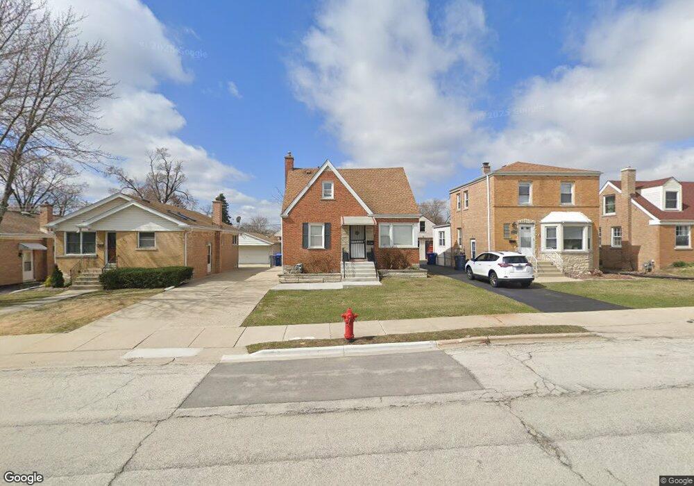
1920 N Taft Ave Berkeley, IL 60163
Estimated Value: $288,000 - $324,000
3
Beds
2
Baths
1,193
Sq Ft
$252/Sq Ft
Est. Value
About This Home
This home is located at 1920 N Taft Ave, Berkeley, IL 60163 and is currently estimated at $300,327, approximately $251 per square foot. 1920 N Taft Ave is a home located in Cook County with nearby schools including Macarthur Intermediate School, Sunnyside Elementary School, and Proviso West High School.
Ownership History
Date
Name
Owned For
Owner Type
Purchase Details
Closed on
Apr 9, 2010
Sold by
Bulmann Robert P and Bulmann Richard W
Bought by
Fox Melissa
Current Estimated Value
Home Financials for this Owner
Home Financials are based on the most recent Mortgage that was taken out on this home.
Original Mortgage
$153,370
Outstanding Balance
$101,003
Interest Rate
5.01%
Mortgage Type
FHA
Estimated Equity
$199,324
Purchase Details
Closed on
Apr 9, 2002
Sold by
Bulmann Mildred E
Bought by
Bulmann Mildred E
Create a Home Valuation Report for This Property
The Home Valuation Report is an in-depth analysis detailing your home's value as well as a comparison with similar homes in the area
Home Values in the Area
Average Home Value in this Area
Purchase History
| Date | Buyer | Sale Price | Title Company |
|---|---|---|---|
| Fox Melissa | $156,500 | Bt | |
| Bulmann Mildred E | -- | -- |
Source: Public Records
Mortgage History
| Date | Status | Borrower | Loan Amount |
|---|---|---|---|
| Open | Fox Melissa | $153,370 |
Source: Public Records
Tax History
| Year | Tax Paid | Tax Assessment Tax Assessment Total Assessment is a certain percentage of the fair market value that is determined by local assessors to be the total taxable value of land and additions on the property. | Land | Improvement |
|---|---|---|---|---|
| 2025 | $7,664 | $24,000 | $2,970 | $21,030 |
| 2024 | $7,664 | $24,000 | $2,970 | $21,030 |
| 2023 | $5,332 | $24,000 | $2,970 | $21,030 |
| 2022 | $5,332 | $15,557 | $2,565 | $12,992 |
| 2021 | $5,355 | $15,557 | $2,565 | $12,992 |
| 2020 | $5,144 | $15,557 | $2,565 | $12,992 |
| 2019 | $3,939 | $12,722 | $2,295 | $10,427 |
| 2018 | $3,859 | $12,722 | $2,295 | $10,427 |
| 2017 | $3,713 | $12,722 | $2,295 | $10,427 |
| 2016 | $4,492 | $13,594 | $2,025 | $11,569 |
| 2015 | $4,428 | $13,594 | $2,025 | $11,569 |
| 2014 | $4,369 | $13,594 | $2,025 | $11,569 |
| 2013 | $4,142 | $13,943 | $2,025 | $11,918 |
Source: Public Records
Map
Nearby Homes
- 504 N Irving Ave
- 2050 Atwood Ave
- 5949 School St
- 250 N Irving Ave
- 226 N Lind Ave
- 522 E Park Manor Ct
- 593 S Edgewood Ave
- 520 N Wolf Rd Unit 203
- 4938 W Randolph St
- 605 N Wolf Rd Unit B9
- 70 N Laverne Ave
- 341 Iroquois Rd
- 4904 W Hawthorne Ave
- 1529 N Hillside Ave
- 956 S Cadwell Ave
- 1447 N Ashbel Ave
- 1428 1/2 N Ashbel Ave
- 928 S Hillcrest Ave
- 515 S Parkview Ave
- 426 E Harrison St
- 1924 N Taft Ave
- 1918 N Taft Ave
- 1916 N Taft Ave
- 1928 N Taft Ave
- 1912 N Taft Ave
- 1932 N Taft Ave
- 1923 Herbert Ave
- 1919 Herbert Ave
- 1908 N Taft Ave
- 1936 N Taft Ave
- 1915 Herbert Ave
- 419 N Taft Ave
- 1931 Herbert Ave
- 5164 Locust St
- 423 N Taft Ave
- 1911 Herbert Ave
- 1904 N Taft Ave
- 1940 N Taft Ave
- 1935 Herbert Ave
- 425 N Taft Ave
Your Personal Tour Guide
Ask me questions while you tour the home.