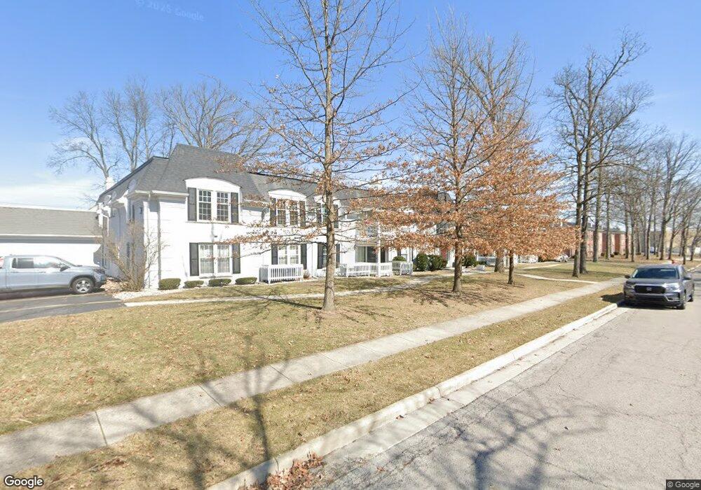
1920 Queenswood Dr Unit U Findlay, OH 45840
Estimated Value: $149,000 - $172,000
2
Beds
2
Baths
1,566
Sq Ft
$105/Sq Ft
Est. Value
About This Home
This home is located at 1920 Queenswood Dr Unit U, Findlay, OH 45840 and is currently estimated at $165,154, approximately $105 per square foot. 1920 Queenswood Dr Unit U is a home located in Hancock County with nearby schools including Van Buren Elementary School, Van Buren Middle School, and Van Buren High School.
Ownership History
Date
Name
Owned For
Owner Type
Purchase Details
Closed on
Nov 29, 2016
Sold by
Bros Koehler and Koehler James C
Bought by
Mull Cheryi A
Current Estimated Value
Home Financials for this Owner
Home Financials are based on the most recent Mortgage that was taken out on this home.
Original Mortgage
$70,200
Outstanding Balance
$56,598
Interest Rate
3.47%
Mortgage Type
New Conventional
Estimated Equity
$108,556
Purchase Details
Closed on
Sep 20, 1988
Bought by
Koehler Bros
Create a Home Valuation Report for This Property
The Home Valuation Report is an in-depth analysis detailing your home's value as well as a comparison with similar homes in the area
Home Values in the Area
Average Home Value in this Area
Purchase History
| Date | Buyer | Sale Price | Title Company |
|---|---|---|---|
| Mull Cheryi A | $78,000 | Mid Am Title | |
| Koehler Bros | -- | -- |
Source: Public Records
Mortgage History
| Date | Status | Borrower | Loan Amount |
|---|---|---|---|
| Open | Mull Cheryi A | $70,200 |
Source: Public Records
Tax History Compared to Growth
Tax History
| Year | Tax Paid | Tax Assessment Tax Assessment Total Assessment is a certain percentage of the fair market value that is determined by local assessors to be the total taxable value of land and additions on the property. | Land | Improvement |
|---|---|---|---|---|
| 2024 | $1,337 | $37,630 | $2,800 | $34,830 |
| 2023 | $1,339 | $37,630 | $2,800 | $34,830 |
| 2022 | $1,334 | $37,630 | $2,800 | $34,830 |
| 2021 | $1,164 | $28,610 | $2,100 | $26,510 |
| 2020 | $1,164 | $28,610 | $2,100 | $26,510 |
| 2019 | $1,143 | $28,610 | $2,100 | $26,510 |
| 2018 | $1,243 | $28,610 | $2,100 | $26,510 |
| 2017 | $1,244 | $28,610 | $2,100 | $26,510 |
| 2016 | $1,268 | $28,610 | $2,100 | $26,510 |
| 2015 | $1,338 | $29,750 | $2,100 | $27,650 |
| 2014 | $1,338 | $29,750 | $2,100 | $27,650 |
| 2012 | $1,350 | $29,750 | $2,100 | $27,650 |
Source: Public Records
Map
Nearby Homes
- 1926 Queenswood Dr
- 1902 Queenswood Dr
- 822 Bright Rd
- 1812 Camelot Ln
- 1825 Greendale Ave
- 537 Bristol Dr
- 1203 Chateau Ct
- 828 Longmeadow Ln
- 1901 Imperial Ln
- 1364 Chateau Cir Unit 31
- 1364 Chateau Cir Unit 26
- 801 Fox Run Rd
- 2000 Rush Creek Ct
- 1303 Chateau Cir Unit 60
- 1306 Chateau Cir Unit 55
- 1306 Chateau Cir Unit 62
- 1306 Chateau Cir Unit 61
- 1309 Chateau Cir Unit 63
- 505 Bright Rd
- 724 Lincolnshire Ln
- 1920 Queenswood Dr Unit U
- 1920 Queenswood Dr Unit U
- 1920 Queenswood Dr Unit U
- 1920 Queenswood Dr Unit U
- 1920 Queenswood Dr Unit U
- 1920 Queenswood Dr Unit U
- 1920 Queenswood Dr Unit U
- 1920 Queenswood Dr Unit U
- 1920 Queenswood Dr Unit U
- 1920 Queenswood Dr Unit U
- 1920 Queenswood Dr Unit U
- 1920 Queenswood Dr Unit c
- 1920 Queenswood Dr Unit U-G
- 1920 Queenswood Dr Unit B
- 1920 Queenswood Dr Unit U-D
- 1920 Queenswood Dr Unit U-H
- 1920 Queenswood Dr Unit U-E
- 1920 Queenswood Dr Unit U-K
- 1920 Queenswood Dr Unit U-K
- 1920 Queenswood Dr