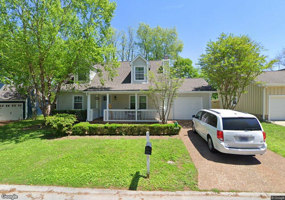
1920 Redbud Ct Franklin, TN 37064
West Franklin NeighborhoodEstimated Value: $501,000 - $567,000
Studio
2
Baths
1,632
Sq Ft
$327/Sq Ft
Est. Value
About This Home
This home is located at 1920 Redbud Ct, Franklin, TN 37064 and is currently estimated at $534,173, approximately $327 per square foot. 1920 Redbud Ct is a home located in Williamson County with nearby schools including Poplar Grove K-4, Poplar Grove 5-8, and Centennial High School.
Ownership History
Date
Name
Owned For
Owner Type
Purchase Details
Closed on
Aug 8, 2003
Sold by
Wilson Angela M and Wilson Morris K
Bought by
Gallagher Christina E
Current Estimated Value
Home Financials for this Owner
Home Financials are based on the most recent Mortgage that was taken out on this home.
Original Mortgage
$116,000
Outstanding Balance
$49,912
Interest Rate
5.42%
Mortgage Type
Purchase Money Mortgage
Estimated Equity
$484,261
Purchase Details
Closed on
Jun 8, 1994
Sold by
Tomlin Ronald L
Bought by
Mayes Angela F
Create a Home Valuation Report for This Property
The Home Valuation Report is an in-depth analysis detailing your home's value as well as a comparison with similar homes in the area
Home Values in the Area
Average Home Value in this Area
Purchase History
| Date | Buyer | Sale Price | Title Company |
|---|---|---|---|
| Gallagher Christina E | $153,000 | -- | |
| Mayes Angela F | -- | -- |
Source: Public Records
Mortgage History
| Date | Status | Borrower | Loan Amount |
|---|---|---|---|
| Open | Gallagher Christina E | $116,000 |
Source: Public Records
Tax History
| Year | Tax Paid | Tax Assessment Tax Assessment Total Assessment is a certain percentage of the fair market value that is determined by local assessors to be the total taxable value of land and additions on the property. | Land | Improvement |
|---|---|---|---|---|
| 2025 | $2,588 | $141,350 | $55,000 | $86,350 |
| 2024 | $2,588 | $91,425 | $26,250 | $65,175 |
| 2023 | $2,488 | $91,425 | $26,250 | $65,175 |
| 2022 | $2,488 | $91,425 | $26,250 | $65,175 |
| 2021 | $2,488 | $91,425 | $26,250 | $65,175 |
| 2020 | $1,867 | $57,850 | $13,750 | $44,100 |
| 2019 | $1,867 | $57,850 | $13,750 | $44,100 |
| 2018 | $1,827 | $57,850 | $13,750 | $44,100 |
| 2017 | $1,798 | $57,850 | $13,750 | $44,100 |
| 2016 | $1,792 | $57,850 | $13,750 | $44,100 |
Source: Public Records
Map
Nearby Homes
- 1910 Redbud Ct
- 1315 Robin Hill Rd
- 5603 Winslet Dr
- 623 W Meade Blvd
- 621 W Meade Blvd
- 7148 Bonterra Dr
- 7152 Bonterra Dr
- 3008 Eliot Rd
- 2042 Township Dr
- 1013 William St
- 2009 Landry Place
- 1309 Windsor Dr
- 1325 Mallard Dr
- 1303 Chickering Dr Unit 101 & 102
- 704 W End Cir
- 133 Rucker Ave Unit 20
- 804 W End Cir
- 3205 Vera Valley Rd
- 308 Fanchers Ct
- 503 N Petway St
- 1918 Redbud Ct
- 1922 Redbud Ct
- 1917 Redbud Ct
- 1924 Redbud Ct
- 1914 Redbud Ct
- 1907 Redbud Ct
- 1704 Twin Oaks Ct
- 412 White Ct
- 1703 Twin Oaks Ct
- 1702 Twin Oaks Ct
- 1912 Redbud Ct
- 1506 Teil Dr
- 409 White Ct
- 408 White Ct
- 1905 Redbud Ct
- 1504 Teil Dr
- 1908 Redbud Ct
- 1701 Twin Oaks Ct
- 1502 Teil Dr
- 1700 Twin Oaks Ct
Your Personal Tour Guide
Ask me questions while you tour the home.