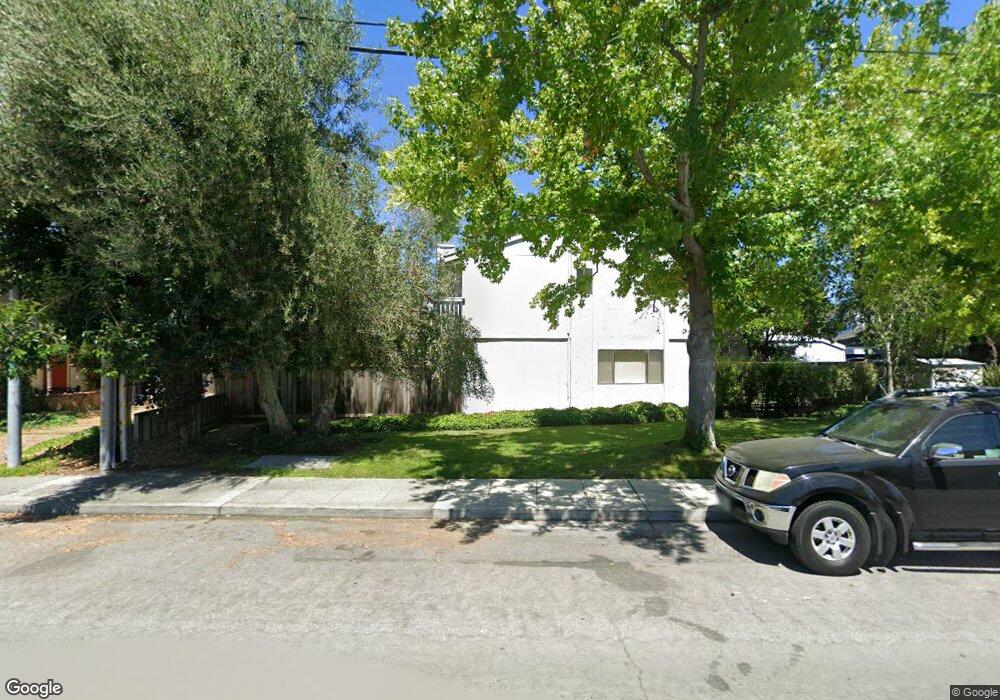
1920 Rock St Unit 7 Mountain View, CA 94043
Monta Loma NeighborhoodEstimated Value: $960,000 - $1,328,000
3
Beds
2
Baths
1,337
Sq Ft
$850/Sq Ft
Est. Value
About This Home
This home is located at 1920 Rock St Unit 7, Mountain View, CA 94043 and is currently estimated at $1,136,587, approximately $850 per square foot. 1920 Rock St Unit 7 is a home located in Santa Clara County with nearby schools including Monta Loma Elementary School, Crittenden Middle School, and Los Altos High School.
Ownership History
Date
Name
Owned For
Owner Type
Purchase Details
Closed on
Sep 16, 2016
Sold by
Aye Tin Tin and Aye Ko Ko
Bought by
Aye Tinmala
Current Estimated Value
Purchase Details
Closed on
Nov 16, 1998
Sold by
Karen Novak
Bought by
Aye Tin Tin and Aye Ko Ko
Home Financials for this Owner
Home Financials are based on the most recent Mortgage that was taken out on this home.
Original Mortgage
$198,750
Outstanding Balance
$44,337
Interest Rate
6.84%
Estimated Equity
$1,092,250
Purchase Details
Closed on
May 18, 1995
Sold by
Schilling Linda Carol
Bought by
Novak Karen
Home Financials for this Owner
Home Financials are based on the most recent Mortgage that was taken out on this home.
Original Mortgage
$158,400
Interest Rate
8.43%
Create a Home Valuation Report for This Property
The Home Valuation Report is an in-depth analysis detailing your home's value as well as a comparison with similar homes in the area
Home Values in the Area
Average Home Value in this Area
Purchase History
| Date | Buyer | Sale Price | Title Company |
|---|---|---|---|
| Aye Tinmala | -- | None Available | |
| Aye Tin Tin | $265,000 | Financial Title Company | |
| Novak Karen | $176,000 | First American Title Guarant |
Source: Public Records
Mortgage History
| Date | Status | Borrower | Loan Amount |
|---|---|---|---|
| Open | Aye Tin Tin | $198,750 | |
| Previous Owner | Novak Karen | $158,400 | |
| Closed | Aye Tin Tin | $53,000 |
Source: Public Records
Tax History
| Year | Tax Paid | Tax Assessment Tax Assessment Total Assessment is a certain percentage of the fair market value that is determined by local assessors to be the total taxable value of land and additions on the property. | Land | Improvement |
|---|---|---|---|---|
| 2025 | $5,042 | $415,418 | $207,709 | $207,709 |
| 2024 | $5,042 | $407,274 | $203,637 | $203,637 |
| 2023 | $4,976 | $399,290 | $199,645 | $199,645 |
| 2022 | $4,960 | $391,462 | $195,731 | $195,731 |
| 2021 | $4,846 | $383,788 | $191,894 | $191,894 |
| 2020 | $4,817 | $379,854 | $189,927 | $189,927 |
| 2019 | $4,611 | $372,406 | $186,203 | $186,203 |
| 2018 | $4,578 | $365,104 | $182,552 | $182,552 |
| 2017 | $4,376 | $357,946 | $178,973 | $178,973 |
| 2016 | $4,291 | $350,928 | $175,464 | $175,464 |
| 2015 | $4,185 | $345,658 | $172,829 | $172,829 |
| 2014 | $4,137 | $338,888 | $169,444 | $169,444 |
Source: Public Records
Map
Nearby Homes
- 1926 Stella St
- 1914 Newman Place
- 701 N Rengstorff Ave Unit 20
- 1901 W Middlefield Rd
- 853B Sierra Vista Ave
- 2041 Atlas Loop
- 1993 Plymouth St Unit 11
- 773 Bryn Mawr Ct Unit 51
- 2064 Rialto Ct
- 1946 San Luis Ave
- 421 Sierra Vista Ave Unit 7
- 2071 Plymouth St Unit J
- 2112 Windrose Place Unit 2112
- 2110 Windrose Place Unit 2110
- 888 N Rengstorff Ave
- 1772 San Luis Ave
- 1208 San Ramon Ave
- 347 N Rengstorff Ave
- 367 Fay Way
- 301 Scarlett Terrace
- 1920 Rock St Unit 10
- 1920 Rock St Unit 9
- 1920 Rock St Unit 8
- 1920 Rock St Unit 6
- 1920 Rock St Unit 5
- 1920 Rock St Unit 4
- 1920 Rock St Unit 3
- 1920 Rock St Unit 2
- 1920 Rock St Unit 22
- 1920 Rock St Unit 21
- 1920 Rock St Unit 20
- 1920 Rock St Unit 19
- 1920 Rock St Unit 18
- 1920 Rock St Unit 17
- 1920 Rock St Unit 16
- 1920 Rock St Unit 15
- 1920 Rock St Unit 14
- 1920 Rock St Unit 13
- 1920 Rock St Unit 12
- 1920 Rock St Unit 11
Your Personal Tour Guide
Ask me questions while you tour the home.