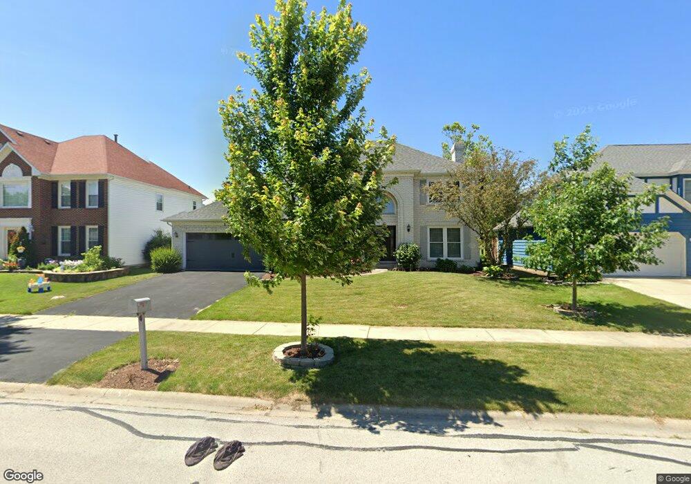
1920 Slippery Rock Rd Naperville, IL 60565
Ranch View NeighborhoodEstimated Value: $663,397 - $729,000
Studio
--
Bath
2,915
Sq Ft
$240/Sq Ft
Est. Value
About This Home
This home is located at 1920 Slippery Rock Rd, Naperville, IL 60565 and is currently estimated at $698,349, approximately $239 per square foot. 1920 Slippery Rock Rd is a home located in DuPage County with nearby schools including Ranch View Elementary School, Kennedy Junior High School, and Naperville Central High School.
Ownership History
Date
Name
Owned For
Owner Type
Purchase Details
Closed on
Sep 6, 2003
Sold by
Vittori Michael L and Vittori Julia B
Bought by
Mohan Kuppuswamy and Mohan Lakshmi
Current Estimated Value
Home Financials for this Owner
Home Financials are based on the most recent Mortgage that was taken out on this home.
Original Mortgage
$306,400
Outstanding Balance
$137,332
Interest Rate
5.75%
Mortgage Type
Purchase Money Mortgage
Estimated Equity
$561,017
Create a Home Valuation Report for This Property
The Home Valuation Report is an in-depth analysis detailing your home's value as well as a comparison with similar homes in the area
Home Values in the Area
Average Home Value in this Area
Purchase History
| Date | Buyer | Sale Price | Title Company |
|---|---|---|---|
| Mohan Kuppuswamy | $383,000 | Pntn |
Source: Public Records
Mortgage History
| Date | Status | Borrower | Loan Amount |
|---|---|---|---|
| Open | Mohan Kuppuswamy | $306,400 |
Source: Public Records
Tax History
| Year | Tax Paid | Tax Assessment Tax Assessment Total Assessment is a certain percentage of the fair market value that is determined by local assessors to be the total taxable value of land and additions on the property. | Land | Improvement |
|---|---|---|---|---|
| 2024 | $11,805 | $200,700 | $69,654 | $131,046 |
| 2023 | $11,382 | $183,170 | $63,570 | $119,600 |
| 2022 | $10,691 | $171,190 | $59,410 | $111,780 |
| 2021 | $10,302 | $164,710 | $57,160 | $107,550 |
| 2020 | $10,083 | $161,750 | $56,130 | $105,620 |
| 2019 | $9,791 | $154,750 | $53,700 | $101,050 |
| 2018 | $9,794 | $154,750 | $53,700 | $101,050 |
| 2017 | $9,598 | $149,530 | $51,890 | $97,640 |
| 2016 | $9,408 | $144,120 | $50,010 | $94,110 |
| 2015 | $9,350 | $135,710 | $47,090 | $88,620 |
| 2014 | $9,361 | $131,760 | $45,720 | $86,040 |
| 2013 | $9,220 | $132,080 | $45,830 | $86,250 |
Source: Public Records
Map
Nearby Homes
- 1864 Slippery Rock Rd
- 1800 Denison Rd
- 1653 Kenyon Dr
- 1736 Ranchview Dr
- 1333 Purdue Ave
- 1405 E Bailey Rd
- 20 Wayewood Ln
- 1007 River Oak Dr
- 1255 E Bailey Rd
- 2243 Aster Ct
- 1620 Fairway Ln
- 1613 Fairway Ln
- 1404 Chelsea Ln
- 586 Daniels St
- 561 Boardman Cir
- 8S295 College Rd
- 25 W 500 Royce Rd
- 3805 Gladstone Dr
- 2238 Allegany Dr
- 613 Bourbon Ct
- 1924 Slippery Rock Rd
- 1916 Slippery Rock Rd
- 1832 Syracuse Rd
- 1912 Slippery Rock Rd
- 1836 Syracuse Rd
- 1928 Slippery Rock Rd
- 1828 Syracuse Rd
- 1840 Syracuse Rd
- 1929 Slippery Rock Rd
- 1925 Slippery Rock Rd
- 1921 Slippery Rock Rd
- 1908 Slippery Rock Rd
- 1932 Slippery Rock Rd
- 1933 Slippery Rock Rd
- 1824 Syracuse Rd
- 1844 Syracuse Ave
- 1844 Syracuse Rd
- 1917 Slippery Rock Rd
- 1820 Syracuse Rd
- 1937 Slippery Rock Rd
Your Personal Tour Guide
Ask me questions while you tour the home.