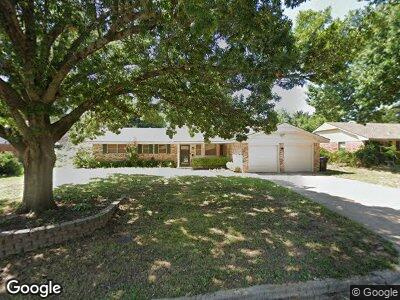
1920 Westbrooke Terrace Norman, OK 73072
Southwest Norman NeighborhoodEstimated Value: $205,000 - $235,000
3
Beds
2
Baths
1,317
Sq Ft
$169/Sq Ft
Est. Value
About This Home
This home is located at 1920 Westbrooke Terrace, Norman, OK 73072 and is currently estimated at $222,943, approximately $169 per square foot. 1920 Westbrooke Terrace is a home located in Cleveland County with nearby schools including Monroe Elementary School, Alcott Middle School, and Norman High School.
Ownership History
Date
Name
Owned For
Owner Type
Purchase Details
Closed on
Jul 1, 2012
Sold by
Patton Patricia A
Bought by
Thomas Keith Todd
Current Estimated Value
Home Financials for this Owner
Home Financials are based on the most recent Mortgage that was taken out on this home.
Original Mortgage
$79,000
Outstanding Balance
$55,527
Interest Rate
3.68%
Mortgage Type
New Conventional
Estimated Equity
$167,977
Purchase Details
Closed on
Dec 30, 2004
Sold by
Broudy Mrtytie Marie
Bought by
Broudy Myrtie Marie and Myrtie Marie Broudy Revocable Trust
Create a Home Valuation Report for This Property
The Home Valuation Report is an in-depth analysis detailing your home's value as well as a comparison with similar homes in the area
Home Values in the Area
Average Home Value in this Area
Purchase History
| Date | Buyer | Sale Price | Title Company |
|---|---|---|---|
| Thomas Keith Todd | $119,000 | None Available | |
| Broudy Myrtie Marie | -- | None Available |
Source: Public Records
Mortgage History
| Date | Status | Borrower | Loan Amount |
|---|---|---|---|
| Open | Thomas Keith Todd | $79,000 |
Source: Public Records
Tax History Compared to Growth
Tax History
| Year | Tax Paid | Tax Assessment Tax Assessment Total Assessment is a certain percentage of the fair market value that is determined by local assessors to be the total taxable value of land and additions on the property. | Land | Improvement |
|---|---|---|---|---|
| 2024 | $1,774 | $14,808 | $2,583 | $12,225 |
| 2023 | $1,693 | $14,103 | $2,870 | $11,233 |
| 2022 | $1,547 | $13,432 | $2,400 | $11,032 |
| 2021 | $1,631 | $13,432 | $2,400 | $11,032 |
| 2020 | $1,595 | $13,432 | $2,400 | $11,032 |
| 2019 | $1,624 | $13,432 | $2,400 | $11,032 |
| 2018 | $1,574 | $13,432 | $2,400 | $11,032 |
| 2017 | $1,592 | $13,432 | $0 | $0 |
| 2016 | $1,618 | $13,432 | $2,400 | $11,032 |
| 2015 | $1,575 | $13,482 | $1,546 | $11,936 |
| 2014 | $1,590 | $13,482 | $1,546 | $11,936 |
Source: Public Records
Map
Nearby Homes
- 2015 Summit Cir
- 2521 McGee Dr Unit 5
- 2301 Mckown Dr
- 1301 24th Ave SW Unit 1305
- 2108 Barton St Unit 2110
- 2814 Shoreridge Ave Unit 2814
- 2812 Shoreridge Ave Unit 2814
- 2022 Morning Dew Trail
- 1406 Aspen Ln
- 1400 Aspen Ln
- 1917 Whispering Pines Cir
- 811 Carriage Ln
- 1230 Avondale Dr
- 1312 Brookside Dr
- 2009 La Dean Dr
- 1032 W Lindsey St
- 1732 Caddell Ln
- 2732 Walnut Rd
- 1614 Cruce St
- 1212 Caddell Ln
- 1920 Westbrooke Terrace
- 1928 Westbrooke Terrace
- 1912 Westbrooke Terrace
- 1855 Rolling Hills St
- 2002 Westbrooke Terrace
- 1904 Westbrooke Terrace
- 1919 Westbrooke Terrace
- 1863 Rolling Hills St
- 2010 Westbrooke Terrace
- 1911 Westbrooke Terrace
- 1847 Rolling Hills St
- 1834 Westbrooke Terrace
- 1871 Rolling Hills St
- 2001 Westbrooke Terrace
- 1903 Westbrooke Terrace
- 1839 Rolling Hills St
- 1862 Rolling Hills St
- 1926 Peter Pan St
- 2009 Westbrooke Terrace
- 1854 Rolling Hills St