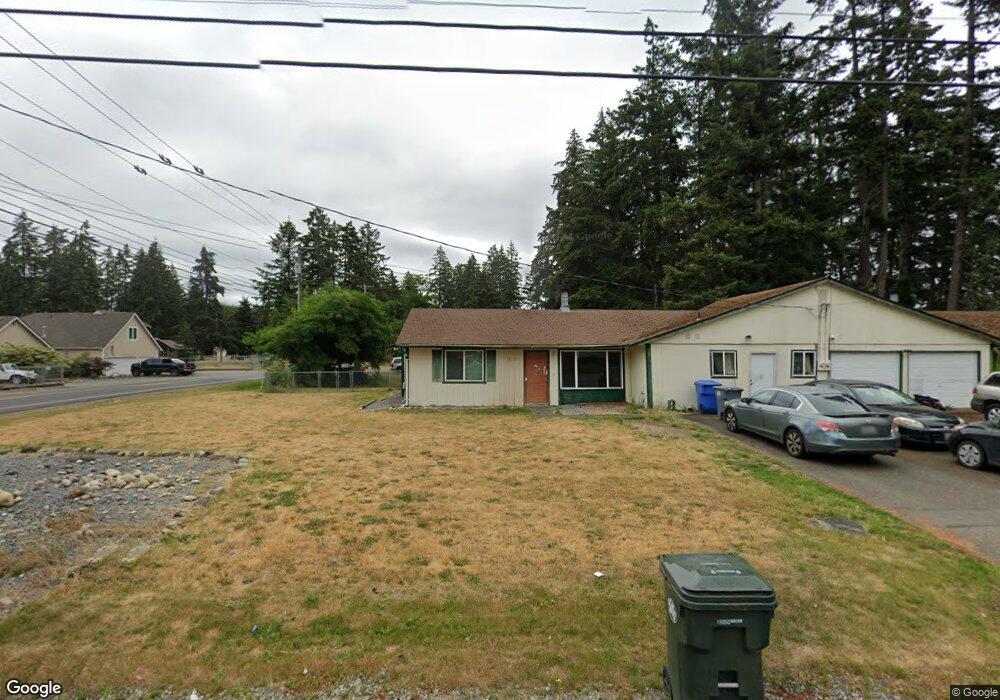
19209 B St E Unit 19211 Spanaway, WA 98387
Estimated Value: $583,000 - $633,000
4
Beds
4
Baths
2,894
Sq Ft
$213/Sq Ft
Est. Value
About This Home
This home is located at 19209 B St E Unit 19211, Spanaway, WA 98387 and is currently estimated at $616,334, approximately $212 per square foot. 19209 B St E Unit 19211 is a home located in Pierce County with nearby schools including Camas Prairie Elementary School, Cedarcrest Junior High School, and Spanaway Lake High School.
Ownership History
Date
Name
Owned For
Owner Type
Purchase Details
Closed on
Jun 30, 2006
Sold by
Foreclosure Investments Llc
Bought by
Laudenglos John
Current Estimated Value
Home Financials for this Owner
Home Financials are based on the most recent Mortgage that was taken out on this home.
Original Mortgage
$243,400
Outstanding Balance
$145,297
Interest Rate
6.75%
Mortgage Type
Purchase Money Mortgage
Estimated Equity
$471,037
Purchase Details
Closed on
Mar 30, 2004
Sold by
Moody Brent A
Bought by
Foreclosure Investments Bgcm Llc
Purchase Details
Closed on
Jan 20, 2004
Sold by
Morley Steven R
Bought by
Moody Brent A and Moody Gary L
Purchase Details
Closed on
Aug 27, 1998
Sold by
Oneill Jong Sil
Bought by
Morley Steven R
Home Financials for this Owner
Home Financials are based on the most recent Mortgage that was taken out on this home.
Original Mortgage
$142,434
Interest Rate
6.91%
Mortgage Type
FHA
Create a Home Valuation Report for This Property
The Home Valuation Report is an in-depth analysis detailing your home's value as well as a comparison with similar homes in the area
Home Values in the Area
Average Home Value in this Area
Purchase History
| Date | Buyer | Sale Price | Title Company |
|---|---|---|---|
| Laudenglos John | $305,000 | Transnation Title | |
| Foreclosure Investments Bgcm Llc | -- | -- | |
| Moody Brent A | $151,408 | -- | |
| Morley Steven R | $145,000 | -- |
Source: Public Records
Mortgage History
| Date | Status | Borrower | Loan Amount |
|---|---|---|---|
| Open | Laudenglos John | $243,400 | |
| Previous Owner | Morley Steven R | $142,434 |
Source: Public Records
Tax History
| Year | Tax Paid | Tax Assessment Tax Assessment Total Assessment is a certain percentage of the fair market value that is determined by local assessors to be the total taxable value of land and additions on the property. | Land | Improvement |
|---|---|---|---|---|
| 2025 | $6,422 | $589,300 | $211,900 | $377,400 |
| 2024 | $6,422 | $580,400 | $205,700 | $374,700 |
| 2023 | $6,422 | $551,600 | $211,900 | $339,700 |
| 2022 | $6,230 | $525,600 | $201,000 | $324,600 |
| 2021 | $5,638 | $400,900 | $132,700 | $268,200 |
| 2019 | $3,657 | $335,300 | $115,800 | $219,500 |
| 2018 | $4,200 | $296,600 | $105,000 | $191,600 |
| 2017 | $3,772 | $267,400 | $92,600 | $174,800 |
| 2016 | $3,436 | $212,100 | $78,300 | $133,800 |
| 2014 | $3,005 | $201,700 | $75,200 | $126,500 |
| 2013 | $3,005 | $183,000 | $64,900 | $118,100 |
Source: Public Records
Map
Nearby Homes
- 2 189th Street Ct E
- 511 190th St E
- 516 189th Street Ct E
- 1 8th Ave E
- 18512 4th Avenue Ct E Unit 14
- 604 185th Street Ct E Unit 28
- 18508 4th Avenue Ct E Unit 15
- 608 185th Street Ct E Unit 29
- 612 185th Street Ct E Unit 30
- 501 185th Street Ct E Unit 19
- 454 184th Street Ct E Unit 64
- 604 184th Street Ct E Unit 50
- 449 184th Street Ct E Unit 57
- 461 184th Street Ct E Unit 54
- 505 184th Street Ct E Unit 53
- 509 184th Street Ct E Unit 52
- 18439 7th Avenue Ct E Unit 37
- 605 184th Street Ct E Unit 49
- 611 184th Street Ct E Unit 48
- 703 184th Street Ct E Unit 47
- 314 192nd St E Unit 316
- 19305 B St E Unit 19307
- 316 192nd St E
- 129 192nd Street Ct E
- 19311 B St E Unit 19313
- 309 192nd St E
- 218 191st Street Ct E Unit 26
- 218 191st Street Ct E
- 19229 B St E
- 19222 B St E
- 402 192nd St E
- 402 192nd St E Unit A & B
- 402A 192nd St E Unit 402B
- 19313 B St E
- 214 191st Street Ct E
- 19212 5th Ave E
- 19212 5th Ave E Unit C&D
- 19212 5th Ave E Unit 1921
- 125 192nd Street Ct E
- 210 191st Street Ct E Unit 24
Your Personal Tour Guide
Ask me questions while you tour the home.