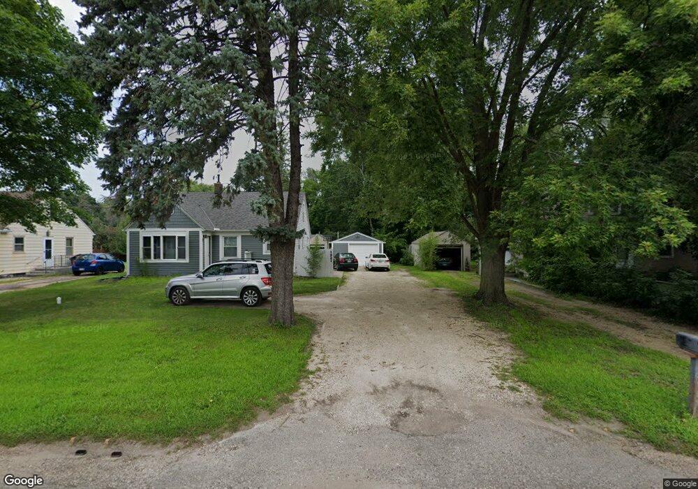
1921 County Road D W New Brighton, MN 55112
Estimated Value: $310,000 - $367,000
3
Beds
1
Bath
1,014
Sq Ft
$343/Sq Ft
Est. Value
About This Home
This home is located at 1921 County Road D W, New Brighton, MN 55112 and is currently estimated at $347,669, approximately $342 per square foot. 1921 County Road D W is a home located in Ramsey County with nearby schools including Valentine Hills Elementary School, Highview Middle School, and Mounds View Senior High School.
Ownership History
Date
Name
Owned For
Owner Type
Purchase Details
Closed on
Mar 4, 2021
Sold by
Riko Contracting Llc
Bought by
Anderson Erik
Current Estimated Value
Home Financials for this Owner
Home Financials are based on the most recent Mortgage that was taken out on this home.
Original Mortgage
$135,400
Outstanding Balance
$100,361
Interest Rate
2.7%
Mortgage Type
New Conventional
Estimated Equity
$247,308
Purchase Details
Closed on
Apr 25, 2016
Sold by
Anoka Hennepin Credit Union
Bought by
Riko Contracting Llc
Home Financials for this Owner
Home Financials are based on the most recent Mortgage that was taken out on this home.
Original Mortgage
$148,000
Interest Rate
3.73%
Mortgage Type
Construction
Purchase Details
Closed on
May 28, 2015
Sold by
Barnes Jennifer
Bought by
Anoka Hennepin Credit Union
Create a Home Valuation Report for This Property
The Home Valuation Report is an in-depth analysis detailing your home's value as well as a comparison with similar homes in the area
Home Values in the Area
Average Home Value in this Area
Purchase History
| Date | Buyer | Sale Price | Title Company |
|---|---|---|---|
| Anderson Erik | -- | Executive Title | |
| Riko Contracting Llc | $134,900 | Guaranty Commercial Title In | |
| Anoka Hennepin Credit Union | $122,873 | None Available |
Source: Public Records
Mortgage History
| Date | Status | Borrower | Loan Amount |
|---|---|---|---|
| Open | Anderson Erik | $135,400 | |
| Previous Owner | Riko Contracting Llc | $148,000 |
Source: Public Records
Tax History Compared to Growth
Tax History
| Year | Tax Paid | Tax Assessment Tax Assessment Total Assessment is a certain percentage of the fair market value that is determined by local assessors to be the total taxable value of land and additions on the property. | Land | Improvement |
|---|---|---|---|---|
| 2025 | $3,848 | $337,100 | $74,800 | $262,300 |
| 2023 | $3,848 | $316,000 | $74,800 | $241,200 |
| 2022 | $3,624 | $310,000 | $74,800 | $235,200 |
| 2021 | $3,226 | $266,900 | $74,800 | $192,100 |
| 2020 | $3,492 | $244,100 | $74,800 | $169,300 |
| 2019 | $3,202 | $245,200 | $74,800 | $170,400 |
| 2018 | $2,836 | $223,900 | $74,800 | $149,100 |
| 2017 | $2,174 | $205,000 | $74,800 | $130,200 |
| 2016 | $2,400 | $0 | $0 | $0 |
| 2015 | -- | $133,700 | $74,800 | $58,900 |
| 2014 | $1,886 | $0 | $0 | $0 |
Source: Public Records
Map
Nearby Homes
- 1932 Glenpaul Ave
- 1960 Glenpaul Ave
- 1999 Edgewater Ave
- 3072 Fairview Ave N
- 1802 Lydia Ave W
- 2 New Brighton Rd
- 4 New Brighton Rd
- 1488 Woodlynn Ave
- 1465 Woodlynn Ave
- 1459 Clarmar Ave W
- 3 New Brighton Rd
- 1 New Brighton Rd
- 950 Cessna Dr
- 737 Mccallum Dr
- 544 Riviera Dr
- 2452 County Road D W
- 2446 County Road D W
- 519 Continental Dr
- 2911 Troseth Rd
- 1688 Chatham Ave
- 1917 County Road D W
- 1927 County Road D W
- 1911 County Road D W
- 1933 County Road D W
- 1907 County Road D W
- 1916 Glenpaul Ave
- 1928 Glenpaul Ave
- 1910 Glenpaul Ave
- 1920 1920 County Road D W
- 1920 County Road D W
- 1932 1932 Glenpaul Ave
- 1903 County Road D W
- 1930 County Road D W
- 1904 Glenpaul Ave
- 1947 County Road D W
- 1903 1903 County Road D W
- 1895 County Road D W
- 1900 Glenpaul Ave
- 1936 Glenpaul Ave
- 3116 Prior Cir