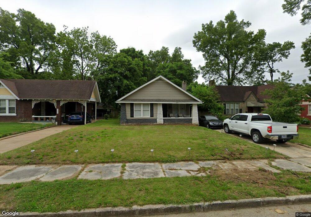
1921 Foster Ave Memphis, TN 38114
Southeast Memphis NeighborhoodEstimated Value: $152,883 - $225,000
3
Beds
2
Baths
1,372
Sq Ft
$135/Sq Ft
Est. Value
About This Home
This home is located at 1921 Foster Ave, Memphis, TN 38114 and is currently estimated at $184,721, approximately $134 per square foot. 1921 Foster Ave is a home located in Shelby County with nearby schools including Hamilton High School, Hanley Schoool - Middle, and Immaculate Conception Cathedral School.
Ownership History
Date
Name
Owned For
Owner Type
Purchase Details
Closed on
Nov 21, 2023
Sold by
Pipe Dreams Properties Inc
Bought by
Perry Demetris
Current Estimated Value
Purchase Details
Closed on
Jan 23, 2023
Sold by
Lyons Curtis L
Bought by
Pipe Dreams Properties Inc
Home Financials for this Owner
Home Financials are based on the most recent Mortgage that was taken out on this home.
Original Mortgage
$155,000
Interest Rate
6.27%
Mortgage Type
New Conventional
Purchase Details
Closed on
Jan 17, 2023
Sold by
Elkins Darryl
Bought by
Lyons Curtis L
Home Financials for this Owner
Home Financials are based on the most recent Mortgage that was taken out on this home.
Original Mortgage
$155,000
Interest Rate
6.27%
Mortgage Type
New Conventional
Create a Home Valuation Report for This Property
The Home Valuation Report is an in-depth analysis detailing your home's value as well as a comparison with similar homes in the area
Home Values in the Area
Average Home Value in this Area
Purchase History
| Date | Buyer | Sale Price | Title Company |
|---|---|---|---|
| Perry Demetris | $155,000 | None Listed On Document | |
| Pipe Dreams Properties Inc | $85,000 | Preferred Title & Escrow | |
| Lyons Curtis L | -- | -- |
Source: Public Records
Mortgage History
| Date | Status | Borrower | Loan Amount |
|---|---|---|---|
| Previous Owner | Pipe Dreams Properties Inc | $155,000 | |
| Previous Owner | Lyons Curtis L | $155,000 |
Source: Public Records
Tax History Compared to Growth
Tax History
| Year | Tax Paid | Tax Assessment Tax Assessment Total Assessment is a certain percentage of the fair market value that is determined by local assessors to be the total taxable value of land and additions on the property. | Land | Improvement |
|---|---|---|---|---|
| 2025 | $536 | $36,750 | $6,900 | $29,850 |
| 2024 | $536 | $15,825 | $1,400 | $14,425 |
| 2023 | $964 | $15,825 | $1,400 | $14,425 |
| 2022 | $964 | $15,825 | $1,400 | $14,425 |
| 2021 | $1,146 | $15,825 | $1,400 | $14,425 |
| 2020 | $889 | $12,275 | $1,400 | $10,875 |
| 2019 | $392 | $12,275 | $1,400 | $10,875 |
| 2018 | $392 | $12,275 | $1,400 | $10,875 |
| 2017 | $402 | $12,275 | $1,400 | $10,875 |
| 2016 | $508 | $11,625 | $0 | $0 |
| 2014 | $508 | $11,625 | $0 | $0 |
Source: Public Records
Map
Nearby Homes
- 1910 Foster Ave
- 1852 Glenview Ave
- 1824 Kendale Ave
- 1825 Foster Ave
- 1837 Waverly Ave
- 2008 Waverly Ave
- 0 S Barksdale St
- 1800 Foster Ave
- 1804 South Pkwy E
- 1891 S Parkway E
- 1944 E Mclemore Ave
- 1960 E Mclemore Ave
- 1952 Southern Ave
- 1960 Southern Ave
- 1151 Tanglewood St
- 1812 Parkway Terrace
- 1931 Manila Ave
- 1985 Manila Ave
- 1150 Tanglewood St
- 1954 Manila Ave
- 1927 Foster Ave
- 1917 Foster Ave
- 1911 Foster Ave
- 1931 Foster Ave
- 1920 Kendale Ave
- 1916 Kendale Ave
- 1937 Foster Ave
- 1907 Foster Ave
- 1926 Kendale Ave
- 1910 Kendale Ave
- 1932 Kendale Ave
- 1920 Foster Ave
- 1941 Foster Ave
- 1926 Foster Ave
- 1916 Foster Ave
- 1906 Kendale Ave
- 1238 S Barksdale St
- 1930 Foster Ave
- 1934 Foster Ave
- 1906 Foster Ave