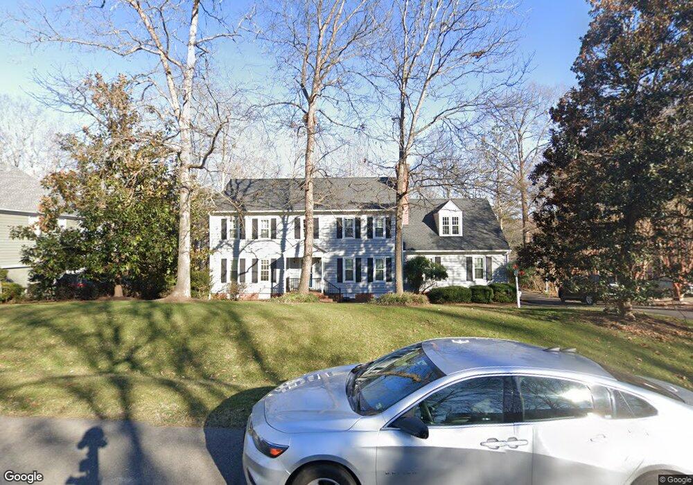
1921 Normandstone Dr Midlothian, VA 23113
Roxshire NeighborhoodEstimated Value: $651,000 - $711,000
5
Beds
3
Baths
2,877
Sq Ft
$234/Sq Ft
Est. Value
About This Home
This home is located at 1921 Normandstone Dr, Midlothian, VA 23113 and is currently estimated at $672,017, approximately $233 per square foot. 1921 Normandstone Dr is a home located in Chesterfield County with nearby schools including Robious Elementary School, Robious Middle School, and James River High School.
Ownership History
Date
Name
Owned For
Owner Type
Purchase Details
Closed on
Feb 28, 2009
Sold by
Livermore Brent Andrew
Bought by
Gilmore David C
Current Estimated Value
Home Financials for this Owner
Home Financials are based on the most recent Mortgage that was taken out on this home.
Original Mortgage
$295,200
Interest Rate
4.92%
Mortgage Type
New Conventional
Purchase Details
Closed on
Jul 8, 2002
Sold by
Moore Raymond E
Bought by
Livermore Brent A and Livermore Ryan C
Home Financials for this Owner
Home Financials are based on the most recent Mortgage that was taken out on this home.
Original Mortgage
$230,350
Interest Rate
6.82%
Mortgage Type
New Conventional
Create a Home Valuation Report for This Property
The Home Valuation Report is an in-depth analysis detailing your home's value as well as a comparison with similar homes in the area
Home Values in the Area
Average Home Value in this Area
Purchase History
| Date | Buyer | Sale Price | Title Company |
|---|---|---|---|
| Gilmore David C | $369,000 | -- | |
| Livermore Brent A | $271,000 | -- |
Source: Public Records
Mortgage History
| Date | Status | Borrower | Loan Amount |
|---|---|---|---|
| Previous Owner | Gilmore David C | $295,200 | |
| Previous Owner | Livermore Brent A | $230,350 |
Source: Public Records
Tax History
| Year | Tax Paid | Tax Assessment Tax Assessment Total Assessment is a certain percentage of the fair market value that is determined by local assessors to be the total taxable value of land and additions on the property. | Land | Improvement |
|---|---|---|---|---|
| 2025 | $5,168 | $577,900 | $145,000 | $432,900 |
| 2024 | $5,168 | $555,900 | $135,000 | $420,900 |
| 2023 | $4,422 | $485,900 | $125,000 | $360,900 |
| 2022 | $4,283 | $465,500 | $115,000 | $350,500 |
| 2021 | $4,053 | $419,700 | $104,000 | $315,700 |
| 2020 | $3,834 | $403,600 | $104,000 | $299,600 |
| 2019 | $3,806 | $400,600 | $101,000 | $299,600 |
| 2018 | $3,662 | $385,500 | $99,000 | $286,500 |
| 2017 | $3,682 | $383,500 | $97,000 | $286,500 |
| 2016 | $3,636 | $378,800 | $97,000 | $281,800 |
| 2015 | $3,585 | $370,800 | $89,000 | $281,800 |
| 2014 | $3,471 | $359,000 | $82,000 | $277,000 |
Source: Public Records
Map
Nearby Homes
- 2101 Normandstone Dr
- 12212 Deerhurst Dr
- 12505 Mandolin Dr
- 1860 Glamorgan Ln
- 11911 Kilrenny Rd
- 11803 N Briar Patch Dr
- 1312 Oldbury Rd
- 1709 Headwaters Rd
- 2303 Bream Dr
- 1331 Warminster Dr
- 11611 E Briar Patch Dr
- 1516 Sandgate Rd
- 1336 Tannery Cir
- 1338 Tannery Cir
- 1522 Sycamore Square Dr
- 1510 Sycamore Square Dr Unit 1510
- 1434 Sycamore Mews Cir
- 000 Flying Cloud Aly Unit 5-2
- 0009 Flying Cloud Aly Unit 50
- 00 Flying Cloud Aly Unit 2-2
- 1931 Normandstone Dr
- 1911 Normandstone Dr
- 1920 Corner Rock Rd
- 1930 Corner Rock Rd
- 1941 Normandstone Dr
- 1920 Normandstone Dr
- 1901 Normandstone Dr
- 1930 Normandstone Dr
- 1940 Normandstone Dr
- 1900 Normandstone Dr
- 1940 Corner Rock Rd
- 1910 Corner Rock Rd
- 2001 Normandstone Dr
- 2000 Normandstone Dr
- 1911 Thornleigh Rd
- 1921 Thornleigh Rd
- 1901 Thornleigh Rd
- 2000 Corner Rock Rd
- 1931 Thornleigh Rd
- 2011 Normandstone Dr
Your Personal Tour Guide
Ask me questions while you tour the home.