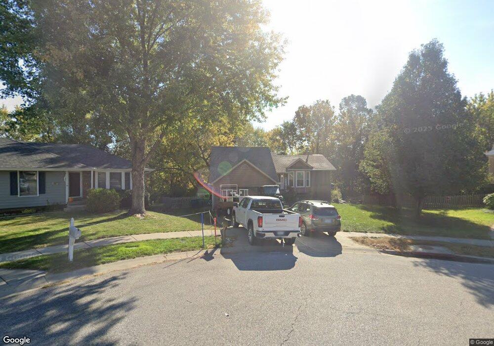
1921 Pheasant Ln Liberty, MO 64068
Estimated Value: $261,543 - $297,000
3
Beds
3
Baths
1,058
Sq Ft
$264/Sq Ft
Est. Value
About This Home
This home is located at 1921 Pheasant Ln, Liberty, MO 64068 and is currently estimated at $279,636, approximately $264 per square foot. 1921 Pheasant Ln is a home located in Clay County with nearby schools including Lillian Schumacher Elementary School, Liberty Middle School, and Liberty High School.
Create a Home Valuation Report for This Property
The Home Valuation Report is an in-depth analysis detailing your home's value as well as a comparison with similar homes in the area
Tax History
| Year | Tax Paid | Tax Assessment Tax Assessment Total Assessment is a certain percentage of the fair market value that is determined by local assessors to be the total taxable value of land and additions on the property. | Land | Improvement |
|---|---|---|---|---|
| 2025 | $2,370 | $35,420 | -- | -- |
| 2024 | $2,370 | $30,820 | -- | -- |
| 2023 | $2,411 | $30,820 | $0 | $0 |
| 2022 | $2,161 | $27,280 | $0 | $0 |
| 2021 | $2,144 | $27,284 | $6,650 | $20,634 |
| 2020 | $1,940 | $23,180 | $4,940 | $18,240 |
| 2019 | $1,940 | $23,180 | $4,940 | $18,240 |
Source: Public Records
Map
Nearby Homes
- 1846 Mallard Dr
- 1205 Robin Cir
- 939 Goldfinch Ln
- 1877 Chickadee Dr
- 2218 Liberty Landing Rd
- 900 Shiloh Ct
- 2600 Magnolia Ave
- 822 Sherrill Ave
- 1200 Silverleaf Ct
- 1059 Fir Ln
- 1022 Jasmine Dr
- 1026 Jasmine Dr
- 1027 Fir Ln
- 1007 Poplar Ln
- 1015 Poplar Ln
- 988 Poplar Ln
- 1012 Poplar Ln
- 1015 Fir Ln
- 904 Paw Ln
- 709 Red Maple Dr
- 1917 Pheasant Ln
- 1925 Pheasant Ln
- 1913 Pheasant Ln
- 1924 Pheasant Ln
- 1920 Pheasant Ln
- 1909 Pheasant Ln
- 1916 Pheasant Ln
- 1229 Pheasant Ct
- 1912 Pheasant Ln
- 1233 Pheasant Ct
- 1225 Pheasant Ct
- 1925 Claywoods Pkwy
- 1237 Pheasant Ct
- 1221 Pheasant Ct
- 1217 Quail Ridge Dr
- 1945 Claywoods Pkwy
- 1224 Pheasant Ct
- 1929 Claywoods Pkwy
- 1212 Quail Ridge Dr
- 1241 Pheasant Ct
Your Personal Tour Guide
Ask me questions while you tour the home.