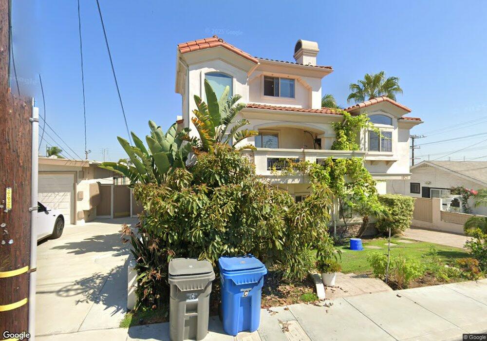
1921 Rockefeller Ln Unit A Redondo Beach, CA 90278
North Redondo Beach NeighborhoodEstimated Value: $1,208,000 - $1,348,000
3
Beds
3
Baths
1,795
Sq Ft
$721/Sq Ft
Est. Value
About This Home
This home is located at 1921 Rockefeller Ln Unit A, Redondo Beach, CA 90278 and is currently estimated at $1,293,299, approximately $720 per square foot. 1921 Rockefeller Ln Unit A is a home located in Los Angeles County with nearby schools including Birney Elementary School, Adams Middle School, and Redondo Union High School.
Ownership History
Date
Name
Owned For
Owner Type
Purchase Details
Closed on
Oct 15, 2006
Sold by
1921 Rockefeller Llc
Bought by
Lee Steven M
Current Estimated Value
Home Financials for this Owner
Home Financials are based on the most recent Mortgage that was taken out on this home.
Original Mortgage
$624,000
Outstanding Balance
$342,168
Interest Rate
5.12%
Mortgage Type
Purchase Money Mortgage
Estimated Equity
$951,131
Create a Home Valuation Report for This Property
The Home Valuation Report is an in-depth analysis detailing your home's value as well as a comparison with similar homes in the area
Home Values in the Area
Average Home Value in this Area
Purchase History
| Date | Buyer | Sale Price | Title Company |
|---|---|---|---|
| Lee Steven M | $780,000 | Lawyers Title Company |
Source: Public Records
Mortgage History
| Date | Status | Borrower | Loan Amount |
|---|---|---|---|
| Open | Lee Steven M | $624,000 |
Source: Public Records
Tax History Compared to Growth
Tax History
| Year | Tax Paid | Tax Assessment Tax Assessment Total Assessment is a certain percentage of the fair market value that is determined by local assessors to be the total taxable value of land and additions on the property. | Land | Improvement |
|---|---|---|---|---|
| 2025 | $12,087 | $1,045,019 | $672,833 | $372,186 |
| 2024 | $12,087 | $1,024,530 | $659,641 | $364,889 |
| 2023 | $11,866 | $1,004,442 | $646,707 | $357,735 |
| 2022 | $11,663 | $984,748 | $634,027 | $350,721 |
| 2021 | $11,352 | $965,441 | $621,596 | $343,845 |
| 2020 | $11,342 | $955,543 | $615,223 | $340,320 |
| 2019 | $11,088 | $936,808 | $603,160 | $333,648 |
| 2018 | $10,638 | $904,000 | $582,000 | $322,000 |
| 2016 | $9,304 | $780,000 | $502,200 | $277,800 |
| 2015 | $9,265 | $780,000 | $502,200 | $277,800 |
| 2014 | $8,429 | $702,000 | $452,000 | $250,000 |
Source: Public Records
Map
Nearby Homes
- 2002 Carnegie Ln Unit A
- 1832 Rockefeller Ln Unit 9
- 1708 Blossom Ln
- 2021 Carnegie Ln Unit 7
- 2100 Carnegie Ln
- 2720 27201/2 Carnegie Ln
- 1900 Vanderbilt Ln
- 1802 Blossom Ln
- 1913 Harriman Ln Unit 1
- 2001 Artesia Blvd Unit 301
- 2001 Artesia Blvd Unit 207
- 2204 Carnegie Ln
- 2005 Mathews Ave Unit A
- 2020 Clark Ln Unit B
- 1812 Clark Ln Unit A
- 2213 Carnegie Ln Unit A
- 1303 Harkness Ln
- 2002 Marshallfield Ln
- 615 Aviation Way
- 2106 Nelson Ave Unit A
- 1921 Rockefeller Ln
- 1921 Rockefeller Ln Unit B
- 1919 Rockefeller Ln
- 1703 Green Ln
- 1923 Rockefeller Ln
- 1705 Green Ln
- 1917 Rockefeller Ln
- 1707 Green Ln
- 1922 1/2 Rockefeller Ln
- 2001 Rockefeller Ln
- 1922 Rockefeller Ln
- 1704 Green Ln
- 1911 Rockefeller Ln Unit F
- 1911 Rockefeller Ln Unit E
- 1911 Rockefeller Ln Unit D
- 1911 Rockefeller Ln Unit C
- 1911 Rockefeller Ln Unit B
- 1911 Rockefeller Ln Unit A
- 1920 Rockefeller Ln
- 1620 Carnegie Ln Unit 3