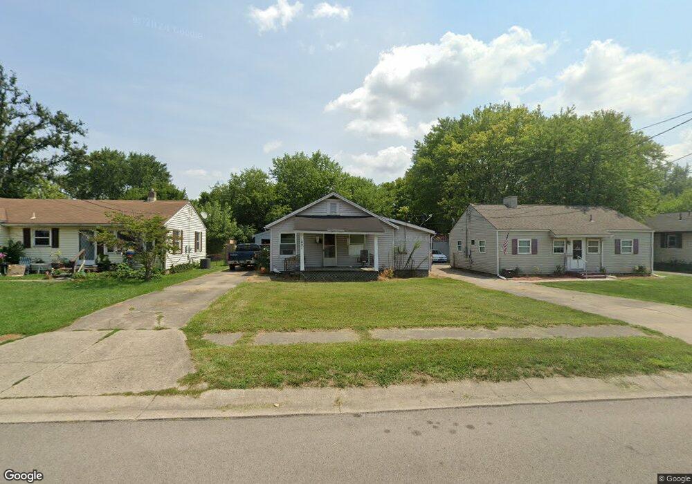
1921 Sheffield St Middletown, OH 45044
Mayfield NeighborhoodEstimated Value: $127,869 - $166,000
3
Beds
1
Bath
986
Sq Ft
$151/Sq Ft
Est. Value
About This Home
This home is located at 1921 Sheffield St, Middletown, OH 45044 and is currently estimated at $148,717, approximately $150 per square foot. 1921 Sheffield St is a home located in Butler County with nearby schools including Mayfield Elementary School, Highview 6th Grade Center, and Middletown Middle School.
Ownership History
Date
Name
Owned For
Owner Type
Purchase Details
Closed on
Aug 29, 2025
Sold by
Mayne Roberta S
Bought by
Mayne Gary L
Current Estimated Value
Purchase Details
Closed on
Oct 29, 1996
Sold by
Rose Estill E
Bought by
Mayne Gary L and Mayne Roberta
Home Financials for this Owner
Home Financials are based on the most recent Mortgage that was taken out on this home.
Original Mortgage
$69,424
Interest Rate
8.32%
Mortgage Type
FHA
Purchase Details
Closed on
Jul 1, 1993
Create a Home Valuation Report for This Property
The Home Valuation Report is an in-depth analysis detailing your home's value as well as a comparison with similar homes in the area
Home Values in the Area
Average Home Value in this Area
Purchase History
| Date | Buyer | Sale Price | Title Company |
|---|---|---|---|
| Mayne Gary L | -- | None Listed On Document | |
| Mayne Gary L | $69,000 | -- | |
| -- | $56,000 | -- |
Source: Public Records
Mortgage History
| Date | Status | Borrower | Loan Amount |
|---|---|---|---|
| Previous Owner | Mayne Gary L | $69,424 |
Source: Public Records
Tax History
| Year | Tax Paid | Tax Assessment Tax Assessment Total Assessment is a certain percentage of the fair market value that is determined by local assessors to be the total taxable value of land and additions on the property. | Land | Improvement |
|---|---|---|---|---|
| 2025 | $1,241 | $24,020 | $4,220 | $19,800 |
| 2024 | $1,241 | $24,020 | $4,220 | $19,800 |
| 2023 | $1,233 | $20,560 | $4,220 | $16,340 |
| 2022 | $1,015 | $17,460 | $4,220 | $13,240 |
| 2021 | $976 | $17,460 | $4,220 | $13,240 |
| 2020 | $1,017 | $17,460 | $4,220 | $13,240 |
| 2019 | $802 | $11,070 | $4,200 | $6,870 |
| 2018 | $698 | $11,070 | $4,200 | $6,870 |
| 2017 | $700 | $11,070 | $4,200 | $6,870 |
| 2016 | $642 | $9,730 | $4,200 | $5,530 |
| 2015 | $633 | $9,730 | $4,200 | $5,530 |
| 2014 | $1,061 | $9,730 | $4,200 | $5,530 |
| 2013 | $1,061 | $17,770 | $4,200 | $13,570 |
Source: Public Records
Map
Nearby Homes
- 1932 Winton St
- 2105 Winton St
- 2120 Fernwood St
- 2128 Lamberton St
- 3216 Beatrice Dr
- 3208 Beatrice Dr
- 1913 Brentwood St
- 2029 Waynedale Ct
- 3200 Lefferson Rd
- 1619 Carriage Dr
- 1619 Carriage St
- 3611 Greenwood Dr
- 3700 Greenwood Dr
- 3220 Barbara Dr
- 3218 Keays Ave
- 2216 Carolina St
- 800 Orchard St
- 1305 Highland St
- 808 The Alameda
- 904 Stanley St
- 1925 Sheffield St Unit 927
- 1917 Sheffield St
- 1929 Sheffield St
- 1913 Sheffield St
- 1933 Sheffield St Unit 935
- 1909 Sheffield St
- 1920 Sheffield St
- 1924 Sheffield St
- 1916 Sheffield St
- 2001 Sheffield St
- 1928 Sheffield St
- 1912 Sheffield St
- 1905 Sheffield St
- 1932 Sheffield St
- 1908 Sheffield St
- 2005 Sheffield St
- 3310 Burbank Ave
- 2000 Sheffield St
- 1901 Sheffield St
- 1902 Sheffield St
Your Personal Tour Guide
Ask me questions while you tour the home.