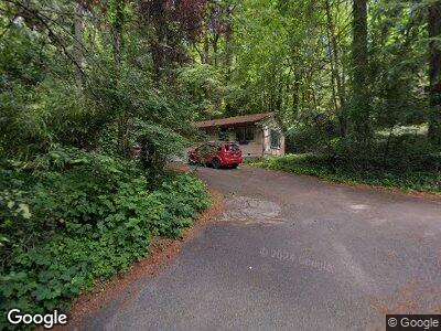
1921 SW Arnold St Portland, OR 97219
Marshall Park NeighborhoodEstimated Value: $434,000 - $522,000
1
Bed
1
Bath
912
Sq Ft
$529/Sq Ft
Est. Value
About This Home
This home is located at 1921 SW Arnold St, Portland, OR 97219 and is currently estimated at $482,238, approximately $528 per square foot. 1921 SW Arnold St is a home located in Multnomah County with nearby schools including Stephenson Elementary School, Jackson Middle School, and Ida B. Wells-Barnett High School.
Ownership History
Date
Name
Owned For
Owner Type
Purchase Details
Closed on
Jan 3, 2018
Sold by
Duncan Susan Mae
Bought by
Duncan Susan Mae and Susan Mae Duncan Trust
Current Estimated Value
Purchase Details
Closed on
Mar 9, 2000
Sold by
Carmichael John Olson
Bought by
Duncan Susan Mae
Home Financials for this Owner
Home Financials are based on the most recent Mortgage that was taken out on this home.
Original Mortgage
$115,200
Interest Rate
8.27%
Mortgage Type
Purchase Money Mortgage
Create a Home Valuation Report for This Property
The Home Valuation Report is an in-depth analysis detailing your home's value as well as a comparison with similar homes in the area
Home Values in the Area
Average Home Value in this Area
Purchase History
| Date | Buyer | Sale Price | Title Company |
|---|---|---|---|
| Duncan Susan Mae | -- | None Available | |
| Duncan Susan Mae | $128,000 | Pacific Nw Title |
Source: Public Records
Mortgage History
| Date | Status | Borrower | Loan Amount |
|---|---|---|---|
| Open | Duncan Susan Mae | $160,000 | |
| Closed | Duncan Susan Mae | $134,314 | |
| Closed | Duncan Susan Mae | $33,350 | |
| Closed | Duncan Susan Mae | $115,200 |
Source: Public Records
Tax History Compared to Growth
Tax History
| Year | Tax Paid | Tax Assessment Tax Assessment Total Assessment is a certain percentage of the fair market value that is determined by local assessors to be the total taxable value of land and additions on the property. | Land | Improvement |
|---|---|---|---|---|
| 2023 | $5,971 | $225,530 | $0 | $0 |
| 2022 | $5,842 | $218,970 | $0 | $0 |
| 2021 | $5,743 | $212,600 | $0 | $0 |
| 2020 | $5,268 | $206,410 | $0 | $0 |
| 2019 | $5,074 | $200,400 | $0 | $0 |
| 2018 | $4,925 | $194,570 | $0 | $0 |
| 2017 | $4,721 | $188,910 | $0 | $0 |
| 2016 | $4,320 | $183,410 | $0 | $0 |
| 2015 | $4,206 | $178,070 | $0 | $0 |
| 2014 | $4,096 | $172,890 | $0 | $0 |
Source: Public Records
Map
Nearby Homes
- 1512 SW Kari Ln
- 10540 SW Lancaster Rd
- 10533 SW 14th Dr
- 10864 SW Creightonwood Place
- 10137 SW Lancaster Rd
- 10151 SW Lancaster Rd
- 11442 SW Woodlee Heights Ct
- 2742 SW Leah Ct
- 11227 SW 27th Ave
- 1035 SW Palatine St
- 1427 SW Maplecrest Dr
- 10939 SW 29th Ct
- 3110 SW Dickinson St
- 11025 SW Boones Ferry Rd
- 1611 SW Dickinson Ln
- 9921 SW Quail Post Rd
- 9825 SW Quail Post Rd
- 9616 SW 12th Dr
- 11019 SW 32nd Ave
- 3308 SW Arnold Heights Terrace
- 1921 SW Arnold St
- 10640 SW Lancaster Rd
- 10630 SW Lancaster Rd
- 10650 SW Lancaster Rd
- 1945 SW Arnold St
- 10620 SW Lancaster Rd
- 10668 SW Lancaster Rd
- 10645 SW Lancaster Rd
- 2011 SW Arnold St
- 2007 SW Arnold St
- 10643 SW Lancaster Rd
- 10674 SW Lancaster Rd
- 1825 SW Arnold St
- 10707 SW 14th Dr
- 10651 SW Lancaster Rd
- 2003 SW Arnold St
- 10710 SW 14th Dr
- 10659 SW Lancaster Rd
- 1922 SW Arnold St
- 1942 SW Arnold St