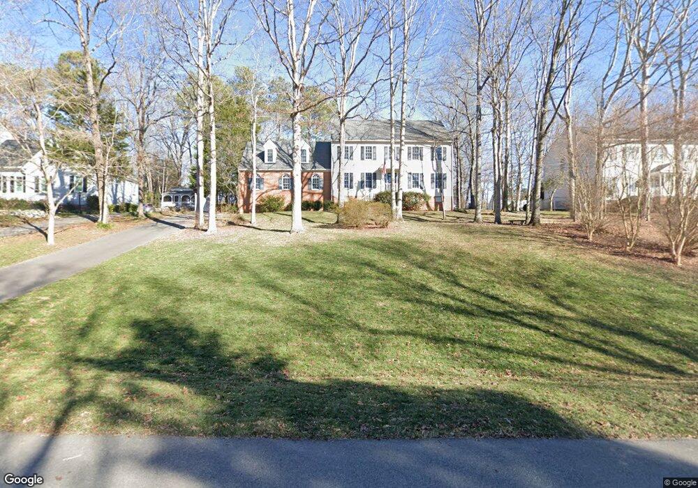
1921 Thornleigh Rd Midlothian, VA 23113
Roxshire NeighborhoodEstimated Value: $693,000 - $757,000
4
Beds
3
Baths
3,346
Sq Ft
$216/Sq Ft
Est. Value
About This Home
This home is located at 1921 Thornleigh Rd, Midlothian, VA 23113 and is currently estimated at $723,031, approximately $216 per square foot. 1921 Thornleigh Rd is a home located in Chesterfield County with nearby schools including Robious Elementary School, Robious Middle School, and James River High School.
Ownership History
Date
Name
Owned For
Owner Type
Purchase Details
Closed on
Mar 8, 2005
Sold by
Hollrah Don
Bought by
Breslin Gerald
Current Estimated Value
Home Financials for this Owner
Home Financials are based on the most recent Mortgage that was taken out on this home.
Original Mortgage
$150,000
Outstanding Balance
$76,197
Interest Rate
5.64%
Mortgage Type
New Conventional
Estimated Equity
$646,834
Create a Home Valuation Report for This Property
The Home Valuation Report is an in-depth analysis detailing your home's value as well as a comparison with similar homes in the area
Home Values in the Area
Average Home Value in this Area
Purchase History
| Date | Buyer | Sale Price | Title Company |
|---|---|---|---|
| Breslin Gerald | $385,000 | -- |
Source: Public Records
Mortgage History
| Date | Status | Borrower | Loan Amount |
|---|---|---|---|
| Open | Breslin Gerald | $150,000 |
Source: Public Records
Tax History Compared to Growth
Tax History
| Year | Tax Paid | Tax Assessment Tax Assessment Total Assessment is a certain percentage of the fair market value that is determined by local assessors to be the total taxable value of land and additions on the property. | Land | Improvement |
|---|---|---|---|---|
| 2025 | $5,798 | $648,700 | $145,000 | $503,700 |
| 2024 | $5,798 | $617,400 | $135,000 | $482,400 |
| 2023 | $4,839 | $531,800 | $125,000 | $406,800 |
| 2022 | $4,591 | $499,000 | $115,000 | $384,000 |
| 2021 | $4,340 | $449,900 | $104,000 | $345,900 |
| 2020 | $4,108 | $432,400 | $104,000 | $328,400 |
| 2019 | $4,079 | $429,400 | $101,000 | $328,400 |
| 2018 | $3,924 | $413,100 | $99,000 | $314,100 |
| 2017 | $3,947 | $411,100 | $97,000 | $314,100 |
| 2016 | $3,928 | $409,200 | $97,000 | $312,200 |
| 2015 | $3,877 | $401,200 | $89,000 | $312,200 |
| 2014 | $3,726 | $385,500 | $82,000 | $303,500 |
Source: Public Records
Map
Nearby Homes
- 11911 Kilrenny Rd
- 11814 N Briar Patch Dr
- 2303 Bream Dr
- 1709 Headwaters Rd
- 12602 Foxstone Ct
- 11815 N Briar Patch Dr
- 1101 Southwick Blvd
- 2735 Swanhurst Dr
- 12260 Haydon Place
- 11714 S Briar Patch Dr
- 1660 Sandgate Rd
- 11735 S Briar Patch Dr
- 1100 Oldbury Rd
- 2310 Oakengate Ln
- 11713 S Briar Patch Dr
- 11709 S Briar Patch Dr
- 1331 Warminster Dr
- 1510 Sycamore Square Dr Unit 1510
- 2725 Stonegate Ct
- 1516 Sandgate Rd
- 1931 Thornleigh Rd
- 1911 Thornleigh Rd
- 1930 Normandstone Dr
- 1940 Normandstone Dr
- 2000 Chartstone Dr
- 2001 Thornleigh Rd
- 1920 Normandstone Dr
- 1901 Thornleigh Rd
- 2000 Normandstone Dr
- 1910 Thornleigh Rd
- 2001 Chartstone Dr
- 1900 Thornleigh Rd
- 1900 Normandstone Dr
- 2010 Normandstone Dr
- 2020 Thornleigh Rd
- 2021 Thornleigh Rd
- 2011 Chartstone Dr
- 1931 Normandstone Dr
- 2010 Chartstone Dr
- 1921 Normandstone Dr