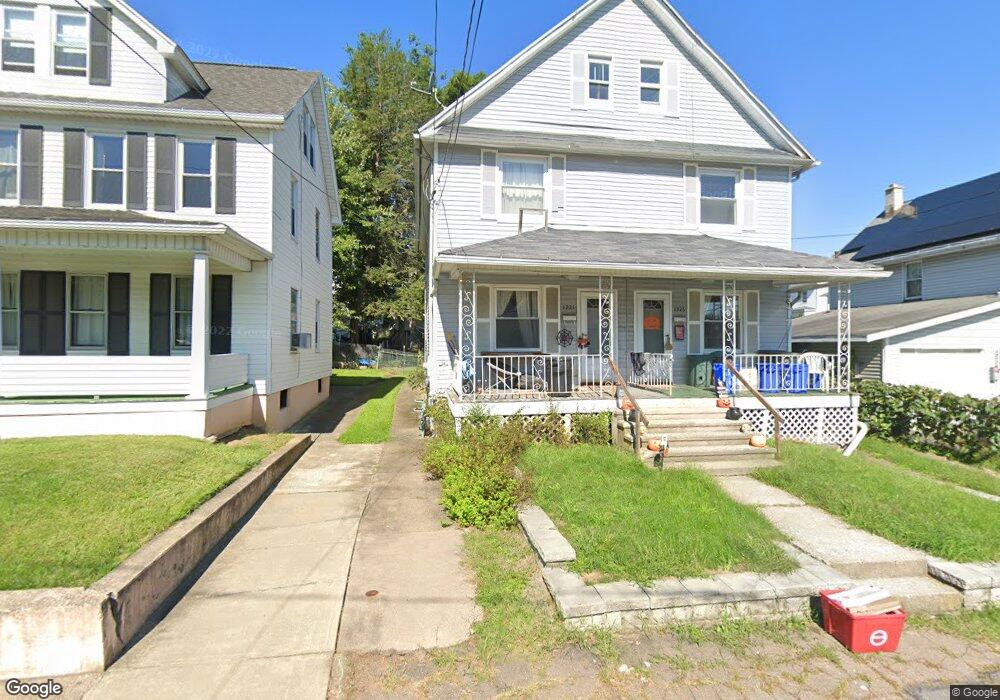
1921 Wint Ave Unit 1923 Scranton, PA 18509
Greenridge NeighborhoodEstimated Value: $143,000 - $187,000
--
Bed
--
Bath
1,677
Sq Ft
$100/Sq Ft
Est. Value
About This Home
This home is located at 1921 Wint Ave Unit 1923, Scranton, PA 18509 and is currently estimated at $167,230, approximately $99 per square foot. 1921 Wint Ave Unit 1923 is a home located in Lackawanna County with nearby schools including Maybeury Elementary School, Pinchbeck Elementary School, and Robert Morris #27.
Ownership History
Date
Name
Owned For
Owner Type
Purchase Details
Closed on
Mar 7, 2015
Sold by
Fields Irene
Bought by
Fields Irene and Fields James
Current Estimated Value
Purchase Details
Closed on
Jun 19, 2013
Sold by
Gesek Kenneth R and Howell Theresa M
Bought by
Federal National Mortgage Association
Purchase Details
Closed on
Aug 31, 2006
Sold by
Brownlee Darla and Brownlee Thomas L
Bought by
Gesek Kenneth R and Howell Theresa M
Home Financials for this Owner
Home Financials are based on the most recent Mortgage that was taken out on this home.
Original Mortgage
$83,700
Interest Rate
6.79%
Mortgage Type
Commercial
Create a Home Valuation Report for This Property
The Home Valuation Report is an in-depth analysis detailing your home's value as well as a comparison with similar homes in the area
Home Values in the Area
Average Home Value in this Area
Purchase History
| Date | Buyer | Sale Price | Title Company |
|---|---|---|---|
| Fields Irene | -- | None Available | |
| Federal National Mortgage Association | $919 | None Available | |
| Gesek Kenneth R | $93,000 | None Available |
Source: Public Records
Mortgage History
| Date | Status | Borrower | Loan Amount |
|---|---|---|---|
| Previous Owner | Gesek Kenneth R | $83,700 |
Source: Public Records
Tax History Compared to Growth
Tax History
| Year | Tax Paid | Tax Assessment Tax Assessment Total Assessment is a certain percentage of the fair market value that is determined by local assessors to be the total taxable value of land and additions on the property. | Land | Improvement |
|---|---|---|---|---|
| 2025 | $3,111 | $10,000 | $1,050 | $8,950 |
| 2024 | $2,836 | $10,000 | $1,050 | $8,950 |
| 2023 | $2,836 | $10,000 | $1,050 | $8,950 |
| 2022 | $2,773 | $10,000 | $1,050 | $8,950 |
| 2021 | $2,773 | $10,000 | $1,050 | $8,950 |
| 2020 | $2,719 | $10,000 | $1,050 | $8,950 |
| 2019 | $2,556 | $10,000 | $1,050 | $8,950 |
| 2018 | $2,556 | $10,000 | $1,050 | $8,950 |
| 2017 | $2,509 | $10,000 | $1,050 | $8,950 |
| 2016 | $0 | $10,000 | $1,050 | $8,950 |
| 2015 | $1,863 | $10,000 | $1,050 | $8,950 |
| 2014 | -- | $10,000 | $1,050 | $8,950 |
Source: Public Records
Map
Nearby Homes
- 2129 Comegys Ave Unit L11
- 512 Electric St Unit 510-516
- 416 Electric St
- 2106 Boulevard Ave
- 1762-1764 Sanderson Ave
- 1747 Monsey Ave
- 2136 N Main Ave
- 802 Sunset St
- 2089 N Main Ave
- 601 Dean St
- 2237 Boulevard Ave
- 119 Spring St
- 35 Dean St
- 2040 Edna Ave
- 1732 Capouse Ave
- 1021 Richmont St
- 2105 Belmont Terrace
- 1606 Dickson Ave
- 525 Green Ridge St
- 1008 Sunset St
- 1921-1923 Wint Ave
- 1923 Wint Ave
- 1917 Wint Ave
- 1925 Wint Ave
- 1922 Smith Place Unit 1924
- 1926 Smith Place
- 1920 Smith Place
- 514 Jadwin St
- 512 Jadwin St
- 512 Jadwin St Unit L 20
- 1924 Wint Ave
- 518 Jadwin St
- 511 Deacon St Unit 513
- 2002 Smith Place Unit 2004
- 523 Detty St
- 2006 Smith Place
- 532 Detty St
- 515 Deacon St
- 519 Deacon St
- 521 Detty St