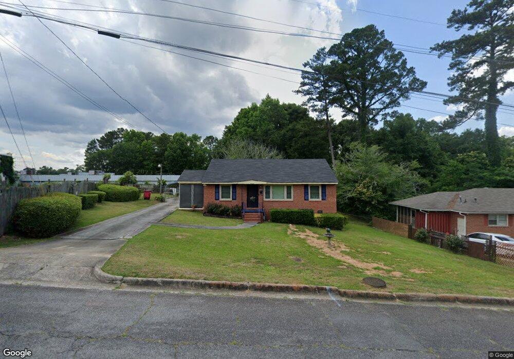
1922 Knightsbridge Rd Macon, GA 31211
Estimated Value: $81,000 - $115,000
2
Beds
1
Bath
1,156
Sq Ft
$79/Sq Ft
Est. Value
About This Home
This home is located at 1922 Knightsbridge Rd, Macon, GA 31211 and is currently estimated at $91,153, approximately $78 per square foot. 1922 Knightsbridge Rd is a home located in Bibb County with nearby schools including Martin Luther King Jr. Elementary School, Appling Middle School, and Northeast High School.
Ownership History
Date
Name
Owned For
Owner Type
Purchase Details
Closed on
May 21, 1993
Sold by
Southern Alliance Capital Corp 2307/335
Bought by
Marshall Genester
Current Estimated Value
Create a Home Valuation Report for This Property
The Home Valuation Report is an in-depth analysis detailing your home's value as well as a comparison with similar homes in the area
Purchase History
| Date | Buyer | Sale Price | Title Company |
|---|---|---|---|
| Marshall Genester | $43,500 | -- |
Source: Public Records
Tax History
| Year | Tax Paid | Tax Assessment Tax Assessment Total Assessment is a certain percentage of the fair market value that is determined by local assessors to be the total taxable value of land and additions on the property. | Land | Improvement |
|---|---|---|---|---|
| 2025 | $869 | $35,378 | $5,120 | $30,258 |
| 2024 | $786 | $30,937 | $3,200 | $27,737 |
| 2023 | $23 | $27,135 | $1,920 | $25,215 |
| 2022 | $417 | $19,053 | $3,208 | $15,845 |
| 2021 | $277 | $14,290 | $2,046 | $12,244 |
| 2020 | $227 | $12,850 | $2,046 | $10,804 |
| 2019 | $229 | $12,850 | $2,046 | $10,804 |
| 2018 | $531 | $12,850 | $2,046 | $10,804 |
| 2017 | $219 | $12,850 | $2,046 | $10,804 |
| 2016 | $210 | $13,055 | $2,046 | $11,009 |
| 2015 | $297 | $13,055 | $2,046 | $11,009 |
| 2014 | $217 | $17,655 | $2,976 | $14,679 |
Source: Public Records
Map
Nearby Homes
- 2418 Tredway Dr
- 2458 Tredway Dr
- 2361 Ollie Dr
- 1977 Thomas Dr
- 2630 Pauladale Dr
- 2285 New Clinton Rd
- 2639 Tredway Dr
- 2675 Pauladale Dr
- 2504 Bedford Place
- 2161 Melton Ave
- 2721 Kensington Place
- 2229 New Clinton Rd
- 2557 Hyde Park Rd
- 2066 Melton Ave
- 837 Artic Cir
- 1235 Boone St
- 1008 Sunnydale Dr
- 896 Roseview Dr
- 909 Johnson St
- 4436 Jeffersonville Rd
- 1930 Knightsbridge Rd
- 1938 Knightsbridge Rd
- 1900 Shurling Dr
- 1931 Knightsbridge Rd
- 1946 Knightsbridge Rd
- 1941 Knightsbridge Rd
- 1328 Pine Hill Dr
- 1949 Knightsbridge Rd
- 2620 Shurling Dr
- 1954 Knightsbridge Rd
- 1938 Bayswater Rd
- 1957 Knightsbridge Rd
- 2333 Shurling Dr
- 1890 Shurling Dr
- 1946 Bayswater Rd
- 1965 Knightsbridge Rd
- 1970 Knightsbridge Rd Unit 213
- 1970 Knightsbridge Rd
- 2360 Tredway Dr
- 1954 Bayswater Rd
Your Personal Tour Guide
Ask me questions while you tour the home.