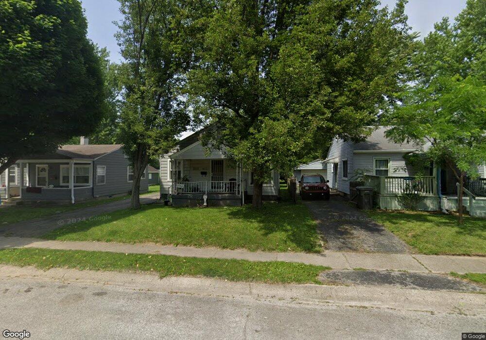
1922 N Bosart Ave Indianapolis, IN 46218
Near Eastside NeighborhoodEstimated Value: $78,000 - $130,000
2
Beds
1
Bath
1,669
Sq Ft
$66/Sq Ft
Est. Value
About This Home
This home is located at 1922 N Bosart Ave, Indianapolis, IN 46218 and is currently estimated at $110,827, approximately $66 per square foot. 1922 N Bosart Ave is a home located in Marion County with nearby schools including Thomas D. Gregg School No. 15, Washington Irving School 14, and Anna Brochhausen School 88.
Ownership History
Date
Name
Owned For
Owner Type
Purchase Details
Closed on
May 26, 2017
Sold by
Richard B
Bought by
Reynolds Leslie
Current Estimated Value
Purchase Details
Closed on
Dec 18, 2006
Sold by
Fannie Mae
Bought by
Little Richard B
Home Financials for this Owner
Home Financials are based on the most recent Mortgage that was taken out on this home.
Original Mortgage
$33,750
Interest Rate
6.24%
Mortgage Type
New Conventional
Purchase Details
Closed on
Mar 15, 2006
Sold by
Brower Timothy M
Bought by
Federal National Mortgage Asn
Purchase Details
Closed on
Dec 9, 2005
Sold by
Valor Homes One Llc
Bought by
Brower Timothy M
Create a Home Valuation Report for This Property
The Home Valuation Report is an in-depth analysis detailing your home's value as well as a comparison with similar homes in the area
Home Values in the Area
Average Home Value in this Area
Purchase History
| Date | Buyer | Sale Price | Title Company |
|---|---|---|---|
| Reynolds Leslie | $13,500 | -- | |
| Reynolds Leslie | $13,500 | Fidelity National Title | |
| Little Richard B | -- | None Available | |
| Federal National Mortgage Asn | -- | None Available | |
| Federal National Mortgage Association | -- | None Available | |
| Brower Timothy M | -- | None Available | |
| Brower Timothy M | -- | None Available |
Source: Public Records
Mortgage History
| Date | Status | Borrower | Loan Amount |
|---|---|---|---|
| Previous Owner | Little Richard B | $33,750 |
Source: Public Records
Tax History Compared to Growth
Tax History
| Year | Tax Paid | Tax Assessment Tax Assessment Total Assessment is a certain percentage of the fair market value that is determined by local assessors to be the total taxable value of land and additions on the property. | Land | Improvement |
|---|---|---|---|---|
| 2024 | $1,703 | $72,900 | $8,900 | $64,000 |
| 2023 | $1,703 | $68,100 | $8,900 | $59,200 |
| 2022 | $1,694 | $68,100 | $8,900 | $59,200 |
| 2021 | $1,496 | $61,200 | $8,900 | $52,300 |
| 2020 | $1,344 | $54,500 | $3,100 | $51,400 |
| 2019 | $1,242 | $49,200 | $3,100 | $46,100 |
| 2018 | $1,041 | $40,400 | $3,100 | $37,300 |
| 2017 | $858 | $36,800 | $3,100 | $33,700 |
| 2016 | $2,747 | $39,900 | $3,100 | $36,800 |
| 2014 | $977 | $45,200 | $3,100 | $42,100 |
| 2013 | $1,068 | $45,200 | $3,100 | $42,100 |
Source: Public Records
Map
Nearby Homes
- 1905 N Bosart Ave
- 1943 N Drexel Ave
- 1940 N Drexel Ave
- 1950 N Dequincy St
- 2016 Glenridge Dr
- 2047 N Bosart Ave
- 1731 N Bosart Ave
- 4605 E 18th St
- 1953 Kildare Ave
- 1946 N Euclid Ave
- 1843 Kildare Ave
- 4706 E 21st St
- 4512 E 21st St
- 1844 N Riley Ave
- 1617 N Bosart Ave
- 4614 E 16th St
- 2048 N Euclid Ave
- 4950 E 18th St
- 2127 Wallace Ave
- 1916 N Colorado Ave
- 1916 N Bosart Ave
- 1930 N Bosart Ave
- 1912 N Bosart Ave
- 1919 N Drexel Ave
- 1923 N Drexel Ave
- 1915 N Drexel Ave
- 1934 N Bosart Ave
- 1927 N Drexel Ave
- 1911 N Drexel Ave
- 1938 N Bosart Ave
- 1931 N Drexel Ave
- 1907 N Drexel Ave
- 1927 N Bosart Ave
- 1911 N Bosart Ave
- 1909 N Bosart Ave
- 1931 N Bosart Ave
- 1935 N Drexel Ave
- 1903 N Drexel Ave
- 1905 N Osart Ave