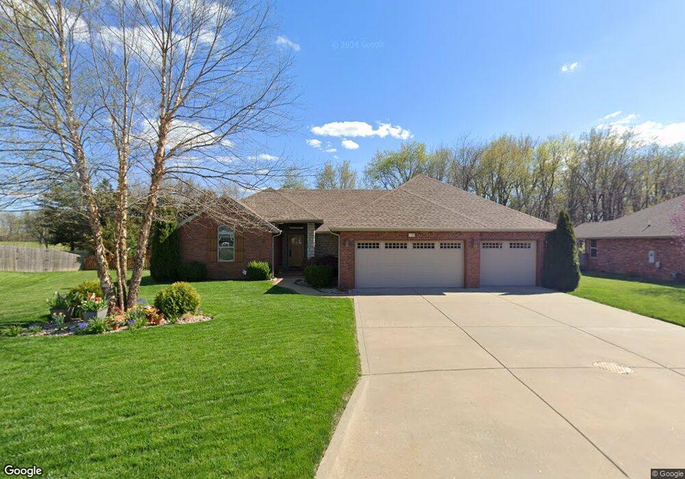
1922 N Pavilion Place Strafford, MO 65757
Southeast Springfield NeighborhoodEstimated Value: $351,000 - $367,000
3
Beds
2
Baths
1,766
Sq Ft
$204/Sq Ft
Est. Value
About This Home
This home is located at 1922 N Pavilion Place, Strafford, MO 65757 and is currently estimated at $359,555, approximately $203 per square foot. 1922 N Pavilion Place is a home with nearby schools including Hickory Hills K-8 School and Glendale High School.
Ownership History
Date
Name
Owned For
Owner Type
Purchase Details
Closed on
May 8, 2012
Sold by
Craftmaster Properties Llc
Bought by
Farrand Wendell M and Farrand Beverly G
Current Estimated Value
Home Financials for this Owner
Home Financials are based on the most recent Mortgage that was taken out on this home.
Original Mortgage
$60,000
Interest Rate
3.9%
Mortgage Type
New Conventional
Create a Home Valuation Report for This Property
The Home Valuation Report is an in-depth analysis detailing your home's value as well as a comparison with similar homes in the area
Home Values in the Area
Average Home Value in this Area
Purchase History
| Date | Buyer | Sale Price | Title Company |
|---|---|---|---|
| Farrand Wendell M | -- | Chonce Escrow & Land Title L |
Source: Public Records
Mortgage History
| Date | Status | Borrower | Loan Amount |
|---|---|---|---|
| Closed | Farrand Wendell M | $60,000 |
Source: Public Records
Tax History Compared to Growth
Tax History
| Year | Tax Paid | Tax Assessment Tax Assessment Total Assessment is a certain percentage of the fair market value that is determined by local assessors to be the total taxable value of land and additions on the property. | Land | Improvement |
|---|---|---|---|---|
| 2025 | $2,714 | $54,660 | $10,450 | $44,210 |
| 2024 | $2,714 | $48,050 | $6,420 | $41,630 |
| 2023 | $2,727 | $48,050 | $6,420 | $41,630 |
| 2022 | $2,450 | $41,990 | $6,420 | $35,570 |
| 2021 | $2,320 | $41,990 | $6,420 | $35,570 |
| 2020 | $2,248 | $38,720 | $6,420 | $32,300 |
| 2019 | $2,188 | $38,720 | $6,420 | $32,300 |
| 2018 | $2,121 | $37,490 | $5,700 | $31,790 |
| 2017 | $2,100 | $34,880 | $5,700 | $29,180 |
| 2016 | $1,953 | $34,880 | $5,700 | $29,180 |
| 2015 | $1,937 | $34,880 | $5,700 | $29,180 |
| 2014 | $1,898 | $33,920 | $5,700 | $28,220 |
Source: Public Records
Map
Nearby Homes
- 2025 N Unbridled Ct
- 1984 N Alysheba Ct
- 5558 E Cavalcade Ln
- 5546 E Cavalcade Ln
- Lake Edge Plan at Wild Horse
- Lake Edge II Plan at Wild Horse
- Lancaster II Plan at Wild Horse
- Meadowood Plan at Wild Horse
- Palomino Plan at Wild Horse
- Silverado Plan at Wild Horse
- Stone Ridge Plan at Wild Horse
- Emerson Plan at Wild Horse
- Lancaster I Plan at Wild Horse
- 5564 E Wild Horse Dr
- 5534 E Cavalcade Ln
- 1999 N Alysheba Ct
- 1999 N Riva Ridge Ct
- 1961 N Cannonade Ct
- 1976 N Citation Ave
- Lot 49 N Silver Charm Ave
- 1914 N Pavilion Place
- 1930 N Pavilion Place
- 1911 N Pavilion
- 1935 N Pavilion Place
- 1906 N Pavilion Place
- 1938 Pavilion Place
- 1927 Pavilion Place
- 1938 N Pavilion Place
- 1946 N Pavilion Place
- 1919 N Pavilion Place
- 1951 Pavilion Place
- 1913 N Trellis Rd
- 1905 N Trellis Rd
- 1954 N Pavilion Place
- 1921 N Trellis Rd
- 5785 E Farm Road 122
- 1929 N Trellis Rd
- 5764 E Gatehouse Dr
- 5776 E Gatehouse Dr
- 1937 N Trellis Rd