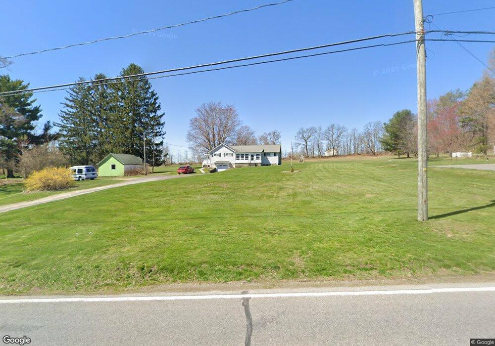
1922 Newton Ransom Blvd Clarks Summit, PA 18411
Estimated Value: $318,000
3
Beds
2
Baths
1,400
Sq Ft
$227/Sq Ft
Est. Value
About This Home
This home is located at 1922 Newton Ransom Blvd, Clarks Summit, PA 18411 and is currently estimated at $318,000, approximately $227 per square foot. 1922 Newton Ransom Blvd is a home located in Lackawanna County with nearby schools including Abington Heights High School.
Ownership History
Date
Name
Owned For
Owner Type
Purchase Details
Closed on
Jul 29, 2010
Sold by
Faraday Frances
Bought by
Sandy Shaun and Sandy Kelly
Current Estimated Value
Home Financials for this Owner
Home Financials are based on the most recent Mortgage that was taken out on this home.
Original Mortgage
$157,098
Outstanding Balance
$104,850
Interest Rate
4.73%
Mortgage Type
New Conventional
Estimated Equity
$213,150
Create a Home Valuation Report for This Property
The Home Valuation Report is an in-depth analysis detailing your home's value as well as a comparison with similar homes in the area
Home Values in the Area
Average Home Value in this Area
Purchase History
| Date | Buyer | Sale Price | Title Company |
|---|---|---|---|
| Sandy Shaun | $151,600 | None Available |
Source: Public Records
Mortgage History
| Date | Status | Borrower | Loan Amount |
|---|---|---|---|
| Open | Sandy Shaun | $157,098 |
Source: Public Records
Tax History Compared to Growth
Tax History
| Year | Tax Paid | Tax Assessment Tax Assessment Total Assessment is a certain percentage of the fair market value that is determined by local assessors to be the total taxable value of land and additions on the property. | Land | Improvement |
|---|---|---|---|---|
| 2025 | $1,740 | $7,148 | $1,148 | $6,000 |
| 2024 | $1,437 | $7,148 | $1,148 | $6,000 |
| 2023 | $1,437 | $7,148 | $1,148 | $6,000 |
| 2022 | $1,407 | $7,148 | $1,148 | $6,000 |
| 2021 | $1,407 | $7,148 | $1,148 | $6,000 |
| 2020 | $1,407 | $7,148 | $1,148 | $6,000 |
| 2019 | $1,360 | $7,148 | $1,148 | $6,000 |
| 2018 | $1,348 | $7,148 | $1,148 | $6,000 |
| 2017 | $1,341 | $7,148 | $1,148 | $6,000 |
| 2016 | $734 | $7,148 | $1,148 | $6,000 |
| 2015 | -- | $7,148 | $1,148 | $6,000 |
| 2014 | -- | $7,148 | $1,148 | $6,000 |
Source: Public Records
Map
Nearby Homes
- 1932 Newton Ransom Blvd
- 0 Milwaukee Rd Unit GSBSC254290
- 2441 Milwaukee Rd
- 2225 Cherry Hill Rd
- 10 Bald Mt Rd
- 1736 Falls Rd
- 0 Blvd
- 2500 Falls Rd
- 2694 Ransom Rd
- 1502 Forest Acres Dr
- 2352 Newton Ransom Blvd
- 2356 Newton Ransom Blvd
- 162 Highland Rd
- 9119 Valley View Dr
- 52 Ivywood Dr Unit L 6
- 9109 Valley View Dr
- 1215 Country Club Rd
- 3018 Main St
- 314 Terrace Ave
- 3061 Main St
- 1926 Newton Ransom Blvd
- 14001 Church Hill Rd
- 14003 Church Hill Rd
- 1928 Newton Ransom Blvd
- 14002 Church Hill Rd
- 1915 Newton Ransom Blvd
- 1911 Newton Ransom Blvd
- 14009 Church Hill Rd
- 14008 Church Hill Rd
- 1909 Newton Ransom Blvd
- 14010 Church Hill Rd
- 1910 Newton Ransom Blvd
- 1907 Newton Ransom Blvd
- 1907 Newton Ransom Blvd
- 1912 Newton Ransom Blvd
- 2004 Terra Dr
- 2006 Terra Dr
- 14014 Church Hill Rd
- 1905 Newton Ransom Blvd
- 2472 Newton Ransom Blvd