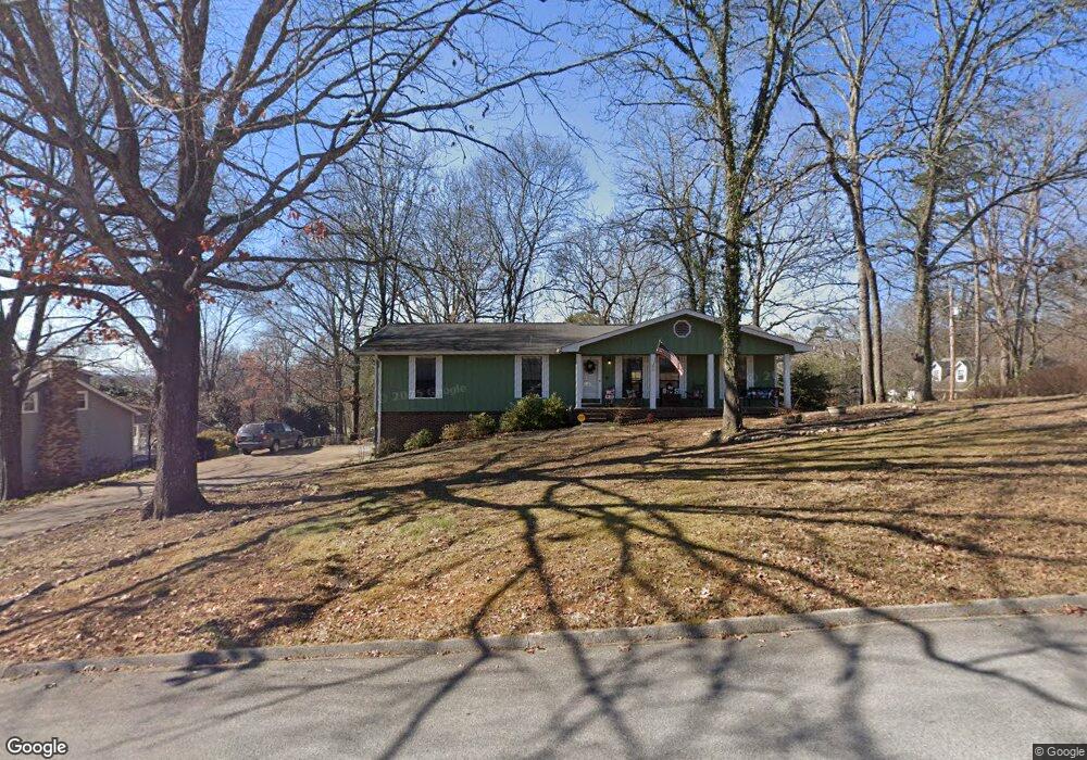
1922 Rock Bluff Rd Unit 4 Hixson, TN 37343
Estimated Value: $389,485 - $404,000
3
Beds
3
Baths
2,320
Sq Ft
$170/Sq Ft
Est. Value
About This Home
This home is located at 1922 Rock Bluff Rd Unit 4, Hixson, TN 37343 and is currently estimated at $394,871, approximately $170 per square foot. 1922 Rock Bluff Rd Unit 4 is a home located in Hamilton County with nearby schools including McConnell Elementary School, Loftis Middle School, and Hixson High School.
Ownership History
Date
Name
Owned For
Owner Type
Purchase Details
Closed on
Jun 18, 2004
Sold by
Ward Geoffrey T and Ward Elizabeth P
Bought by
Slifko Samuel C and Slifko Jennifer B
Current Estimated Value
Home Financials for this Owner
Home Financials are based on the most recent Mortgage that was taken out on this home.
Original Mortgage
$124,550
Outstanding Balance
$61,252
Interest Rate
6.09%
Mortgage Type
Unknown
Estimated Equity
$333,619
Purchase Details
Closed on
Sep 8, 1998
Sold by
Barnett James R and Barnett Karen L
Bought by
Ward Geoffrey T and Ward Elizabeth P
Home Financials for this Owner
Home Financials are based on the most recent Mortgage that was taken out on this home.
Original Mortgage
$75,000
Interest Rate
6.96%
Create a Home Valuation Report for This Property
The Home Valuation Report is an in-depth analysis detailing your home's value as well as a comparison with similar homes in the area
Home Values in the Area
Average Home Value in this Area
Purchase History
| Date | Buyer | Sale Price | Title Company |
|---|---|---|---|
| Slifko Samuel C | $149,500 | Northgate Title Escrow Inc | |
| Ward Geoffrey T | $120,500 | First Title |
Source: Public Records
Mortgage History
| Date | Status | Borrower | Loan Amount |
|---|---|---|---|
| Open | Slifko Samuel C | $124,550 | |
| Previous Owner | Ward Geoffrey T | $75,000 |
Source: Public Records
Tax History Compared to Growth
Tax History
| Year | Tax Paid | Tax Assessment Tax Assessment Total Assessment is a certain percentage of the fair market value that is determined by local assessors to be the total taxable value of land and additions on the property. | Land | Improvement |
|---|---|---|---|---|
| 2024 | $1,143 | $51,075 | $0 | $0 |
| 2023 | $1,152 | $51,075 | $0 | $0 |
| 2022 | $1,152 | $51,075 | $0 | $0 |
| 2021 | $1,152 | $51,075 | $0 | $0 |
| 2020 | $1,197 | $42,950 | $0 | $0 |
| 2019 | $1,197 | $42,950 | $0 | $0 |
| 2018 | $1,197 | $42,950 | $0 | $0 |
| 2017 | $1,197 | $42,950 | $0 | $0 |
| 2016 | $1,094 | $0 | $0 | $0 |
| 2015 | $1,094 | $39,225 | $0 | $0 |
| 2014 | $1,094 | $0 | $0 | $0 |
Source: Public Records
Map
Nearby Homes
- 1926 Rock Bluff Rd
- 6507 Shallow Mar Ln
- 1826 Rock Bluff Rd Unit 5
- 2112 River Bluff Dr
- 6517 Shelter Cove Dr
- 6572 Fairview Rd
- 1924 Bay Pointe Dr
- 6512 Fairview Rd
- 000 Hixson Pike
- The Norwood II Plan at Emerson Ridge
- The Maddux II Plan at Emerson Ridge
- The Ellison II Plan at Emerson Ridge
- 0 Hixson Pike Unit RTC3015987
- 0 Hixson Pike Unit 1522313
- 2051 Paige Meadows Ct
- 1949 Farmstead Dr
- 0 Ridge Lake Rd Unit RTC2805180
- 0 Ridge Lake Rd Unit 1509241
- 1657 Destiny Dr
- 1663 Destiny Dr
- 1924 Rock Bluff Rd
- 6524 Shallowmar Ln
- 1916 Rock Bluff Rd
- 6520 Shallowmar Ln
- 1923 Rock Bluff Rd
- 1921 Rock Bluff Rd
- 1921 Rock Bluff Rd Unit 432
- 1925 Rock Bluff Rd
- 1912 Rock Bluff Rd
- 1919 Rock Bluff Rd
- 6523 Shallowmar Ln Unit 8
- 6523 Shallow Mar Ln
- 1930 Rock Bluff Rd
- 6516 Shallowmar Ln
- 1915 Rock Bluff Rd
- 1915 Rock Bluff Rd Unit 432
- 1929 Rock Bluff Rd
- 1929 Rock Bluff Rd Unit 432
- 6603 Schooner Bay Ln
- 1910 Rock Bluff Rd