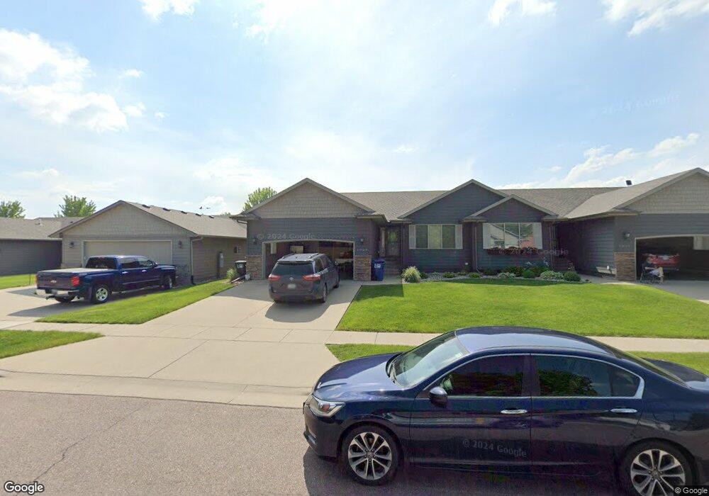
1923 S Wheatland Ct Sioux Falls, SD 57106
Northwest Sioux Falls NeighborhoodEstimated Value: $365,000 - $412,000
4
Beds
3
Baths
2,209
Sq Ft
$176/Sq Ft
Est. Value
About This Home
This home is located at 1923 S Wheatland Ct, Sioux Falls, SD 57106 and is currently estimated at $388,319, approximately $175 per square foot. 1923 S Wheatland Ct is a home located in Minnehaha County with nearby schools including Discovery Elementary School, Memorial Middle School, and Jefferson High School - 67.
Ownership History
Date
Name
Owned For
Owner Type
Purchase Details
Closed on
Dec 30, 2024
Sold by
Fluit Cody and Fluit Ktrina
Bought by
Kerner Leon and Kerner Lisa
Current Estimated Value
Purchase Details
Closed on
Apr 2, 2019
Sold by
Koster Don and Koster Diane
Bought by
Fluit Cody and Fluit Ktrina
Home Financials for this Owner
Home Financials are based on the most recent Mortgage that was taken out on this home.
Original Mortgage
$223,771
Interest Rate
4.4%
Mortgage Type
FHA
Create a Home Valuation Report for This Property
The Home Valuation Report is an in-depth analysis detailing your home's value as well as a comparison with similar homes in the area
Home Values in the Area
Average Home Value in this Area
Purchase History
| Date | Buyer | Sale Price | Title Company |
|---|---|---|---|
| Kerner Leon | $201,000 | Stewart Title Co | |
| Fluit Cody | $228,000 | Stewart Title Company |
Source: Public Records
Mortgage History
| Date | Status | Borrower | Loan Amount |
|---|---|---|---|
| Previous Owner | Fluit Cody | $223,771 |
Source: Public Records
Tax History Compared to Growth
Tax History
| Year | Tax Paid | Tax Assessment Tax Assessment Total Assessment is a certain percentage of the fair market value that is determined by local assessors to be the total taxable value of land and additions on the property. | Land | Improvement |
|---|---|---|---|---|
| 2024 | $4,435 | $329,600 | $58,900 | $270,700 |
| 2023 | $5,246 | $300,900 | $51,800 | $249,100 |
| 2022 | $5,231 | $283,900 | $51,800 | $232,100 |
| 2021 | $3,607 | $222,400 | $0 | $0 |
| 2020 | $3,607 | $187,100 | $0 | $0 |
| 2019 | $3,811 | $193,896 | $0 | $0 |
| 2018 | $3,431 | $182,024 | $0 | $0 |
| 2017 | $3,471 | $174,510 | $24,296 | $150,214 |
| 2016 | $3,471 | $174,510 | $24,296 | $150,214 |
| 2015 | $3,635 | $173,231 | $23,017 | $150,214 |
| 2014 | -- | $172,754 | $22,540 | $150,214 |
Source: Public Records
Map
Nearby Homes
- 0 S Ellis Rd
- 8708 W Norma Trail
- 8105 W 24th St
- 8113 W 24th St
- 8812 W Norma Trail
- 8101 W 24th St
- 1612 S Meadowland Ave
- 1604 S Kinderhook Ave
- 1516 S Kathryn Ave
- 1512 S Kathryn Ave
- 1501 S Wheatland Ave
- 1517 S Kathryn Ave
- 8901 W 32nd St Unit 6
- 1508 S Kathryn Ave
- 1315 S President Ct
- 1500 S Kathryn Ave
- 1405 S Maria Ave
- 1917 S Grinnell Ave
- 8808 W 22nd St
- 1504 S Gill Ave
- 2001 S Wheatland Ct
- 1921 S Wheatland Ct
- 2003 S Wheatland Ct
- 1919 S Wheatland Ct
- 1917 S Wheatland Ct
- 2007 S Wheatland Ct
- 1920 S Wheatland Ct
- 1915 S Wheatland Ct
- 2009 S Wheatland Ct
- 1912 S Wheatland Ct
- 2002 S Barret Place
- 2000 S Barret Place
- 2004 S Wheatland Ct
- 2006 S Barret Place
- 1913 S Wheatland Ct
- 2000 S Barret Place Unit 41
- 2004 S Barret Place
- 2010 S Barret Place Unit 46
- 2008 S Barret Place
- 2008 S Wheatland Ave