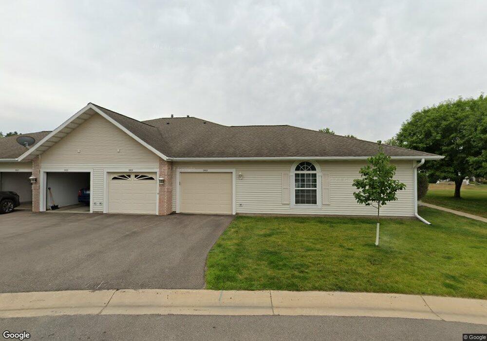
1923 Topaz Point Ln SW Rochester, MN 55902
Estimated Value: $236,000 - $289,000
2
Beds
2
Baths
1,092
Sq Ft
$238/Sq Ft
Est. Value
About This Home
This home is located at 1923 Topaz Point Ln SW, Rochester, MN 55902 and is currently estimated at $259,541, approximately $237 per square foot. 1923 Topaz Point Ln SW is a home located in Olmsted County with nearby schools including Bamber Valley Elementary School, John Adams Middle School, and Mayo Senior High School.
Ownership History
Date
Name
Owned For
Owner Type
Purchase Details
Closed on
Jul 20, 2017
Sold by
Walker Randall R and Walker Laura J
Bought by
Mcwilliams Dennis L and Mcwilliams Joan M
Current Estimated Value
Home Financials for this Owner
Home Financials are based on the most recent Mortgage that was taken out on this home.
Original Mortgage
$143,000
Outstanding Balance
$118,809
Interest Rate
3.89%
Mortgage Type
New Conventional
Estimated Equity
$140,732
Purchase Details
Closed on
Jul 19, 2012
Sold by
Corey Peggy and Estate Of Rose M Corey
Bought by
Walker Randall R and Walker Laura J
Home Financials for this Owner
Home Financials are based on the most recent Mortgage that was taken out on this home.
Original Mortgage
$117,800
Interest Rate
3.66%
Mortgage Type
New Conventional
Create a Home Valuation Report for This Property
The Home Valuation Report is an in-depth analysis detailing your home's value as well as a comparison with similar homes in the area
Home Values in the Area
Average Home Value in this Area
Purchase History
| Date | Buyer | Sale Price | Title Company |
|---|---|---|---|
| Mcwilliams Dennis L | $183,000 | Edina Realty Title Inc | |
| Walker Randall R | $124,000 | None Available |
Source: Public Records
Mortgage History
| Date | Status | Borrower | Loan Amount |
|---|---|---|---|
| Open | Mcwilliams Dennis L | $143,000 | |
| Previous Owner | Walker Randall R | $117,800 |
Source: Public Records
Tax History Compared to Growth
Tax History
| Year | Tax Paid | Tax Assessment Tax Assessment Total Assessment is a certain percentage of the fair market value that is determined by local assessors to be the total taxable value of land and additions on the property. | Land | Improvement |
|---|---|---|---|---|
| 2024 | $65 | $218,500 | $40,000 | $178,500 |
| 2023 | -- | $217,000 | $40,000 | $177,000 |
| 2022 | $2,408 | $206,500 | $40,000 | $166,500 |
| 2021 | $2,208 | $192,200 | $40,000 | $152,200 |
| 2020 | $2,126 | $178,400 | $30,000 | $148,400 |
| 2019 | $2,074 | $167,100 | $30,000 | $137,100 |
| 2018 | $1,701 | $164,200 | $30,000 | $134,200 |
| 2017 | $1,626 | $144,000 | $20,100 | $123,900 |
| 2016 | $1,530 | $107,400 | $16,300 | $91,100 |
| 2015 | $1,440 | $98,800 | $15,900 | $82,900 |
| 2014 | $1,414 | $100,000 | $16,000 | $84,000 |
| 2012 | -- | $101,100 | $16,013 | $85,087 |
Source: Public Records
Map
Nearby Homes
- 1941 Waterford Place SW
- 3177 Glenwood Rd SW
- 3125 Glenwood Rd SW
- 2961 Glenwood Rd SW
- 1814 Mayowood Rd SW
- 1810 Mayowood Rd SW
- 1568 Salem Ct SW
- 2449 Salem Heights Ln SW
- 1911 Greenfield Ln SW Unit E
- 1747 Mayowood Rd SW
- 2229 Ponderosa Dr SW
- 2114 Ponderosa Dr SW
- 1704 Lakeview Dr SW
- 2236 Ponderosa Dr SW
- 3018 Mayowood Common Cir SW
- 1726 Mayowood Rd SW
- 1710 Mayowood Ct SW
- 1750 Mayowood Rd SW
- 1758 Mayowood Rd SW
- 1702 Mayowood Ct SW
- 1923 Topaz Pointe Ln SW
- 1921 Topaz Point Ln SW
- 1921 Topaz Pointe Ln SW
- 1925 Topaz Point Ln SW
- 1925 Topaz Pointe Ln SW
- 1927 Topaz Point Ln SW
- 1927 Topaz Pointe Ln SW
- 1911 Topaz Pointe Ln SW
- 1911 Topaz Point Ln SW
- 1909 Topaz Pointe Ln SW
- 1909 Topaz Point Ln SW
- 1924 Waterford Place SW
- 1940 Waterford Place SW
- 1942 Waterford Place SW
- 1907 Topaz Pointe Ln SW
- 1943 Topaz Point Ln SW
- 1914 Waterford Place SW
- 1907 Topaz Point Ln SW
- 1943 Topaz Pointe Ln SW
- 1910 Waterford Place SW