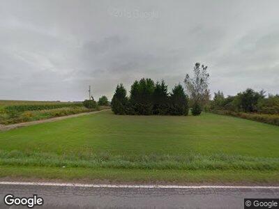
19230 W Stanton Rd Unit A Pierson, MI 49339
Estimated Value: $189,491 - $330,000
--
Bed
--
Bath
--
Sq Ft
10
Acres
About This Home
This home is located at 19230 W Stanton Rd Unit A, Pierson, MI 49339 and is currently estimated at $275,123. 19230 W Stanton Rd Unit A is a home located in Montcalm County with nearby schools including MacNaughton Elementary School, Sand Lake Elementary School, and Tri County Middle School.
Ownership History
Date
Name
Owned For
Owner Type
Purchase Details
Closed on
Jun 6, 2023
Sold by
Orcutt Travis Andrew
Bought by
Orcutt Travis A and Orcutt Lydia
Current Estimated Value
Purchase Details
Closed on
Jan 11, 2012
Sold by
Brocker Kenneth G
Bought by
Orcutt Travis A
Purchase Details
Closed on
Oct 10, 2003
Sold by
Brocker Kenneth G and Brocker Jordy C
Bought by
Brocker Kenneth G
Purchase Details
Closed on
Oct 25, 1996
Sold by
Brocker C Jordy
Bought by
Brocker Kenneth G and Brocker Jordy C
Purchase Details
Closed on
Apr 1, 1994
Create a Home Valuation Report for This Property
The Home Valuation Report is an in-depth analysis detailing your home's value as well as a comparison with similar homes in the area
Home Values in the Area
Average Home Value in this Area
Purchase History
| Date | Buyer | Sale Price | Title Company |
|---|---|---|---|
| Orcutt Travis A | -- | None Listed On Document | |
| Orcutt Travis A | -- | -- | |
| Brocker Kenneth G | -- | -- | |
| Brocker Kenneth G | -- | -- | |
| -- | $34,500 | -- |
Source: Public Records
Mortgage History
| Date | Status | Borrower | Loan Amount |
|---|---|---|---|
| Previous Owner | Rucutt Travis O | $22,000 | |
| Previous Owner | Orcutt Travis A | $29,693 | |
| Previous Owner | Brocker Kenneth G | $30,000 | |
| Previous Owner | Brocker Kenneth G | $25,000 |
Source: Public Records
Tax History Compared to Growth
Tax History
| Year | Tax Paid | Tax Assessment Tax Assessment Total Assessment is a certain percentage of the fair market value that is determined by local assessors to be the total taxable value of land and additions on the property. | Land | Improvement |
|---|---|---|---|---|
| 2024 | $938 | $63,100 | $0 | $0 |
| 2023 | -- | $57,700 | $0 | $0 |
| 2022 | -- | $48,100 | $0 | $0 |
| 2021 | -- | $45,500 | $0 | $0 |
| 2020 | -- | -- | $0 | $0 |
| 2019 | -- | -- | $0 | $0 |
| 2018 | -- | -- | $0 | $0 |
| 2017 | -- | -- | $0 | $0 |
| 2016 | -- | -- | $0 | $0 |
| 2015 | -- | -- | $0 | $0 |
| 2014 | -- | -- | $0 | $0 |
Source: Public Records
Map
Nearby Homes
- V/L W Stanton Rd
- 18990 W Kimball Rd
- 2424 N Maple Hill Rd
- 20389 Freedom Dr
- 491 Bitter Creek Ln
- 2446 Maple Hill Rd
- 6665 E Lake St
- 411 E Lake St
- 16617 W Stanton Rd
- 1466 N Marble Rd
- 55 1st St
- 310 E Maple St NE
- 363 W Lake St Unit 93
- 2125 N Dagget Rd
- 7175 Grosvenor St NE
- 2765 Elmwood Dr
- Parcel A Matthew Ct
- 17050 Harvard Ave NE
- 5057 N Point Dr
- 22770 Oak St
- 19230 W Stanton Rd
- 19230 W Stanton Rd Unit A
- 19168 W Stanton Rd
- 19229 W Stanton Rd
- 19364 W Stanton Rd
- 19427 W Stanton Rd
- 19522 W Stanton Rd
- 19545 W Stanton Rd
- 19552 W Stanton Rd
- 1576 N Jones Rd
- 1576 N Jones Rd
- 19174 W Pierson Rd
- 18803 W Stanton Rd
- 19525 W Pierson Rd
- 18933 W Pierson Rd
- 1624 Jones Rd
- 19020 W Pierson Rd
- 19718 W Pierson Rd
- 19718 W Pierson Rd
- 1035 N Jones Rd
