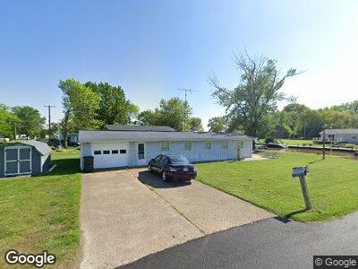
1924 S Stover Rd Port Clinton, OH 43452
Estimated Value: $174,508 - $248,000
2
Beds
1
Bath
1,056
Sq Ft
$192/Sq Ft
Est. Value
About This Home
This home is located at 1924 S Stover Rd, Port Clinton, OH 43452 and is currently estimated at $202,877, approximately $192 per square foot. 1924 S Stover Rd is a home located in Ottawa County with nearby schools including Bataan Memorial Primary School, Bataan Memorial Intermediate School, and Port Clinton Middle School.
Ownership History
Date
Name
Owned For
Owner Type
Purchase Details
Closed on
Oct 3, 2008
Sold by
Lorensen Robin M
Bought by
Leahy Mark A and Fischer Teresa M
Current Estimated Value
Home Financials for this Owner
Home Financials are based on the most recent Mortgage that was taken out on this home.
Original Mortgage
$95,100
Interest Rate
6.52%
Mortgage Type
Purchase Money Mortgage
Create a Home Valuation Report for This Property
The Home Valuation Report is an in-depth analysis detailing your home's value as well as a comparison with similar homes in the area
Home Values in the Area
Average Home Value in this Area
Purchase History
| Date | Buyer | Sale Price | Title Company |
|---|---|---|---|
| Leahy Mark A | $135,100 | Hartung Title |
Source: Public Records
Mortgage History
| Date | Status | Borrower | Loan Amount |
|---|---|---|---|
| Open | Leahy Mark A | $97,000 | |
| Closed | Leahy Mark A | $95,100 |
Source: Public Records
Tax History Compared to Growth
Tax History
| Year | Tax Paid | Tax Assessment Tax Assessment Total Assessment is a certain percentage of the fair market value that is determined by local assessors to be the total taxable value of land and additions on the property. | Land | Improvement |
|---|---|---|---|---|
| 2024 | $1,449 | $42,186 | $17,325 | $24,861 |
| 2023 | $1,449 | $35,837 | $15,747 | $20,090 |
| 2022 | $1,340 | $35,836 | $15,746 | $20,090 |
| 2021 | $1,339 | $35,840 | $15,750 | $20,090 |
| 2020 | $1,394 | $35,840 | $15,750 | $20,090 |
| 2019 | $1,372 | $35,840 | $15,750 | $20,090 |
| 2018 | $1,328 | $35,840 | $15,750 | $20,090 |
| 2017 | $1,241 | $32,950 | $13,350 | $19,600 |
| 2016 | $1,244 | $32,950 | $13,350 | $19,600 |
| 2015 | $1,249 | $32,950 | $13,350 | $19,600 |
| 2014 | $630 | $32,950 | $13,350 | $19,600 |
| 2013 | $1,264 | $32,950 | $13,350 | $19,600 |
Source: Public Records
Map
Nearby Homes
- 1924 S Stover Rd
- 1924 S Stover Dr
- 1936 S Stover Rd
- 1958 S Stover Rd
- 1923 S Stover Rd
- 1972 S Stover Rd
- 50 Ewersen Rd
- 1945 S Stover Rd
- 1945 E State Rd
- 1978 S Stover Rd
- 1957 E State Rd
- 1979 S Stover Dr
- 1957 S Stover Rd
- 1969 E State Rd
- 1979 S Stover Rd
- 1981 E State Rd
- 1985 S Stover Rd
- 5497 W Fairway
- 125 Bayview Dr
- 2 s/l Bayview Dr