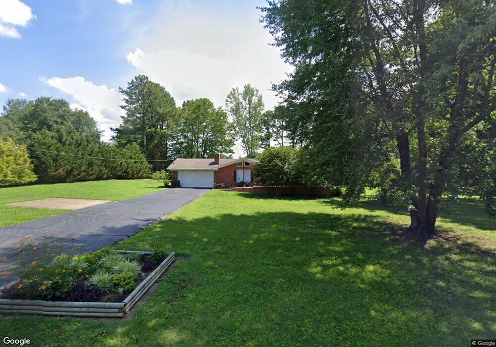
1925 Branch Dr Lawrenceburg, TN 38464
Estimated Value: $255,395 - $325,000
--
Bed
2
Baths
1,652
Sq Ft
$182/Sq Ft
Est. Value
About This Home
This home is located at 1925 Branch Dr, Lawrenceburg, TN 38464 and is currently estimated at $300,099, approximately $181 per square foot. 1925 Branch Dr is a home located in Lawrence County with nearby schools including Ingram Sowell Elementary School, Lawrenceburg Public Elementary School, and David Crockett Elementary School.
Ownership History
Date
Name
Owned For
Owner Type
Purchase Details
Closed on
Aug 13, 2008
Sold by
Mclean Emagene S
Bought by
Michael Mclain
Current Estimated Value
Purchase Details
Closed on
May 4, 1998
Sold by
Wayne Hill Anthony
Bought by
Romer Linda C
Purchase Details
Closed on
May 15, 1992
Bought by
Hill Anthony Wayne and Kristin Diane
Purchase Details
Closed on
Dec 14, 1988
Bought by
Frazier Arthur D and Wilma Jean
Purchase Details
Closed on
Feb 23, 1979
Bought by
Summers Patrick
Create a Home Valuation Report for This Property
The Home Valuation Report is an in-depth analysis detailing your home's value as well as a comparison with similar homes in the area
Home Values in the Area
Average Home Value in this Area
Purchase History
| Date | Buyer | Sale Price | Title Company |
|---|---|---|---|
| Michael Mclain | $225,000 | -- | |
| Romer Linda C | $85,000 | -- | |
| Hill Anthony Wayne | $69,000 | -- | |
| Frazier Arthur D | $56,000 | -- | |
| Summers Patrick | -- | -- |
Source: Public Records
Tax History Compared to Growth
Tax History
| Year | Tax Paid | Tax Assessment Tax Assessment Total Assessment is a certain percentage of the fair market value that is determined by local assessors to be the total taxable value of land and additions on the property. | Land | Improvement |
|---|---|---|---|---|
| 2025 | $1,028 | $51,125 | $0 | $0 |
| 2024 | $1,028 | $51,125 | $7,500 | $43,625 |
| 2023 | $1,028 | $51,125 | $7,500 | $43,625 |
| 2022 | $1,028 | $51,125 | $7,500 | $43,625 |
| 2021 | $840 | $28,375 | $3,575 | $24,800 |
| 2020 | $840 | $28,375 | $3,575 | $24,800 |
| 2019 | $840 | $28,375 | $3,575 | $24,800 |
| 2018 | $840 | $28,375 | $3,575 | $24,800 |
| 2017 | $840 | $28,375 | $3,575 | $24,800 |
| 2016 | $840 | $28,375 | $3,575 | $24,800 |
| 2015 | $777 | $28,375 | $3,575 | $24,800 |
| 2014 | $735 | $26,850 | $3,575 | $23,275 |
Source: Public Records
Map
Nearby Homes
- 114 Hummingbird Ln
- 132 Sundance Dr
- 52 Beuerlein Cir
- 31 Community Rd
- 14 Delana Ave
- 975 Weakley Creek Rd
- 4000 Weakley Creek Rd
- 4951 Weakley Creek Rd
- 0 Woodland Cir Unit RTC3033314
- 48 Woodland Cir
- 970 9th St
- 1050 Baylee Cir
- 801 Douglas Dr
- 1303 5th Ave
- 717 Toben Terrace
- 413 Kirk St
- 729 Weakley Creek Rd
- 1083 Mattox Town Rd
- 1088 Mattox Town Rd
- 545 Kent St
- 2185 Betty Ave
- 1993 Branch Dr
- 2165 Betty Ave
- 1910 Branch Dr
- 1950 Branch Dr
- 0 Branch Dr
- 2135 Betty Ave
- 1900 Branch Dr
- 1997 Branch Dr
- 2175 Pine Ridge Dr
- 2190 Betty Ave
- 1998 Branch Dr
- 2150 Betty Ave
- 1890 Branch Dr
- 2111 Betty Ave
- 2155 Pine Ridge Dr
- 2120 Betty Ave
- 1889 Branch Dr
- 2000 Branch Dr
- 2190 Pine Ridge Dr