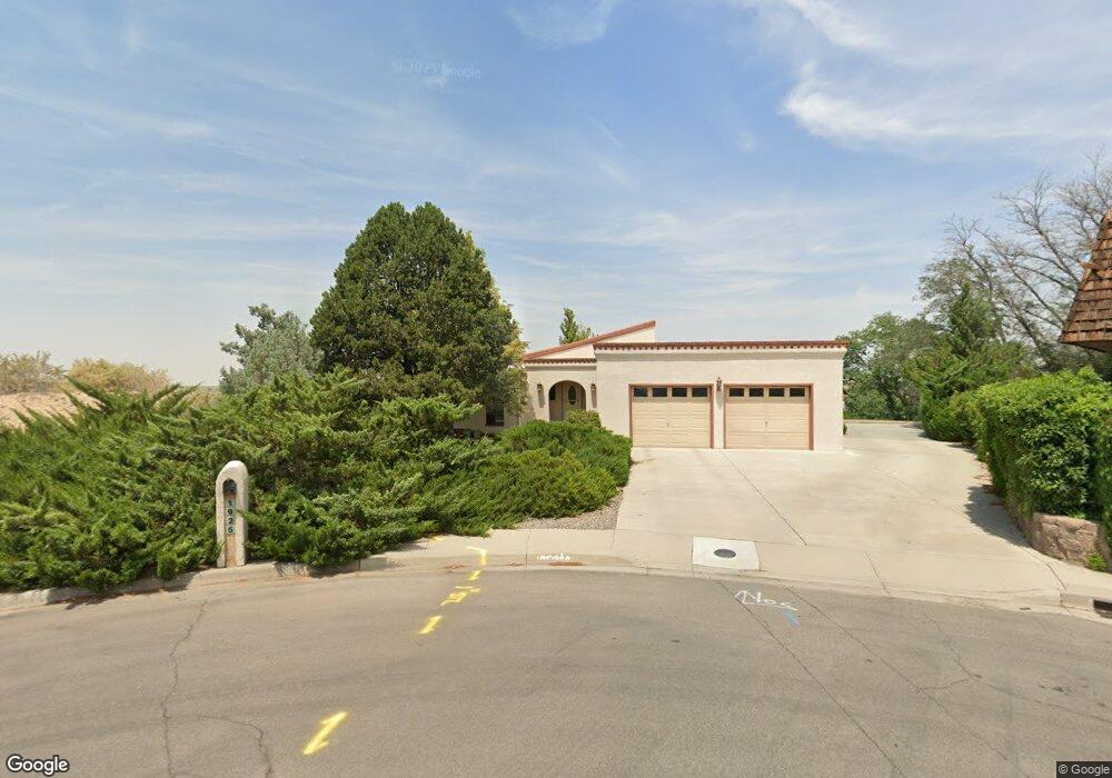
1925 Chilton Ct Farmington, NM 87401
Estimated Value: $338,000 - $381,000
--
Bed
--
Bath
1,920
Sq Ft
$187/Sq Ft
Est. Value
About This Home
This home is located at 1925 Chilton Ct, Farmington, NM 87401 and is currently estimated at $358,504, approximately $186 per square foot. 1925 Chilton Ct is a home located in San Juan County with nearby schools including McKinley Elementary School, Tibbetts Middle School, and Farmington High School.
Ownership History
Date
Name
Owned For
Owner Type
Purchase Details
Closed on
Aug 30, 2021
Sold by
Larae Dowdy Lana and Dowdy Lana L
Bought by
Afresh Start Llc
Current Estimated Value
Purchase Details
Closed on
Jun 3, 2010
Sold by
Crabb Carlton L and Crabb Talma L
Bought by
Dowdy Lana and Lana Dowdy Revocable Trust
Home Financials for this Owner
Home Financials are based on the most recent Mortgage that was taken out on this home.
Original Mortgage
$208,000
Interest Rate
5%
Mortgage Type
New Conventional
Create a Home Valuation Report for This Property
The Home Valuation Report is an in-depth analysis detailing your home's value as well as a comparison with similar homes in the area
Home Values in the Area
Average Home Value in this Area
Purchase History
| Date | Buyer | Sale Price | Title Company |
|---|---|---|---|
| Afresh Start Llc | -- | None Listed On Document | |
| Dowdy Lana | -- | None Available |
Source: Public Records
Mortgage History
| Date | Status | Borrower | Loan Amount |
|---|---|---|---|
| Previous Owner | Dowdy Lana | $208,000 |
Source: Public Records
Tax History Compared to Growth
Tax History
| Year | Tax Paid | Tax Assessment Tax Assessment Total Assessment is a certain percentage of the fair market value that is determined by local assessors to be the total taxable value of land and additions on the property. | Land | Improvement |
|---|---|---|---|---|
| 2024 | $2,395 | $100,748 | $0 | $0 |
| 2023 | $2,395 | $97,814 | $0 | $0 |
| 2022 | $2,283 | $94,965 | $0 | $0 |
| 2021 | $2,199 | $92,199 | $0 | $0 |
| 2020 | $2,134 | $89,724 | $0 | $0 |
| 2019 | $2,118 | $89,517 | $0 | $0 |
| 2018 | $2,115 | $91,889 | $0 | $0 |
| 2017 | $2,108 | $91,557 | $0 | $0 |
| 2016 | $2,091 | $91,726 | $0 | $0 |
| 2015 | $2,056 | $91,726 | $0 | $0 |
| 2014 | $2,058 | $91,625 | $0 | $0 |
Source: Public Records
Map
Nearby Homes
- 636 Ridge Lea Ct
- 1805 Brenwood Dr
- LOT 4 XX W 24th St
- 2412 Pheasant Place
- 2413 N Municipal Dr
- 212 W Sunset Place
- 195 McDonald Rd
- 200 W 24th St
- 212 W 25th St
- XX Brookside Dr
- 3104 N Western Ave
- 2900 Northwood Dr
- 1011 N Auburn Ave
- 3108 N Mesa Dr
- 2906 Northwood Dr
- 3003 Northwood Cir
- 3105 N Sunset Ave
- 1013 N Orchard Dr
- 3110 N Sunset Ave
- 1108 N Dustin Ave