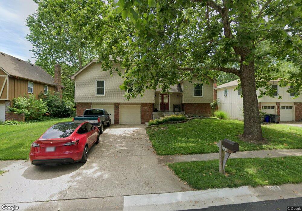
1925 E 152nd St Olathe, KS 66062
Olathe AreaEstimated Value: $340,000 - $372,000
About This Home
This home is located at 1925 E 152nd St, Olathe, KS 66062 and is currently estimated at $360,641, approximately $224 per square foot. 1925 E 152nd St is a home located in Johnson County with nearby schools including Scarborough Elementary School, Indian Trail Middle School, and Olathe South Sr High School.
Ownership History
We collect this data history from publicly available records. To have your information removed, we recommend requesting removal directly through your county’s website.
Purchase Details
Home Financials for this Owner
Home Financials are based on the most recent Mortgage that was taken out on this home.Purchase Details
Purchase Details
Home Financials for this Owner
Home Financials are based on the most recent Mortgage that was taken out on this home.Home Values in the Area
Average Home Value in this Area
Purchase History
We collect this data history from publicly available records. To have your information removed, we recommend requesting removal directly through your county’s website.
| Date | Buyer | Sale Price | Title Company |
|---|---|---|---|
| -- | Mokan Title Services Inc | ||
| $15,472 | Continental Title Co | ||
| -- | Columbian National Title Ins |
Mortgage History
We collect this data history from publicly available records. To have your information removed, we recommend requesting removal directly through your county’s website.
| Date | Status | Borrower | Loan Amount |
|---|---|---|---|
| Open | $156,300 | ||
| Previous Owner | $118,360 |
Tax History
We collect this data history from publicly available records. To have your information removed, we recommend requesting removal directly through your county’s website.
| Year | Tax Paid | Tax Assessment Tax Assessment Total Assessment is a certain percentage of the fair market value that is determined by local assessors to be the total taxable value of land and additions on the property. | Land | Improvement |
|---|---|---|---|---|
| 2025 | $4,090 | $37,076 | $7,528 | $29,548 |
| 2024 | $3,992 | $35,766 | $6,843 | $28,923 |
| 2023 | $3,694 | $32,396 | $6,223 | $26,173 |
| 2022 | $3,461 | $29,532 | $5,413 | $24,119 |
| 2021 | $3,377 | $27,381 | $5,413 | $21,968 |
| 2020 | $3,207 | $25,783 | $4,919 | $20,864 |
| 2019 | $3,087 | $24,667 | $4,916 | $19,751 |
| 2018 | $2,963 | $23,517 | $4,923 | $18,594 |
| 2017 | $2,698 | $21,218 | $4,099 | $17,119 |
| 2016 | $2,407 | $19,447 | $4,099 | $15,348 |
| 2015 | $2,150 | $17,412 | $3,416 | $13,996 |
| 2013 | -- | $14,663 | $3,416 | $11,247 |
Map
- 1845 E 152nd Ct
- 1725 S Kiowa Dr
- 2105 S Kenwood St
- 16729 S Woodstone Dr
- 1369 E 154th Terrace
- 17360 W 156th St
- 1828 E Mohawk Dr
- 1509 S Scarborough St
- 17320 W 156th Terrace
- 15466 S Wyandotte Dr
- 1428 S Scarborough St
- 1332 E 154th St
- 14805 S Bradley Dr
- 15481 S Wyandotte Dr
- 16660 W 155th Terrace
- 1308 S Apache Ct
- 15020 S Locust St
- 14813 S Wyandotte Dr
- 2118 S Central St
- 1385 E Meadow Ln
- 1913 E 152nd St
- 1917 E 152nd St
- 1909 E 152nd St
- 1921 E 152nd St
- 1905 E 152nd St
- 1908 E 152nd Terrace
- 1904 E 152nd Terrace
- 1830 S Abbey Cir
- 1912 E 152nd Terrace
- 1900 E 152nd Terrace
- 1914 E 152nd St
- 1901 E 152nd St
- 1826 S Abbey Cir
- 1916 E 152nd Terrace
- 1830 S Arrowhead Dr
- 1822 E 152nd Terrace
- 1835 S Abbey Cir
- 2001 E 152nd St
- 1843 E 152nd St
- 1825 S Arrowhead Dr
Ask me questions while you tour the home.