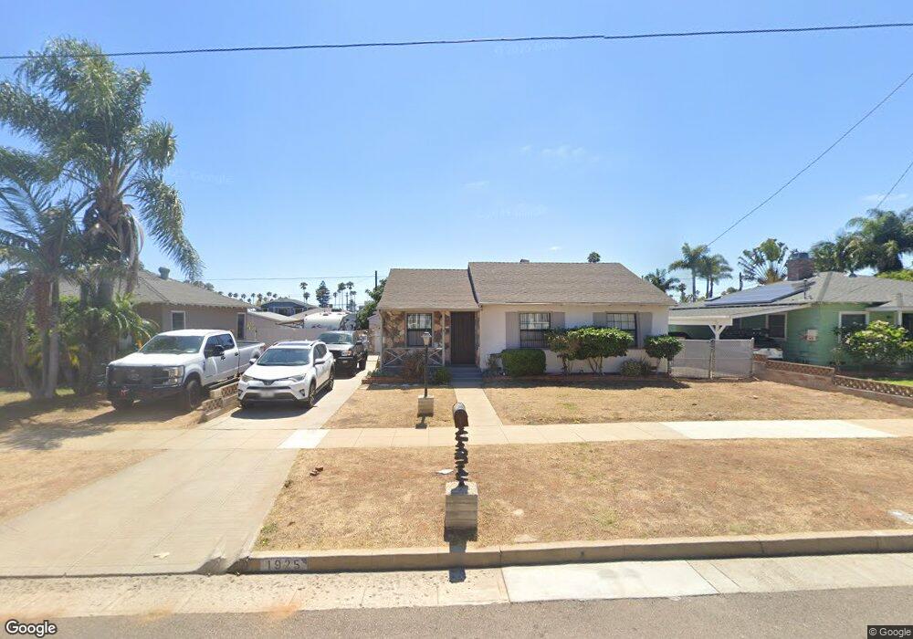
1925 S Ditmar St Oceanside, CA 92054
South Oceanside NeighborhoodEstimated Value: $1,255,514 - $1,619,000
3
Beds
1
Bath
1,408
Sq Ft
$989/Sq Ft
Est. Value
About This Home
This home is located at 1925 S Ditmar St, Oceanside, CA 92054 and is currently estimated at $1,392,129, approximately $988 per square foot. 1925 S Ditmar St is a home located in San Diego County with nearby schools including South Oceanside Elementary School, Lincoln Middle School, and Oceanside High School.
Ownership History
Date
Name
Owned For
Owner Type
Purchase Details
Closed on
Mar 4, 2016
Sold by
Hayes Lenora N
Bought by
Hayes Matthew Paul and Brinkerhoff Melissa Lee
Current Estimated Value
Home Financials for this Owner
Home Financials are based on the most recent Mortgage that was taken out on this home.
Original Mortgage
$440,000
Outstanding Balance
$347,910
Interest Rate
3.62%
Mortgage Type
New Conventional
Estimated Equity
$1,044,219
Purchase Details
Closed on
Mar 15, 1996
Sold by
Balint John C and Balint Lorna L
Bought by
Balint John C and Balint Lorna L
Create a Home Valuation Report for This Property
The Home Valuation Report is an in-depth analysis detailing your home's value as well as a comparison with similar homes in the area
Home Values in the Area
Average Home Value in this Area
Purchase History
| Date | Buyer | Sale Price | Title Company |
|---|---|---|---|
| Hayes Matthew Paul | $550,000 | Title 365 | |
| Balint John C | -- | Orange Coast Title |
Source: Public Records
Mortgage History
| Date | Status | Borrower | Loan Amount |
|---|---|---|---|
| Open | Hayes Matthew Paul | $440,000 |
Source: Public Records
Tax History
| Year | Tax Paid | Tax Assessment Tax Assessment Total Assessment is a certain percentage of the fair market value that is determined by local assessors to be the total taxable value of land and additions on the property. | Land | Improvement |
|---|---|---|---|---|
| 2025 | $3,921 | $353,003 | $307,251 | $45,752 |
| 2024 | $3,921 | $346,082 | $301,227 | $44,855 |
| 2023 | $3,800 | $339,297 | $295,321 | $43,976 |
| 2022 | $3,743 | $332,645 | $289,531 | $43,114 |
| 2021 | $3,757 | $326,123 | $283,854 | $42,269 |
| 2020 | $3,642 | $322,780 | $280,944 | $41,836 |
| 2019 | $3,537 | $316,452 | $275,436 | $41,016 |
| 2018 | $3,500 | $310,248 | $270,036 | $40,212 |
| 2017 | $6,297 | $561,000 | $510,000 | $51,000 |
| 2016 | $479 | $46,404 | $19,102 | $27,302 |
| 2015 | $465 | $45,708 | $18,816 | $26,892 |
| 2014 | $448 | $44,814 | $18,448 | $26,366 |
Source: Public Records
Map
Nearby Homes
- 1840 S Tremont St
- 1834 S Tremont St
- 2156 S Coast Hwy
- 2132 S Coast Hwy
- 2120 S Coast Hwy
- 2186 S Coast Hwy
- 1921 S Myers St
- 1842-46 S Pacific St
- 1846 S Pacific St
- 1931 S Pacific St
- 920 Morse St
- 1002 Morse St
- 1220 Morse St
- 1413 La Salina St
- 1602 S Pacific St Unit 100
- 79 St Malo Unit 79
- 2525 Jefferson St Unit B
- 2535 Jefferson St Unit 10
- 120 Sherri Ln
- 2383 Ocean St
- 1921 S Ditmar St
- 1929 S Ditmar St
- 1928 Alvarado St
- 1917 S Ditmar St
- 1933 S Ditmar St
- 1924 Alvarado St
- 1932 Alvarado St
- 1920 Alvarado St
- 1936 Alvarado St
- 1913 S Ditmar St
- 714 Vista Way
- 710 Vista Way
- 1916 Alvarado St
- 1926 S Ditmar St
- 1930 S Ditmar St
- 706 Vista Way
- 1922 S Ditmar St
- 1934 S Ditmar St
- 1909 S Ditmar St
- 702 Vista Way
Your Personal Tour Guide
Ask me questions while you tour the home.