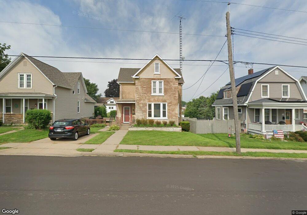
1925 St Ambrose Dubuque, IA 52001
Estimated Value: $176,000 - $231,551
5
Beds
2
Baths
1,936
Sq Ft
$107/Sq Ft
Est. Value
About This Home
This home is located at 1925 St Ambrose, Dubuque, IA 52001 and is currently estimated at $206,638, approximately $106 per square foot. 1925 St Ambrose is a home located in Dubuque County with nearby schools including Irving Elementary School, George Washington Middle School, and Dubuque Senior High School.
Ownership History
Date
Name
Owned For
Owner Type
Purchase Details
Closed on
Apr 25, 2011
Sold by
Alm Jeffrey C and Zamzow Erin E
Bought by
Mueller John A
Current Estimated Value
Home Financials for this Owner
Home Financials are based on the most recent Mortgage that was taken out on this home.
Original Mortgage
$56,000
Outstanding Balance
$37,626
Interest Rate
4.25%
Mortgage Type
Adjustable Rate Mortgage/ARM
Estimated Equity
$169,012
Purchase Details
Closed on
Apr 24, 2007
Sold by
Felderman Michael T and Felderman Debra K
Bought by
Alm Jeffrey C and Zamzow Erin E
Home Financials for this Owner
Home Financials are based on the most recent Mortgage that was taken out on this home.
Original Mortgage
$12,990
Interest Rate
6.21%
Mortgage Type
Balloon
Create a Home Valuation Report for This Property
The Home Valuation Report is an in-depth analysis detailing your home's value as well as a comparison with similar homes in the area
Home Values in the Area
Average Home Value in this Area
Purchase History
| Date | Buyer | Sale Price | Title Company |
|---|---|---|---|
| Mueller John A | $70,000 | None Available | |
| Alm Jeffrey C | $130,000 | None Available |
Source: Public Records
Mortgage History
| Date | Status | Borrower | Loan Amount |
|---|---|---|---|
| Open | Mueller John A | $56,000 | |
| Previous Owner | Alm Jeffrey C | $12,990 | |
| Previous Owner | Alm Jeffrey C | $103,920 |
Source: Public Records
Tax History Compared to Growth
Tax History
| Year | Tax Paid | Tax Assessment Tax Assessment Total Assessment is a certain percentage of the fair market value that is determined by local assessors to be the total taxable value of land and additions on the property. | Land | Improvement |
|---|---|---|---|---|
| 2025 | $2,920 | $210,600 | $27,800 | $182,800 |
| 2024 | $2,920 | $203,100 | $25,200 | $177,900 |
| 2023 | $2,836 | $203,100 | $25,200 | $177,900 |
| 2022 | $2,710 | $163,910 | $23,970 | $139,940 |
| 2021 | $2,710 | $163,910 | $23,970 | $139,940 |
| 2020 | $2,602 | $146,310 | $22,710 | $123,600 |
| 2019 | $2,568 | $146,310 | $22,710 | $123,600 |
| 2018 | $2,668 | $138,140 | $22,710 | $115,430 |
| 2017 | $2,536 | $145,770 | $22,710 | $123,060 |
| 2016 | $2,536 | $131,320 | $22,710 | $108,610 |
| 2015 | $2,484 | $131,320 | $22,710 | $108,610 |
| 2014 | $2,378 | $129,190 | $22,710 | $106,480 |
Source: Public Records
Map
Nearby Homes
- 1949 Saint Ambrose St
- 1896 Floraview Dr
- 1821 Glendale Ct
- 2447 Asbury Rd
- 2095 Mullin Rd
- 1865 Wood St
- 1735 Wood St
- 1730 Chaney Rd
- 1568 Fairfax Ave
- 1455 Adair St
- 1425 Adair St
- 1650 Drexel Ave
- 2625 New Haven St
- 1445 Wood St
- 1395 Brown Ave
- 1390 Loras Blvd
- 2341 Cir
- 2347 Coventry Park Unit C-011
- 1495 Glen Oak St
- 130 Devon Dr
- 1925 Saint Ambrose St
- 1937 Saint Ambrose St
- 1911 St Ambrose
- 1911 Saint Ambrose St
- 2335 Rosedale Ave
- 1961 Saint Ambrose St
- 1961 St Ambrose
- 1895 Saint Ambrose St
- 1975 Saint Ambrose St
- 2355 Rosedale Ave
- 1885 Saint Ambrose St
- 1983 Saint Ambrose St
- 2330 Rosedale Ave
- 2365 Rosedale Ave
- 2350 Rosedale Ave
- 1875 Saint Ambrose St
- 1989 St Ambrose
- 1989 Saint Ambrose St
- 2120 Clarke Dr
- 1870 Saint Ambrose St