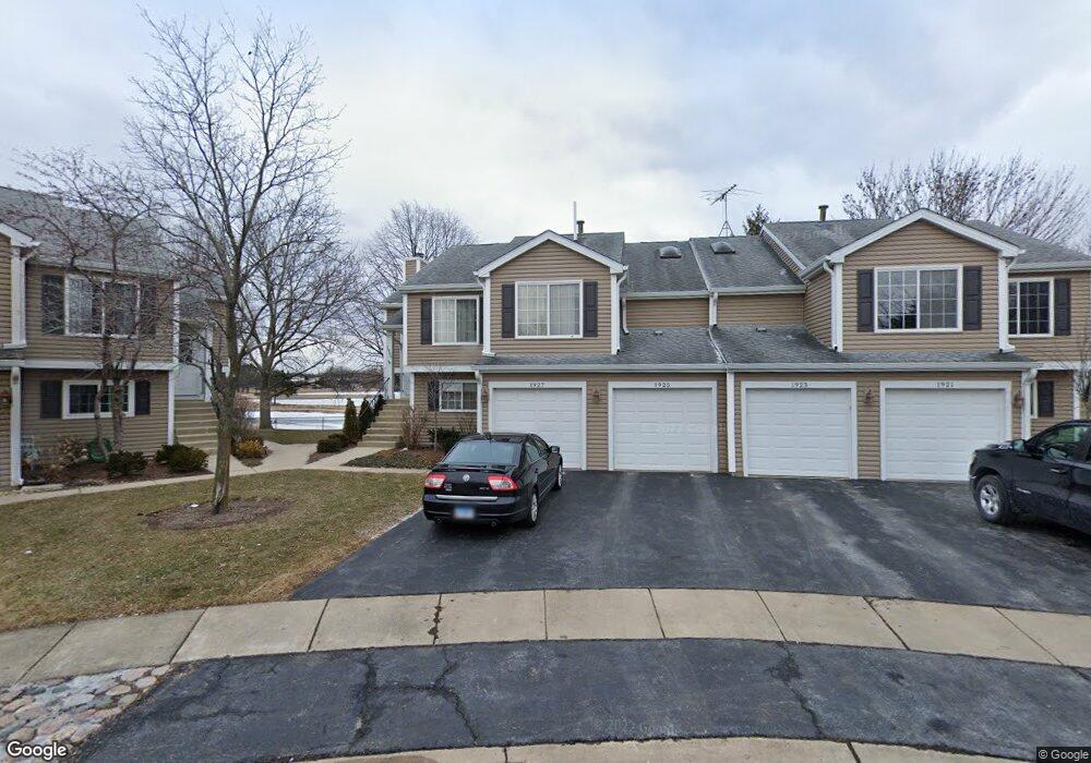
1925 Windsong Dr Unit 293E1 Schaumburg, IL 60194
West Schaumburg NeighborhoodEstimated Value: $258,074 - $286,000
2
Beds
--
Bath
1,200
Sq Ft
$231/Sq Ft
Est. Value
About This Home
This home is located at 1925 Windsong Dr Unit 293E1, Schaumburg, IL 60194 and is currently estimated at $277,519, approximately $231 per square foot. 1925 Windsong Dr Unit 293E1 is a home located in Cook County with nearby schools including Elizabeth Blackwell Elementary School, Dwight D Eisenhower Junior High School, and Hoffman Estates High School.
Ownership History
Date
Name
Owned For
Owner Type
Purchase Details
Closed on
Feb 21, 2013
Sold by
Miklos Robert C and Miklos Therese H
Bought by
Miklos Robert Charles and Robert Charles Miklos Trust
Current Estimated Value
Purchase Details
Closed on
Mar 19, 1999
Sold by
Alas Karen Perille and Perille Karen
Bought by
Miklos Robert C
Home Financials for this Owner
Home Financials are based on the most recent Mortgage that was taken out on this home.
Original Mortgage
$129,200
Outstanding Balance
$31,403
Interest Rate
6.8%
Estimated Equity
$246,116
Purchase Details
Closed on
Apr 14, 1995
Sold by
Rocos Stephen and Rocos Regina C
Bought by
Perille Karen
Home Financials for this Owner
Home Financials are based on the most recent Mortgage that was taken out on this home.
Original Mortgage
$96,000
Interest Rate
8.55%
Create a Home Valuation Report for This Property
The Home Valuation Report is an in-depth analysis detailing your home's value as well as a comparison with similar homes in the area
Home Values in the Area
Average Home Value in this Area
Purchase History
| Date | Buyer | Sale Price | Title Company |
|---|---|---|---|
| Miklos Robert Charles | -- | None Available | |
| Miklos Robert C | $136,000 | -- | |
| Perille Karen | $123,000 | -- |
Source: Public Records
Mortgage History
| Date | Status | Borrower | Loan Amount |
|---|---|---|---|
| Open | Miklos Robert C | $129,200 | |
| Previous Owner | Perille Karen | $96,000 |
Source: Public Records
Tax History Compared to Growth
Tax History
| Year | Tax Paid | Tax Assessment Tax Assessment Total Assessment is a certain percentage of the fair market value that is determined by local assessors to be the total taxable value of land and additions on the property. | Land | Improvement |
|---|---|---|---|---|
| 2024 | $2,230 | $21,332 | $3,490 | $17,842 |
| 2023 | $2,227 | $21,332 | $3,490 | $17,842 |
| 2022 | $2,227 | $21,332 | $3,490 | $17,842 |
| 2021 | $2,426 | $15,671 | $5,497 | $10,174 |
| 2020 | $2,224 | $15,671 | $5,497 | $10,174 |
| 2019 | $2,211 | $17,500 | $5,497 | $12,003 |
| 2018 | $2,275 | $14,460 | $3,403 | $11,057 |
| 2017 | $2,243 | $14,460 | $3,403 | $11,057 |
| 2016 | $3,297 | $14,460 | $3,403 | $11,057 |
| 2015 | $3,067 | $12,900 | $2,966 | $9,934 |
| 2014 | $3,048 | $12,900 | $2,966 | $9,934 |
| 2013 | $2,953 | $12,900 | $2,966 | $9,934 |
Source: Public Records
Map
Nearby Homes
- 1020 Denham Place Unit 1
- 1912 Finchley Ct Unit 3
- 808 Bishop Ct Unit 2
- 1103 Southbridge Ln
- 1121 Southbridge Ln
- 1375 Rebecca Dr Unit 318
- 2216 Andover Ct
- 1475 Rebecca Dr Unit 217
- 1698 Pebble Beach Dr
- 1672 Cornell Dr
- 1685 Cornell Dr
- 2312 Hyde Ct
- 2342 Hamilton Place
- 1901 Kingsley Dr
- 775 Harmon Blvd
- 2201 Brittany Ct Unit 20
- 1415 N Oakmont Rd
- 1763 Bristol Walk Unit 1763
- 604 N Brookdale Dr
- 1475 Crowfoot Cir S
- 1921 Windsong Dr Unit 292E1
- 1923 Windsong Dr Unit 294E1
- 1927 Windsong Dr Unit 291E1
- 1933 Windsong Dr Unit 304E1
- 1933 Windsong Dr Unit 1933
- 1933 Windsong Dr Unit 30-4
- 1917 Windsong Dr Unit 281E1
- 1931 Windsong Dr Unit 302E1
- 1915 Windsong Dr Unit 283E1
- 1935 Windsong Dr Unit 303E1
- 1935 Windsong Dr Unit 1935
- 1935 Windsong Dr Unit 30-3
- 1911 Windsong Dr Unit 282E1
- 1911 Windsong Dr Unit 28-2
- 1913 Windsong Dr Unit 284E1
- 1913 Windsong Dr Unit 28-4
- 1937 Windsong Dr Unit 301E1
- 1937 Windsong Dr Unit 30-1
- 1907 Windsong Dr Unit 271E1
- 1905 Windsong Dr Unit 273E1